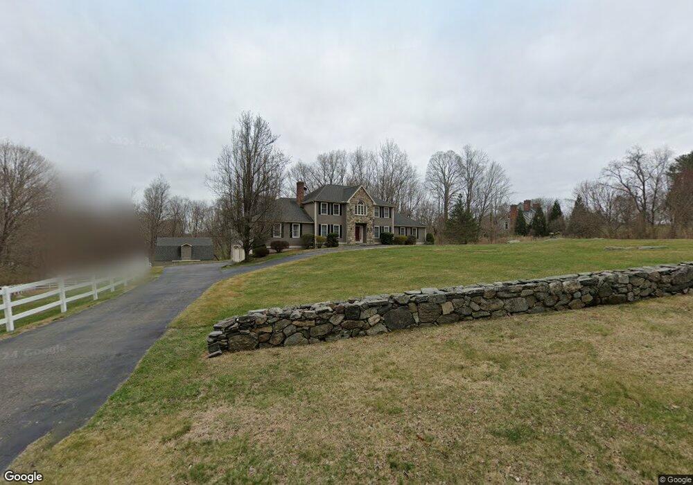
300 Judd Rd Easton, CT 06612
Estimated Value: $1,128,000 - $1,170,000
4
Beds
4
Baths
3,722
Sq Ft
$309/Sq Ft
Est. Value
About This Home
This home is located at 300 Judd Rd, Easton, CT 06612 and is currently estimated at $1,151,624, approximately $309 per square foot. 300 Judd Rd is a home located in Fairfield County with nearby schools including Samuel Staples Elementary School, Helen Keller Middle School, and Joel Barlow High School.
Ownership History
Date
Name
Owned For
Owner Type
Purchase Details
Closed on
Aug 2, 2004
Sold by
Romaszewski Joseph B and Carmody Marinne A
Bought by
Tondi Gerard L and Hafen-Tondi Clauda A
Current Estimated Value
Home Financials for this Owner
Home Financials are based on the most recent Mortgage that was taken out on this home.
Original Mortgage
$240,000
Interest Rate
6.33%
Purchase Details
Closed on
Dec 15, 1993
Sold by
Michael Burton Bldrs
Bought by
Romaszewski Joseph and Carmody Marianni
Purchase Details
Closed on
Feb 24, 1993
Sold by
Sunshine Leonard and Sunshine Iris
Bought by
Michael Burton Bldrs
Create a Home Valuation Report for This Property
The Home Valuation Report is an in-depth analysis detailing your home's value as well as a comparison with similar homes in the area
Home Values in the Area
Average Home Value in this Area
Purchase History
| Date | Buyer | Sale Price | Title Company |
|---|---|---|---|
| Tondi Gerard L | $840,000 | -- | |
| Tondi Gerard L | $840,000 | -- | |
| Romaszewski Joseph | $420,000 | -- | |
| Romaszewski Joseph | $420,000 | -- | |
| Michael Burton Bldrs | $160,000 | -- | |
| Michael Burton Bldrs | $160,000 | -- |
Source: Public Records
Mortgage History
| Date | Status | Borrower | Loan Amount |
|---|---|---|---|
| Open | Michael Burton Bldrs | $177,000 | |
| Closed | Michael Burton Bldrs | $200,000 | |
| Closed | Michael Burton Bldrs | $240,000 |
Source: Public Records
Tax History Compared to Growth
Tax History
| Year | Tax Paid | Tax Assessment Tax Assessment Total Assessment is a certain percentage of the fair market value that is determined by local assessors to be the total taxable value of land and additions on the property. | Land | Improvement |
|---|---|---|---|---|
| 2025 | $17,655 | $569,520 | $174,440 | $395,080 |
| 2024 | $16,824 | $569,520 | $174,440 | $395,080 |
| 2023 | $16,493 | $569,520 | $174,440 | $395,080 |
| 2022 | $16,197 | $569,520 | $174,440 | $395,080 |
| 2021 | $17,326 | $535,570 | $205,980 | $329,590 |
| 2020 | $16,603 | $535,570 | $205,980 | $329,590 |
| 2019 | $16,779 | $535,570 | $205,980 | $329,590 |
| 2018 | $16,806 | $535,570 | $205,980 | $329,590 |
| 2017 | $17,877 | $535,570 | $205,980 | $329,590 |
| 2016 | $15,517 | $503,650 | $230,480 | $273,170 |
| 2015 | $15,301 | $503,650 | $230,480 | $273,170 |
| 2014 | $15,059 | $503,650 | $230,480 | $273,170 |
Source: Public Records
Map
Nearby Homes
- 82 Rock House Rd
- 294 Maple Rd
- 49 Quarter Horse Dr
- 27 W Woodland Dr
- 34 Easton Rd
- 33 Patmar Dr
- 235 Rock House Rd
- 34 Birchwood Rd
- 22 Serene Way
- 7 Jet Brook Rd
- 5288 Madison Ave
- 14 Little Diet Rd
- 37 Kitcher Ct
- 77 Bart Rd
- 30 Hi Barlow Rd
- 1 Hi Barlow Rd
- 302 Fairmount Dr Unit B
- 52 Aunt Park Ln
- 18 Sebastian Tr
- 52 Autumn Dr