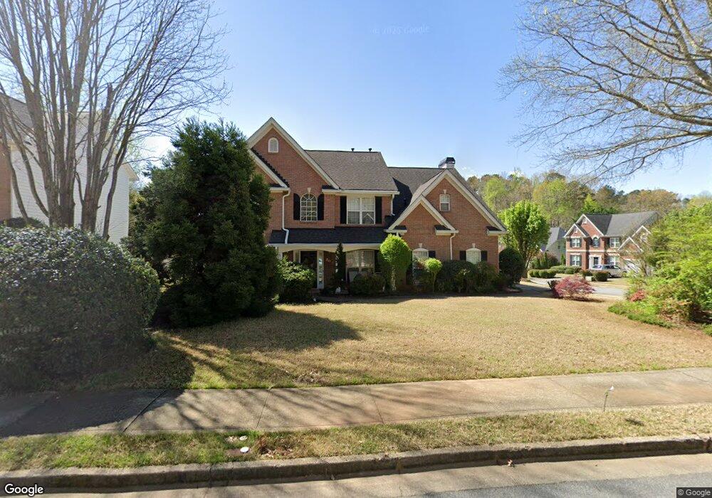
300 Kimball Trace Alpharetta, GA 30022
Estimated Value: $496,000 - $659,000
3
Beds
3
Baths
2,044
Sq Ft
$283/Sq Ft
Est. Value
About This Home
This home is located at 300 Kimball Trace, Alpharetta, GA 30022 and is currently estimated at $579,465, approximately $283 per square foot. 300 Kimball Trace is a home located in Fulton County with nearby schools including New Prospect Elementary School, Webb Bridge Middle School, and Alpharetta High School.
Ownership History
Date
Name
Owned For
Owner Type
Purchase Details
Closed on
May 27, 1999
Sold by
Rick Olson Homes Inc
Bought by
Duncan Charles E and Duncan Pamela L
Current Estimated Value
Home Financials for this Owner
Home Financials are based on the most recent Mortgage that was taken out on this home.
Original Mortgage
$116,435
Outstanding Balance
$30,328
Interest Rate
6.9%
Mortgage Type
New Conventional
Estimated Equity
$549,137
Create a Home Valuation Report for This Property
The Home Valuation Report is an in-depth analysis detailing your home's value as well as a comparison with similar homes in the area
Home Values in the Area
Average Home Value in this Area
Purchase History
| Date | Buyer | Sale Price | Title Company |
|---|---|---|---|
| Duncan Charles E | $226,500 | -- |
Source: Public Records
Mortgage History
| Date | Status | Borrower | Loan Amount |
|---|---|---|---|
| Open | Duncan Charles E | $116,435 |
Source: Public Records
Tax History Compared to Growth
Tax History
| Year | Tax Paid | Tax Assessment Tax Assessment Total Assessment is a certain percentage of the fair market value that is determined by local assessors to be the total taxable value of land and additions on the property. | Land | Improvement |
|---|---|---|---|---|
| 2025 | $398 | $226,600 | $68,240 | $158,360 |
| 2023 | $5,165 | $183,000 | $40,320 | $142,680 |
| 2022 | $2,754 | $183,000 | $40,320 | $142,680 |
| 2021 | $3,025 | $138,560 | $29,840 | $108,720 |
| 2020 | $3,033 | $127,800 | $35,640 | $92,160 |
| 2019 | $351 | $125,520 | $35,000 | $90,520 |
| 2018 | $2,745 | $109,360 | $30,160 | $79,200 |
| 2017 | $2,633 | $102,200 | $26,960 | $75,240 |
| 2016 | $2,632 | $102,200 | $26,960 | $75,240 |
| 2015 | $3,030 | $102,200 | $26,960 | $75,240 |
| 2014 | $2,037 | $79,200 | $13,400 | $65,800 |
Source: Public Records
Map
Nearby Homes
- 10900 Wittenridge Dr Unit I3
- 10900 Wittenridge Dr Unit H8
- 10900 Wittenridge Dr Unit L6
- 10900 Wittenridge Dr Unit C7
- 10845 Carrissa Trail
- 465 Kirkstall Trail
- 125 Sandridge Ct
- 610 Varina Way
- 870 Longstone Landing
- 345 Kincardine Way Unit IIIA
- 825 Highland Bend Cove
- 3396 Carverton Ln
- 10880 Windham Way
- 105 Kimball Bridge Cove
- 3430 Waters Mill Dr
- 3962 Erin Dr
- 3010 Brooke View Ct Unit 5
- 4255 Park Brooke Trace
- 0 State Bridge Way Unit 6718888
- 11000 Kimball Crest Dr
- 310 Kimball Trace
- 305 Kimball Trace
- 315 Kimball Trace
- 0 Kimball Trace
- 11055 Kimball Crest Dr
- 320 Kimball Trace Unit 19
- 320 Kimball Trace
- 11065 Kimball Crest Dr
- 10990 Kimball Crest Dr
- 11045 Kimball Crest Dr
- 11075 Kimball Crest Dr
- 325 Kimball Trace
- 10980 Kimball Crest Dr
- 11035 Kimball Crest Dr
- 200 Kimball Way
- 210 Kimball Way
- 210 Kimball Way
- 330 Kimball Trace