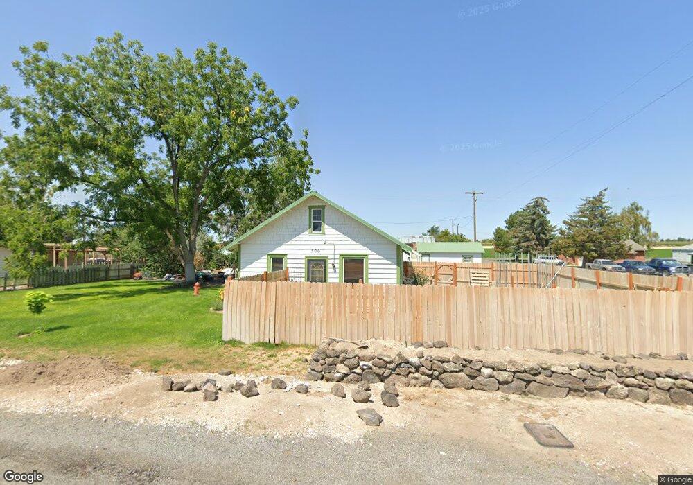
300 Maple St Castleford, ID 83321
Estimated Value: $163,000 - $228,000
2
Beds
1
Bath
912
Sq Ft
$221/Sq Ft
Est. Value
About This Home
This home is located at 300 Maple St, Castleford, ID 83321 and is currently estimated at $201,667, approximately $221 per square foot. 300 Maple St is a home with nearby schools including Castleford School.
Ownership History
Date
Name
Owned For
Owner Type
Purchase Details
Closed on
Oct 26, 2020
Sold by
Estate Of John Lowell Walker
Bought by
Walker Che Chandler
Current Estimated Value
Purchase Details
Closed on
Sep 26, 2018
Sold by
Aguirre Tony and Aguirre Kim
Bought by
Walker John
Purchase Details
Closed on
Dec 5, 2008
Sold by
Aguirre Tony and Mccormick Kim
Bought by
Aguirre Tony and Aguirre Kim
Home Financials for this Owner
Home Financials are based on the most recent Mortgage that was taken out on this home.
Original Mortgage
$45,000
Interest Rate
6.47%
Mortgage Type
New Conventional
Create a Home Valuation Report for This Property
The Home Valuation Report is an in-depth analysis detailing your home's value as well as a comparison with similar homes in the area
Purchase History
| Date | Buyer | Sale Price | Title Company |
|---|---|---|---|
| Walker Che Chandler | -- | None Available | |
| Walker John | -- | Title Fact Inc | |
| Aguirre Tony | -- | First American Title Company |
Source: Public Records
Mortgage History
| Date | Status | Borrower | Loan Amount |
|---|---|---|---|
| Previous Owner | Aguirre Tony | $45,000 |
Source: Public Records
Tax History
| Year | Tax Paid | Tax Assessment Tax Assessment Total Assessment is a certain percentage of the fair market value that is determined by local assessors to be the total taxable value of land and additions on the property. | Land | Improvement |
|---|---|---|---|---|
| 2025 | $380 | $106,721 | $35,715 | $71,006 |
| 2024 | $389 | $106,721 | $35,715 | $71,006 |
| 2023 | $245 | $75,564 | $35,715 | $39,849 |
| 2022 | $344 | $77,110 | $37,261 | $39,849 |
| 2021 | $295 | $52,598 | $20,702 | $31,896 |
| 2020 | $291 | $46,482 | $19,055 | $27,427 |
| 2019 | $258 | $37,968 | $11,105 | $26,863 |
| 2018 | $494 | $37,414 | $11,105 | $26,309 |
| 2017 | $404 | $30,128 | $11,105 | $19,023 |
| 2016 | $422 | $28,663 | $0 | $0 |
| 2015 | $429 | $28,663 | $11,105 | $17,558 |
| 2012 | -- | $27,268 | $0 | $0 |
Source: Public Records
Map
Nearby Homes
- 3752 N 1200 E
- 4343 N N 1200 E
- 3851 N 1400 E Unit A
- 1350 E 3900 N
- 1164 E 4150 N
- 4222 A Peck St
- TBD 4300 N
- Lot 1 Buhl Country Club Estates Subd
- 19878 Highway 30
- HWY 30 N 1600 E
- 1027 Clear Creek Dr
- 910 Moonglo Rd Unit 49
- 910 Moon Glo Ave Unit 8
- 940 Applewood Dr
- 966 Milner St
- 939 Craven Ave
- 1213 Burley Ave
- 1625 Maple St Unit 20
- 701 14th Ave N
- 117 14th Ave N
Your Personal Tour Guide
Ask me questions while you tour the home.