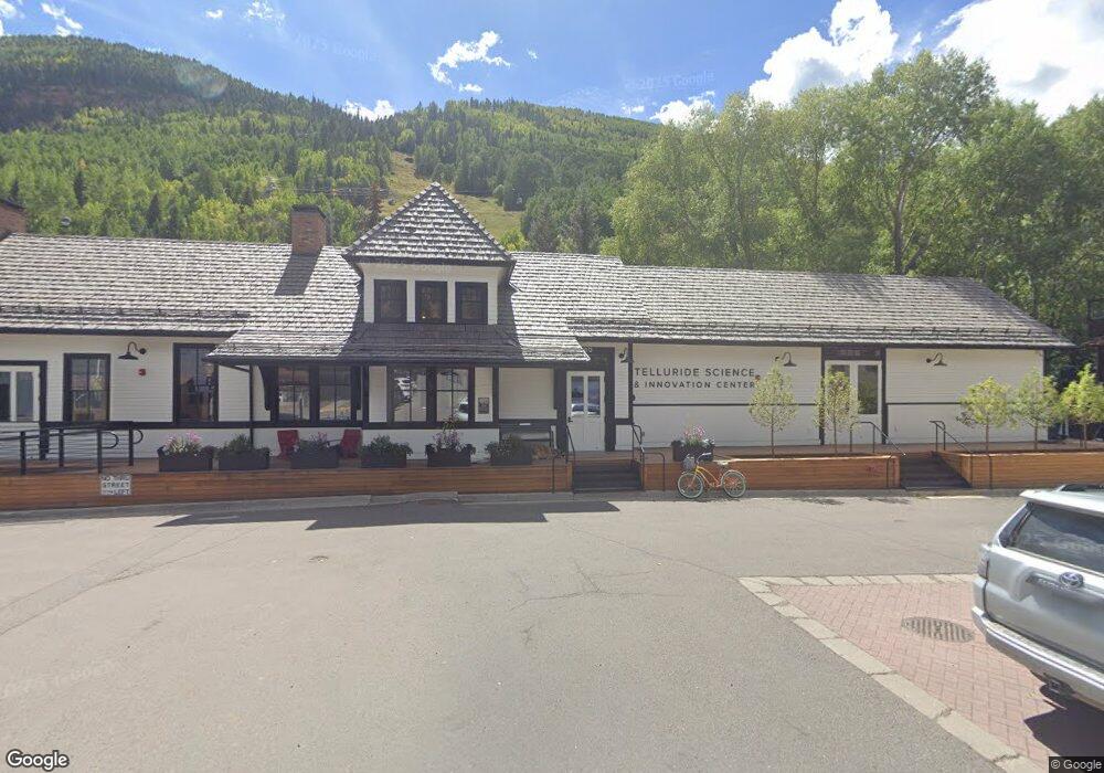
300 S Townsend St Unit 1,2,3 Telluride, CO 81435
Estimated Value: $761,000 - $5,113,672
--
Bed
1
Bath
867
Sq Ft
$3,810/Sq Ft
Est. Value
About This Home
This home is located at 300 S Townsend St Unit 1,2,3, Telluride, CO 81435 and is currently estimated at $3,302,918, approximately $3,809 per square foot. 300 S Townsend St Unit 1,2,3 is a home located in San Miguel County with nearby schools including Telluride Intermediate School, Telluride Middle School, and Telluride High School.
Ownership History
Date
Name
Owned For
Owner Type
Purchase Details
Closed on
Oct 16, 2020
Sold by
The Ah Haa School For The Arts Inc
Bought by
Telluride Science Research Center
Current Estimated Value
Home Financials for this Owner
Home Financials are based on the most recent Mortgage that was taken out on this home.
Original Mortgage
$3,500,000
Outstanding Balance
$3,113,063
Interest Rate
2.9%
Mortgage Type
Credit Line Revolving
Estimated Equity
$189,855
Purchase Details
Closed on
Apr 13, 2007
Sold by
Loo James O
Bought by
Aris Inc
Purchase Details
Closed on
Oct 9, 1992
Sold by
Cobb Partners
Bought by
Loo James O
Create a Home Valuation Report for This Property
The Home Valuation Report is an in-depth analysis detailing your home's value as well as a comparison with similar homes in the area
Home Values in the Area
Average Home Value in this Area
Purchase History
| Date | Buyer | Sale Price | Title Company |
|---|---|---|---|
| Telluride Science Research Center | $5,250,000 | Land Title Guarantee Co | |
| Aris Inc | $3,000,000 | None Available | |
| Loo James O | $296,000 | -- |
Source: Public Records
Mortgage History
| Date | Status | Borrower | Loan Amount |
|---|---|---|---|
| Open | Telluride Science Research Center | $3,500,000 |
Source: Public Records
Tax History Compared to Growth
Tax History
| Year | Tax Paid | Tax Assessment Tax Assessment Total Assessment is a certain percentage of the fair market value that is determined by local assessors to be the total taxable value of land and additions on the property. | Land | Improvement |
|---|---|---|---|---|
| 2024 | -- | $549,610 | $0 | $549,610 |
| 2023 | $0 | $549,610 | $0 | $549,610 |
| 2022 | $0 | $549,610 | $0 | $549,610 |
| 2021 | $0 | $571,280 | $0 | $571,280 |
| 2020 | $0 | $571,280 | $0 | $571,280 |
| 2019 | $0 | $571,280 | $0 | $571,280 |
| 2018 | $0 | $0 | $0 | $0 |
| 2017 | $0 | $0 | $0 | $0 |
| 2016 | $0 | $571,280 | $0 | $571,280 |
| 2015 | $0 | $571,280 | $0 | $571,280 |
| 2014 | -- | $0 | $0 | $0 |
Source: Public Records
Map
Nearby Homes
- 515 W Depot Ave Unit A
- 515 W Depot Ave Unit B
- 475 W Depot Ave
- 368 S Davis St Unit A7
- 542 B W Pacific Ave Unit B
- 122 S Townsend St Unit 3
- 546 W Pacific Ave
- 398 S Davis St Unit SW201
- 398 S Davis St Unit C302
- 398 S Davis St Unit SW302
- 548 W Pacific Ave Unit B
- 413 W Depot Ave
- 431 W Pacific Ave Unit D
- 333 S Davis St Unit 315 & 317
- 567 W Pacific Ave Unit B
- 260 S Aspen St Unit 3
- 651 W Pacific Ave Unit 315B
- 445 W Colorado Ave
- 394 W Colorado Ave Unit D
- 438 W Columbia Ave
- 271 S Townsend St Unit A4
- 271 S Townsend St Unit A5
- 510 Depot Ave
- 515 W Depot Ave
- 290 S Townsend St Unit 1,2,3
- 290 S Townsend St
- 480 Depot Ave
- Lot 1 Depot Alley Unit 1
- 485 Depot Ave
- 474 W Depot Ave
- 524 W Depot Ave Unit D
- 524 W Depot Ave Unit A
- 475 Depot Ave
- A1 W Depot Ave Unit A1
- 525 W Depot Ave Unit A
- 525 W Depot Ave Unit C
- 525 W Depot Ave Unit B
- 525 W Depot Ave
- 465 Depot Ave
- 401 W Depot Ave Unit 8E