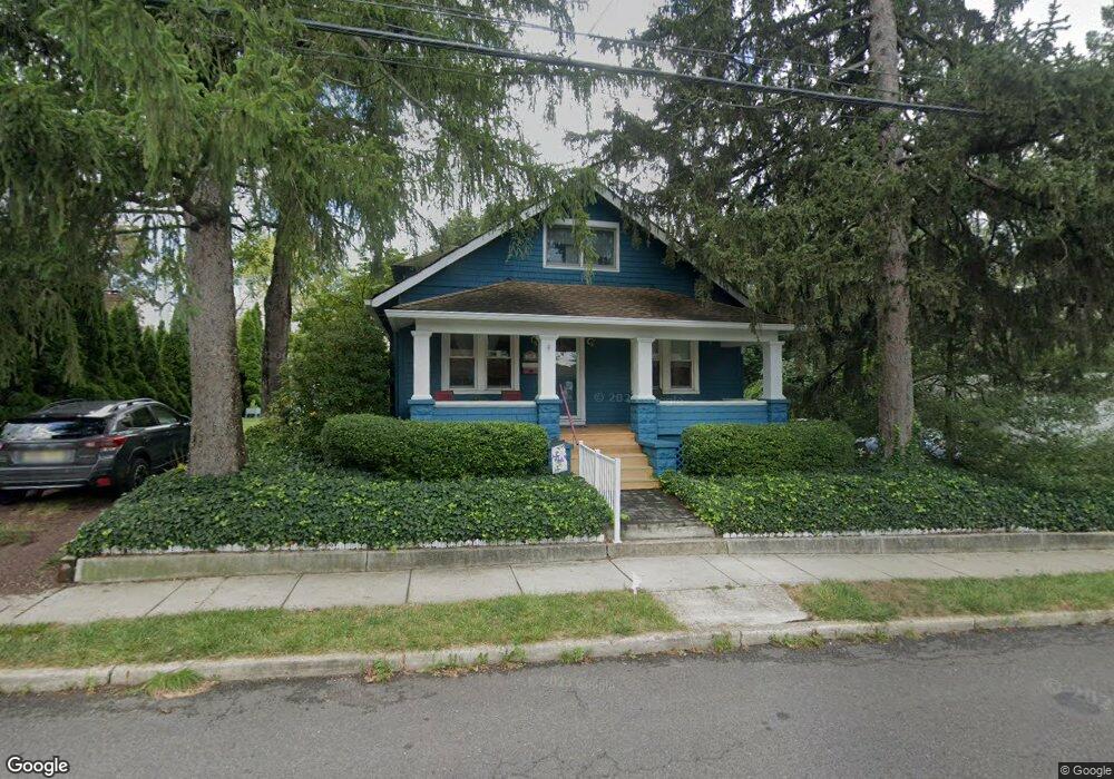
300 Summit St Hightstown, NJ 08520
Estimated Value: $490,000 - $549,000
--
Bed
--
Bath
1,596
Sq Ft
$321/Sq Ft
Est. Value
About This Home
This home is located at 300 Summit St, Hightstown, NJ 08520 and is currently estimated at $511,658, approximately $320 per square foot. 300 Summit St is a home located in Mercer County with nearby schools including Melvin H. Kreps Middle School, Hightstown High School, and SciCore Academy.
Ownership History
Date
Name
Owned For
Owner Type
Purchase Details
Closed on
Jun 16, 2005
Sold by
Sinay David
Bought by
Lasko Donald and Lasko Kathryn
Current Estimated Value
Home Financials for this Owner
Home Financials are based on the most recent Mortgage that was taken out on this home.
Original Mortgage
$272,000
Outstanding Balance
$141,726
Interest Rate
5.73%
Estimated Equity
$369,932
Purchase Details
Closed on
May 26, 2000
Sold by
Ondy Christopher
Bought by
Sinay David and Cianflone Jill
Home Financials for this Owner
Home Financials are based on the most recent Mortgage that was taken out on this home.
Original Mortgage
$135,900
Interest Rate
8.12%
Purchase Details
Closed on
Mar 5, 1993
Sold by
Wadsworth Jeffrey M and Wadsworth Melinda M
Bought by
Ondy Christopher E and Ondy Kathryn
Purchase Details
Closed on
Oct 14, 1992
Sold by
Carduner Brian and Carduner Jocelyn
Bought by
Wadsworth Jeffrey M and Wadsworth Melinda M
Create a Home Valuation Report for This Property
The Home Valuation Report is an in-depth analysis detailing your home's value as well as a comparison with similar homes in the area
Home Values in the Area
Average Home Value in this Area
Purchase History
| Date | Buyer | Sale Price | Title Company |
|---|---|---|---|
| Lasko Donald | $340,000 | -- | |
| Sinay David | $151,000 | -- | |
| Ondy Christopher E | $130,000 | -- | |
| Wadsworth Jeffrey M | $134,500 | -- |
Source: Public Records
Mortgage History
| Date | Status | Borrower | Loan Amount |
|---|---|---|---|
| Open | Lasko Donald | $272,000 | |
| Previous Owner | Sinay David | $135,900 |
Source: Public Records
Tax History Compared to Growth
Tax History
| Year | Tax Paid | Tax Assessment Tax Assessment Total Assessment is a certain percentage of the fair market value that is determined by local assessors to be the total taxable value of land and additions on the property. | Land | Improvement |
|---|---|---|---|---|
| 2025 | $10,792 | $220,100 | $73,700 | $146,400 |
| 2024 | $10,681 | $220,100 | $73,700 | $146,400 |
| 2023 | $10,681 | $220,100 | $73,700 | $146,400 |
| 2022 | $9,940 | $220,100 | $73,700 | $146,400 |
| 2021 | $9,940 | $220,100 | $73,700 | $146,400 |
| 2020 | $9,713 | $220,100 | $73,700 | $146,400 |
| 2019 | $9,442 | $220,100 | $73,700 | $146,400 |
| 2018 | $9,167 | $220,100 | $73,700 | $146,400 |
| 2017 | $9,073 | $220,100 | $73,700 | $146,400 |
| 2016 | $8,993 | $220,100 | $73,700 | $146,400 |
| 2015 | $8,936 | $220,100 | $73,700 | $146,400 |
| 2014 | $8,993 | $220,100 | $73,700 | $146,400 |
Source: Public Records
Map
Nearby Homes
- 201 Morrison Ave
- 365 Stockton St
- 107 Hausser Ave
- 104 1st Ave
- 400 Stockton St
- 145 Lincoln Ave
- 141 Lincoln Ave
- 203 Hutchinson St
- 309 Lincoln Ave
- 302 S Main St
- 17 Winchester Dr
- 58 Teal Ct
- 102 Teal Ct
- 0 Route 130
- 28 Columbia Ave
- 108 Orchard Ave
- 128 Monmouth St
- 15 Brownstone Rd
- 1 Sterling Ct
- 219 Maxwell Ave
- 302 Summit St
- 220 Summit St
- 142 Summit St
- 301 Summit St
- 303 Summit St
- 304 Morrison Ave
- 302 Morrison Ave
- 302 2ND FLOOR Morrison Ave
- 211 Summit St
- 209 Summit St
- 204 Summit St
- 234 Morrison Ave
- 310 Morrison Ave
- 314 Morrison Ave
- 207 Summit St
- 316 Morrison Ave
- 205 Summit St
- 160 1st Ave
- 315 2nd Ave
- 203 Summit St