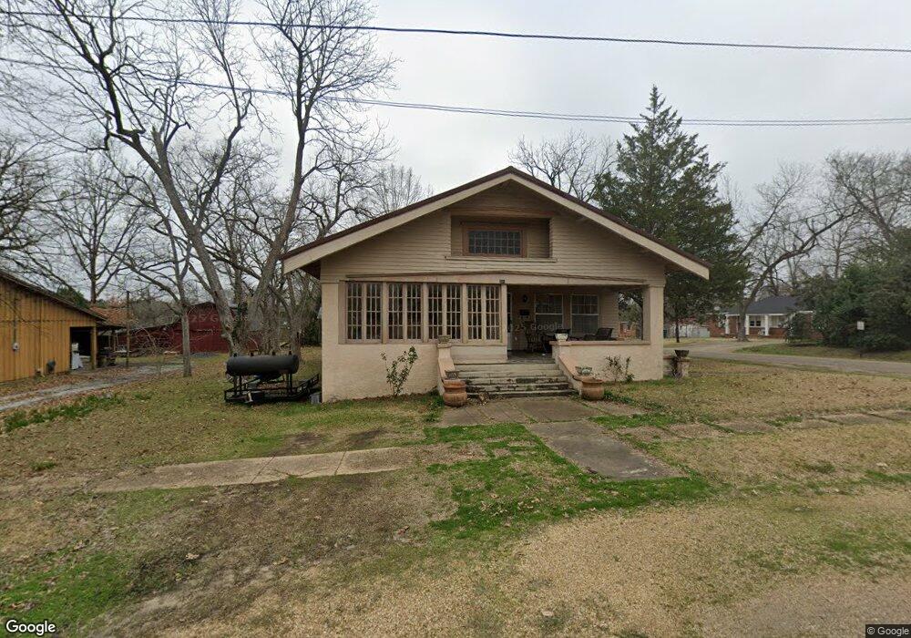
300 W Perry St Demopolis, AL 36732
Estimated Value: $148,464 - $179,000
Studio
--
Bath
1,902
Sq Ft
$87/Sq Ft
Est. Value
About This Home
This home is located at 300 W Perry St, Demopolis, AL 36732 and is currently estimated at $165,366, approximately $86 per square foot. 300 W Perry St is a home located in Marengo County with nearby schools including Westside Elementary School, U.S. Jones Elementary School, and Demopolis Middle School.
Ownership History
Date
Name
Owned For
Owner Type
Purchase Details
Closed on
Oct 24, 2011
Sold by
The Estate Of Bessie D Thigpen
Bought by
Morris Michael
Current Estimated Value
Home Financials for this Owner
Home Financials are based on the most recent Mortgage that was taken out on this home.
Original Mortgage
$2,322
Interest Rate
4.16%
Create a Home Valuation Report for This Property
The Home Valuation Report is an in-depth analysis detailing your home's value as well as a comparison with similar homes in the area
Home Values in the Area
Average Home Value in this Area
Purchase History
| Date | Buyer | Sale Price | Title Company |
|---|---|---|---|
| Morris Michael | -- | -- |
Source: Public Records
Mortgage History
| Date | Status | Borrower | Loan Amount |
|---|---|---|---|
| Closed | Morris Michael | $2,322 | |
| Open | Morris Michael | $75,437 |
Source: Public Records
Tax History
| Year | Tax Paid | Tax Assessment Tax Assessment Total Assessment is a certain percentage of the fair market value that is determined by local assessors to be the total taxable value of land and additions on the property. | Land | Improvement |
|---|---|---|---|---|
| 2024 | $739 | $14,100 | $1,100 | $13,000 |
| 2023 | $739 | $13,540 | $0 | $0 |
| 2022 | $643 | $12,400 | $0 | $0 |
| 2021 | $615 | $11,920 | $1,100 | $10,820 |
| 2020 | $565 | $11,020 | $1,100 | $9,920 |
| 2019 | $529 | $11,000 | $1,080 | $9,920 |
| 2018 | $528 | $11,000 | $1,080 | $9,920 |
| 2017 | $470 | $9,900 | $1,080 | $8,820 |
| 2016 | $470 | $9,900 | $1,080 | $8,820 |
| 2015 | $470 | $0 | $0 | $0 |
| 2014 | $470 | $0 | $0 | $0 |
| 2013 | $289 | $0 | $0 | $0 |
Source: Public Records
Map
Nearby Homes
- 500 S Main Ave Unit S
- 703 The Cove
- 205 S Ash Ave
- 1106 Lillian Ln
- 1510 W Jackson St
- 1511 Service St
- 1315 Forest Brook Dr
- 00 Forest Brook
- 0 U S 80 Unit 20102631
- County Highway 21
- 1600 Elmwood Dr
- 1704 Maple Leaf Dr
- 1805 Cypress Cove Rd
- 0 Highway 80
- 0 Hwy 43 S
- 0 River Ranch Rd
- 5469 County Road 19
- 335 Cedar Cove Dr
- 482 Sandpiper Dr
- 480 Sandpiper Dr
- 304 W Perry St
- 301 W Decatur St
- 401 S Commissioners Ave
- 305 S Commissioners Ave
- 303 W Decatur St
- 307 S Desounettes Ave
- 305 S Desounettes Ave
- 209 W Decatur St
- 303 S Desounettes Ave
- 301 W Perry St Unit W
- 207 W Decatur St
- 307 W Perry St
- 301 S Desounettes Ave
- 310 S Main Ave
- 310 S Main Ave
- 302 S Main Ave
- 204 W Decatur St
- 403 W Decatur St
- 300 S Main Ave
- 400 S Main Ave
Your Personal Tour Guide
Ask me questions while you tour the home.