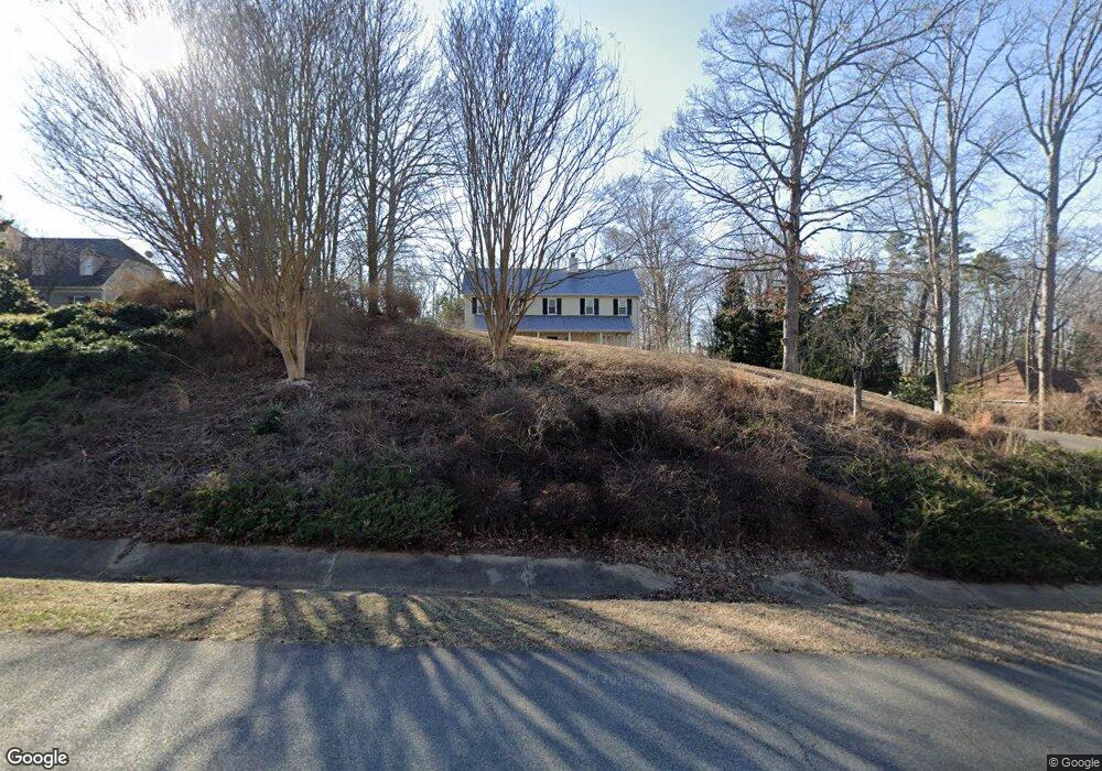
3000 Summerhurst Dr Midlothian, VA 23113
Robious NeighborhoodEstimated Value: $702,542 - $827,000
4
Beds
4
Baths
3,446
Sq Ft
$220/Sq Ft
Est. Value
About This Home
This home is located at 3000 Summerhurst Dr, Midlothian, VA 23113 and is currently estimated at $758,886, approximately $220 per square foot. 3000 Summerhurst Dr is a home located in Chesterfield County with nearby schools including Robious Elementary School, Robious Middle School, and James River High School.
Ownership History
Date
Name
Owned For
Owner Type
Purchase Details
Closed on
Jan 16, 2015
Sold by
Wade Brian and Wade Susan E
Bought by
Wade Trustees Brian J
Current Estimated Value
Purchase Details
Closed on
May 8, 2000
Sold by
Peple Ii Edward C
Bought by
Wade Brian and Wade Susan E
Home Financials for this Owner
Home Financials are based on the most recent Mortgage that was taken out on this home.
Original Mortgage
$228,000
Interest Rate
8.21%
Mortgage Type
Credit Line Revolving
Create a Home Valuation Report for This Property
The Home Valuation Report is an in-depth analysis detailing your home's value as well as a comparison with similar homes in the area
Home Values in the Area
Average Home Value in this Area
Purchase History
| Date | Buyer | Sale Price | Title Company |
|---|---|---|---|
| Wade Trustees Brian J | -- | -- | |
| Wade Brian | $285,000 | -- |
Source: Public Records
Mortgage History
| Date | Status | Borrower | Loan Amount |
|---|---|---|---|
| Previous Owner | Wade Brian | $228,000 |
Source: Public Records
Tax History Compared to Growth
Tax History
| Year | Tax Paid | Tax Assessment Tax Assessment Total Assessment is a certain percentage of the fair market value that is determined by local assessors to be the total taxable value of land and additions on the property. | Land | Improvement |
|---|---|---|---|---|
| 2025 | $5,298 | $592,500 | $160,000 | $432,500 |
| 2024 | $5,298 | $592,200 | $160,000 | $432,200 |
| 2023 | $5,047 | $554,600 | $140,000 | $414,600 |
| 2022 | $4,915 | $531,500 | $132,000 | $399,500 |
| 2021 | $4,576 | $479,100 | $122,000 | $357,100 |
| 2020 | $4,740 | $496,300 | $122,000 | $374,300 |
| 2019 | $4,715 | $496,300 | $122,000 | $374,300 |
| 2018 | $4,675 | $496,300 | $122,000 | $374,300 |
| 2017 | $4,611 | $477,700 | $122,000 | $355,700 |
| 2016 | $4,586 | $477,700 | $122,000 | $355,700 |
| 2015 | $4,491 | $465,200 | $110,000 | $355,200 |
| 2014 | $4,294 | $447,300 | $98,000 | $349,300 |
Source: Public Records
Map
Nearby Homes
- 3010 Middlewood Rd
- 12213 Capwell Dr
- 3530 Old Gun Rd W
- 12602 Foxstone Ct
- 2008 Magnolia Grove Way
- 2735 Swanhurst Dr
- 11240 Turnley Ln
- 3805 Solebury Place
- 2819 Live Oak Ln
- 2800 Live Oak Ln
- 10841 Ramshorn Rd
- 11763 N Briar Patch Dr
- 11627 E Briar Patch Dr
- 3820 Reeds Landing Cir
- 11714 S Briar Patch Dr
- 11814 N Briar Patch Dr
- 11815 N Briar Patch Dr
- 11713 S Briar Patch Dr
- 11709 S Briar Patch Dr
- 12931 River Hills Dr
- 2980 Summerhurst Dr
- 3103 Waterton Dr
- 3101 Waterton Dr
- 2970 Summerhurst Dr
- 3020 Summerhurst Dr
- 2981 Summerhurst Dr
- 3001 Summerhurst Dr
- 2971 Summerhurst Dr
- 3011 Summerhurst Dr
- 3111 Waterton Dr
- 3030 Summerhurst Dr
- 2961 Summerhurst Dr
- 2960 Summerhurst Dr
- 3031 Summerhurst Dr
- 3121 Waterton Dr
- 2960 Misty Ridge Ct
- 2950 Misty Ridge Ct
- 3102 Waterton Dr
- 2962 Misty Ridge Ct
- 3040 Summerhurst Dr