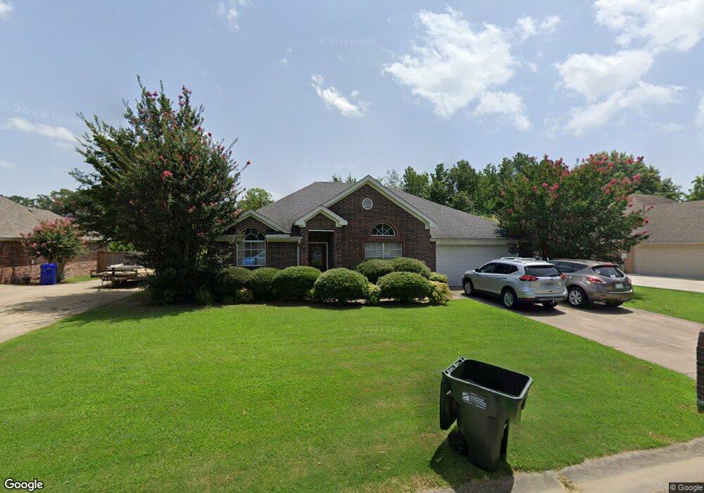
3005 Franklin Cir Conway, AR 72034
Downtown Conway NeighborhoodEstimated Value: $327,000 - $347,000
--
Bed
3
Baths
2,410
Sq Ft
$140/Sq Ft
Est. Value
About This Home
This home is located at 3005 Franklin Cir, Conway, AR 72034 and is currently estimated at $337,272, approximately $139 per square foot. 3005 Franklin Cir is a home located in Faulkner County with nearby schools including Julia Lee Moore Elementary School, Conway Junior High School, and Conway High School.
Ownership History
Date
Name
Owned For
Owner Type
Purchase Details
Closed on
May 9, 2006
Bought by
Trent
Current Estimated Value
Purchase Details
Closed on
Aug 16, 2005
Bought by
Roberts Dated 3-10-04
Purchase Details
Closed on
Jan 3, 2005
Bought by
Trent
Purchase Details
Closed on
Mar 10, 2004
Sold by
Trent Family Lp
Bought by
Roberts Michelle L
Purchase Details
Closed on
Mar 10, 1998
Bought by
Trent Family
Create a Home Valuation Report for This Property
The Home Valuation Report is an in-depth analysis detailing your home's value as well as a comparison with similar homes in the area
Home Values in the Area
Average Home Value in this Area
Purchase History
| Date | Buyer | Sale Price | Title Company |
|---|---|---|---|
| Trent | -- | -- | |
| Roberts Dated 3-10-04 | $110,800 | -- | |
| Trent | -- | -- | |
| Roberts Michelle L | $110,800 | None Available | |
| Trent Family | -- | -- |
Source: Public Records
Mortgage History
| Date | Status | Borrower | Loan Amount |
|---|---|---|---|
| Closed | Roberts Michelle L | $0 |
Source: Public Records
Tax History Compared to Growth
Tax History
| Year | Tax Paid | Tax Assessment Tax Assessment Total Assessment is a certain percentage of the fair market value that is determined by local assessors to be the total taxable value of land and additions on the property. | Land | Improvement |
|---|---|---|---|---|
| 2025 | $2,565 | $62,150 | $6,000 | $56,150 |
| 2024 | $2,351 | $62,150 | $6,000 | $56,150 |
| 2023 | $2,138 | $42,250 | $5,200 | $37,050 |
| 2022 | $2,138 | $42,250 | $5,200 | $37,050 |
| 2021 | $2,034 | $42,250 | $5,200 | $37,050 |
| 2020 | $1,849 | $36,540 | $5,200 | $31,340 |
| 2019 | $1,849 | $36,540 | $5,200 | $31,340 |
| 2018 | $1,849 | $36,540 | $5,200 | $31,340 |
| 2017 | $1,849 | $36,540 | $5,200 | $31,340 |
| 2016 | $1,849 | $36,540 | $5,200 | $31,340 |
| 2015 | $1,823 | $36,020 | $5,200 | $30,820 |
| 2014 | $1,823 | $36,020 | $5,200 | $30,820 |
Source: Public Records
Map
Nearby Homes
- 3020 Ashley Dr
- 1715 Royal Dr
- 1810 Royal Dr
- 1840 Drury Ln
- 3115 Baxter Dr
- 3115 Tyler St
- 3335 Nicklaus Dr
- 2850 Carmichael Dr
- 8 Smoking Oaks Rd
- 11 Red Oak Dr
- 9 Fair Oaks Dr
- 1690 Winterbrook Dr
- 1240 Salem Rd
- 15 Brier Springs Dr
- 1205 Salem Rd
- 1145 Salem Rd
- 1320 Nob Hill St
- 1330 Nob Hill St
- 50 White Oak Dr
- 27 Brierwood Cir
- 2995 Franklin Cir
- 3015 Franklin Cir
- 1910 Payne Ln
- 2990 Crawford Loop
- 2985 Franklin Cir
- 3000 Crawford Loop
- 2980 Franklin Cir
- 1905 Payne Ln
- 1920 Payne Ln
- 0 Franklin Cir
- 2980 Crawford Loop
- 2975 Franklin Cir
- 1915 Payne Ln
- 3010 Crawford Loop
- 3035 Franklin Cir
- 2970 Franklin Cir
- 1925 Payne Ln
- 2970 Crawford Loop
- 3020 Crawford Loop
- 2965 Franklin Cir