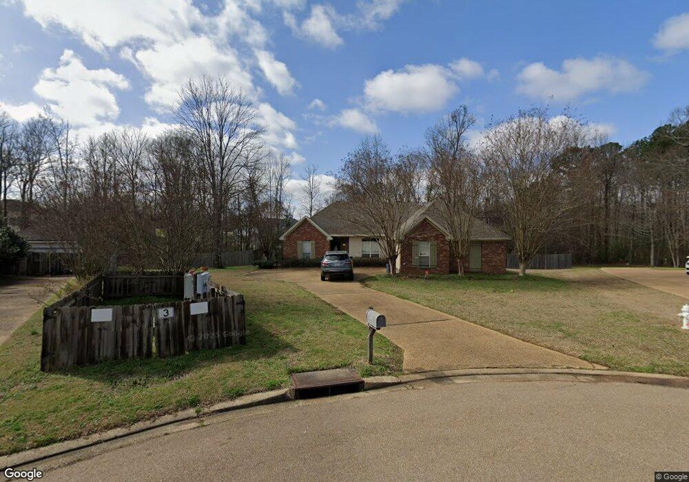
3007 Stonehendge Dr Brandon, MS 39042
Estimated Value: $254,000 - $278,000
3
Beds
2
Baths
1,710
Sq Ft
$156/Sq Ft
Est. Value
About This Home
This home is located at 3007 Stonehendge Dr, Brandon, MS 39042 and is currently estimated at $267,520, approximately $156 per square foot. 3007 Stonehendge Dr is a home located in Rankin County with nearby schools including Rouse Elementary School, Brandon Elementary School, and Stonebridge Elementary School.
Ownership History
Date
Name
Owned For
Owner Type
Purchase Details
Closed on
Nov 13, 2017
Sold by
Pickering Michael P
Bought by
Pickering Mallory C
Current Estimated Value
Purchase Details
Closed on
Jun 23, 2009
Sold by
Paul A Paul A and Pearson Lauren M
Bought by
Pickering Michael P and Pickering Mallory C
Home Financials for this Owner
Home Financials are based on the most recent Mortgage that was taken out on this home.
Original Mortgage
$159,354
Interest Rate
4.88%
Mortgage Type
VA
Create a Home Valuation Report for This Property
The Home Valuation Report is an in-depth analysis detailing your home's value as well as a comparison with similar homes in the area
Home Values in the Area
Average Home Value in this Area
Purchase History
| Date | Buyer | Sale Price | Title Company |
|---|---|---|---|
| Pickering Mallory C | -- | -- | |
| Pickering Michael P | -- | -- |
Source: Public Records
Mortgage History
| Date | Status | Borrower | Loan Amount |
|---|---|---|---|
| Previous Owner | Pickering Michael P | $159,354 |
Source: Public Records
Tax History Compared to Growth
Tax History
| Year | Tax Paid | Tax Assessment Tax Assessment Total Assessment is a certain percentage of the fair market value that is determined by local assessors to be the total taxable value of land and additions on the property. | Land | Improvement |
|---|---|---|---|---|
| 2024 | $1,935 | $17,127 | $0 | $0 |
| 2023 | $1,810 | $16,167 | $0 | $0 |
| 2022 | $1,786 | $16,167 | $0 | $0 |
| 2021 | $1,786 | $16,167 | $0 | $0 |
| 2020 | $1,786 | $16,167 | $0 | $0 |
| 2019 | $1,609 | $14,483 | $0 | $0 |
| 2018 | $1,580 | $14,483 | $0 | $0 |
| 2017 | $1,580 | $14,483 | $0 | $0 |
| 2016 | $1,409 | $14,151 | $0 | $0 |
| 2015 | $1,409 | $14,151 | $0 | $0 |
| 2014 | $1,379 | $14,151 | $0 | $0 |
| 2013 | -- | $14,151 | $0 | $0 |
Source: Public Records
Map
Nearby Homes
- 589 Asbury Lane Dr
- 2022 S Cobblestone Cove
- 110 Alex Seals Ln
- 126 Asbury Square
- 0 Asbury Lane Dr Unit 4124886
- 1015 Longwood Place
- 141 Richburg Ct
- 112 Richburg Ct
- 0 Brock Cir Unit 4126665
- 0 Eldorado Cove Unit 4107565
- 167 Woodgate Dr
- 155 Post Hill Rd
- 135 Ridge Cove
- 141 Post Hill Rd
- 225 Burnham Rd
- 108 Fairdale Place
- 112 Fairdale Place
- 116 Long Meadow Ct
- 111 Hickory Hill Place
- 710 Chickasaw Dr S
- 3006 Stonehendge Dr
- 3005 Stonehendge Dr
- 3004 Stonehendge Dr
- 3003 Stonehendge Dr
- 3002 Stonehendge Dr
- 588 Asbury Lane Dr
- 3001 Stonehendge Dr
- 1001 Cobblestone Place
- 2002 S Cobblestone Cove
- 586 Asbury Lane Dr
- 1003 Cobblestone Place
- 1005 Cobblestone Place
- 1016 S Cobblestone Cove
- 584 Asbury Lane Dr
- 1000 Cobblestone Place
- 2007 Stonehendge Dr
- 2006 S Cobblestone Cove
- 1002 Cobblestone Place
- 1007 Cobblestone Place
- 2046 S Cobblestone Cove