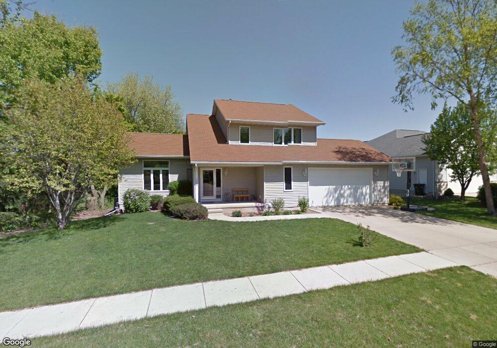
3008 Q Ave NW Cedar Rapids, IA 52405
Estimated Value: $334,000 - $373,000
4
Beds
4
Baths
1,903
Sq Ft
$183/Sq Ft
Est. Value
About This Home
This home is located at 3008 Q Ave NW, Cedar Rapids, IA 52405 and is currently estimated at $347,409, approximately $182 per square foot. 3008 Q Ave NW is a home located in Linn County with nearby schools including Kentucky Tech - Ashland Reg Tech Center, Ponderosa Elementary School, and Madison Elementary School.
Ownership History
Date
Name
Owned For
Owner Type
Purchase Details
Closed on
Sep 28, 2007
Sold by
Farmers State Bank
Bought by
Dillman Mark A and Dillman Jorie L
Current Estimated Value
Home Financials for this Owner
Home Financials are based on the most recent Mortgage that was taken out on this home.
Original Mortgage
$190,800
Outstanding Balance
$121,907
Interest Rate
6.66%
Mortgage Type
Purchase Money Mortgage
Estimated Equity
$225,502
Purchase Details
Closed on
Feb 14, 2007
Sold by
Rickertsen Lonnie R and Rickertsen Mary J
Bought by
Farmers State Bank
Create a Home Valuation Report for This Property
The Home Valuation Report is an in-depth analysis detailing your home's value as well as a comparison with similar homes in the area
Home Values in the Area
Average Home Value in this Area
Purchase History
| Date | Buyer | Sale Price | Title Company |
|---|---|---|---|
| Dillman Mark A | $211,500 | None Available | |
| Farmers State Bank | -- | None Available |
Source: Public Records
Mortgage History
| Date | Status | Borrower | Loan Amount |
|---|---|---|---|
| Open | Dillman Mark A | $190,800 |
Source: Public Records
Tax History Compared to Growth
Tax History
| Year | Tax Paid | Tax Assessment Tax Assessment Total Assessment is a certain percentage of the fair market value that is determined by local assessors to be the total taxable value of land and additions on the property. | Land | Improvement |
|---|---|---|---|---|
| 2025 | $4,606 | $304,800 | $63,800 | $241,000 |
| 2024 | $4,850 | $282,100 | $59,300 | $222,800 |
| 2023 | $4,850 | $270,700 | $59,300 | $211,400 |
| 2022 | $4,570 | $238,800 | $59,300 | $179,500 |
| 2021 | $4,676 | $229,600 | $45,600 | $184,000 |
| 2020 | $4,676 | $220,500 | $45,600 | $174,900 |
| 2019 | $4,282 | $207,200 | $36,500 | $170,700 |
| 2018 | $4,160 | $207,200 | $36,500 | $170,700 |
| 2017 | $4,396 | $210,400 | $36,500 | $173,900 |
| 2016 | $4,353 | $204,800 | $36,500 | $168,300 |
| 2015 | $4,489 | $210,986 | $36,469 | $174,517 |
| 2014 | $4,304 | $210,986 | $36,469 | $174,517 |
| 2013 | $4,208 | $210,986 | $36,469 | $174,517 |
Source: Public Records
Map
Nearby Homes
- 1733 Hillside Dr NW
- 1613 Southview Dr NW
- 327* Edgewood Rd NW
- 0 River Bluffs Dr
- 2825 Schultz Dr NW
- 2801 Schultz Dr NW
- 2520 N Ave NW
- S River Bluffs Dr Unit S of River Bluffs Dr
- 2143 Sugar Creek Dr NW
- 3802 Richland Dr NW
- 2147 Sugar Creek Dr NW
- 2210 O Ave NW
- 1322 Woodside Dr NW
- 3313 Crestwood Dr NW
- 0 O Ave NW
- 1724 O Ave NW
- 1608 Morris Ave NW
- 2623 Iris Ave NW
- 912 29th St NW
- 949 Westwood Dr NW
- 3002 Q Ave NW
- 2930 Q Ave NW
- 3009 Q Ave NW
- 3003 Q Ave NW
- 2922 Q Ave NW
- 2929 Q Ave NW
- 2921 Q Ave NW
- 2914 Q Ave NW
- 2915 Q Ave NW
- 1756 Woodside Ct NW
- 1826 29th St NW
- 1757 Woodside Ct NW
- 2906 Q Ave NW
- 2907 Q Ave NW
- 1904 29th St NW
- 1752 29th St NW
- 1751 Woodside Ct NW
- 1744 Woodside Ct NW
- 1912 29th St NW
- 1748 29th St NW