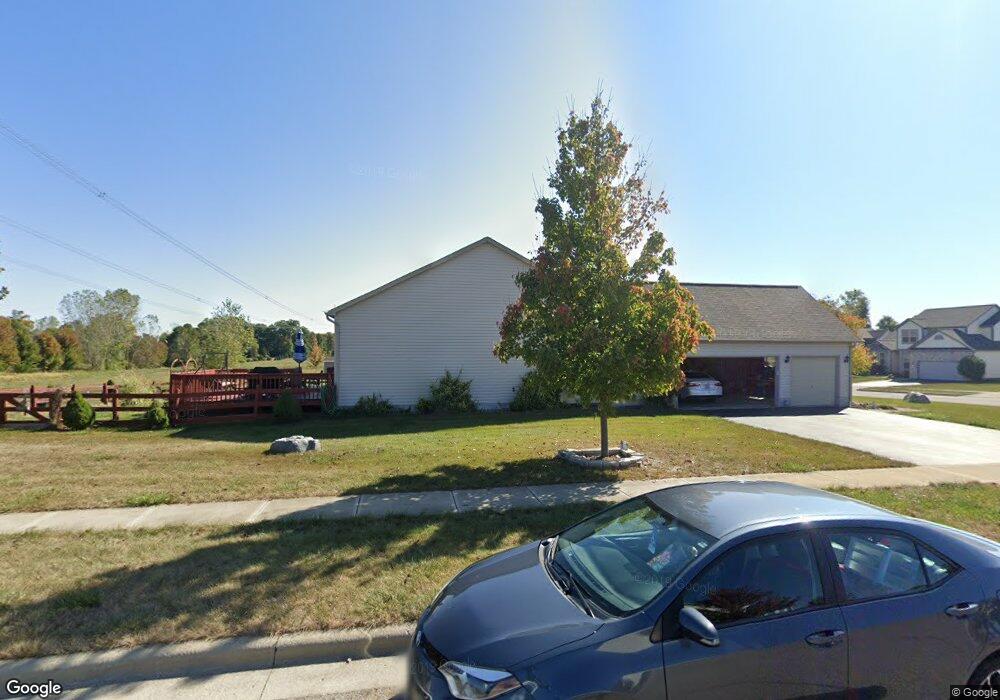
3009 Coltsbridge Dr Lewis Center, OH 43035
Orange NeighborhoodEstimated Value: $458,000 - $576,000
3
Beds
2
Baths
2,115
Sq Ft
$232/Sq Ft
Est. Value
About This Home
This home is located at 3009 Coltsbridge Dr, Lewis Center, OH 43035 and is currently estimated at $490,255, approximately $231 per square foot. 3009 Coltsbridge Dr is a home located in Delaware County with nearby schools including Alum Creek Elementary School, Olentangy Shanahan Middle School, and Olentangy High School.
Ownership History
Date
Name
Owned For
Owner Type
Purchase Details
Closed on
Apr 5, 2024
Sold by
Kimmins Connie Rose
Bought by
Mclain Ian and Walton Kelsey
Current Estimated Value
Home Financials for this Owner
Home Financials are based on the most recent Mortgage that was taken out on this home.
Original Mortgage
$344,000
Outstanding Balance
$338,918
Interest Rate
6.94%
Mortgage Type
Credit Line Revolving
Estimated Equity
$151,337
Purchase Details
Closed on
Aug 22, 2008
Sold by
Rockford Homes Inc
Bought by
Kimmins James Edward and Kimmins Connie Rose
Home Financials for this Owner
Home Financials are based on the most recent Mortgage that was taken out on this home.
Original Mortgage
$144,000
Interest Rate
6.42%
Mortgage Type
Purchase Money Mortgage
Create a Home Valuation Report for This Property
The Home Valuation Report is an in-depth analysis detailing your home's value as well as a comparison with similar homes in the area
Home Values in the Area
Average Home Value in this Area
Purchase History
| Date | Buyer | Sale Price | Title Company |
|---|---|---|---|
| Mclain Ian | $143,333 | Transcounty Title | |
| Kimmins James Edward | $252,800 | Title First |
Source: Public Records
Mortgage History
| Date | Status | Borrower | Loan Amount |
|---|---|---|---|
| Open | Mclain Ian | $344,000 | |
| Previous Owner | Kimmins James Edward | $144,000 |
Source: Public Records
Tax History Compared to Growth
Tax History
| Year | Tax Paid | Tax Assessment Tax Assessment Total Assessment is a certain percentage of the fair market value that is determined by local assessors to be the total taxable value of land and additions on the property. | Land | Improvement |
|---|---|---|---|---|
| 2024 | $6,197 | $121,770 | $22,260 | $99,510 |
| 2023 | $6,254 | $121,770 | $22,260 | $99,510 |
| 2022 | $6,163 | $98,980 | $16,800 | $82,180 |
| 2021 | $6,197 | $98,980 | $16,800 | $82,180 |
| 2020 | $6,227 | $98,980 | $16,800 | $82,180 |
| 2019 | $4,987 | $83,620 | $16,800 | $66,820 |
| 2018 | $5,010 | $83,620 | $16,800 | $66,820 |
| 2017 | $2,324 | $79,840 | $14,630 | $65,210 |
| 2016 | $5,067 | $79,840 | $14,630 | $65,210 |
| 2015 | $4,625 | $79,840 | $14,630 | $65,210 |
| 2014 | $4,690 | $79,840 | $14,630 | $65,210 |
| 2013 | $4,798 | $79,840 | $14,630 | $65,210 |
Source: Public Records
Map
Nearby Homes
- 2771 Abbey Knoll Dr
- 3144 Abbey Knoll Dr
- 2515 Coltsbridge Dr
- 2840 Waukeegan Ave
- 3177 Shoreline Dr
- 0 E Orange Rd
- 1915 Myrtle St
- 7631 Pleasant Colony Ct
- 7698 Gladshire Blvd
- 3902 Rivers Run Dr
- 2567 Carmel Dr
- 1811 Ivy St
- 6566 Morningside Dr
- 7715 Windy Hill Ct Unit 7715
- 7959 S Old State Rd
- 1955 Royal Oak Dr
- 1929 Rocklake Ct
- 6440 Morningside Dr
- 6315 Crystal Valley Dr
- 1654 Sunflower St
- 3099 Coltsbridge Dr
- 2935 Abbey Knoll Dr
- 2951 Abbey Knoll Dr
- 2881 Abbey Knoll Dr
- 2916 Abbey Knoll Dr
- 2900 Abbey Knoll Dr
- 2936 Abbey Knoll Dr
- 2971 Abbey Knoll Dr
- 2882 Abbey Knoll Dr
- 3055 Coltsbridge Dr
- 2864 Abbey Knoll Dr
- 2970 Abbey Knoll Dr
- 2989 Abbey Knoll Dr
- 2841 Abbey Knoll Dr
- 2891 Tweed Ct
- 2911 Tweed Ct
- 2879 Tweed Ct
- 3090 Woodstone Dr
- 2869 Tweed Ct
- 2848 Abbey Knoll Dr