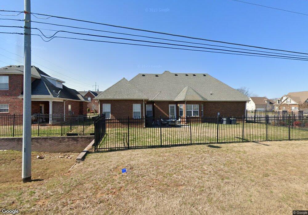
3009 Community Cir Murfreesboro, TN 37128
Estimated Value: $377,000 - $431,000
--
Bed
--
Bath
1,818
Sq Ft
$223/Sq Ft
Est. Value
About This Home
This home is located at 3009 Community Cir, Murfreesboro, TN 37128 and is currently estimated at $405,978, approximately $223 per square foot. 3009 Community Cir is a home located in Rutherford County with nearby schools including Salem Elementary School, Barfield Elementary School, and Rockvale Middle School.
Ownership History
Date
Name
Owned For
Owner Type
Purchase Details
Closed on
Nov 27, 2007
Sold by
Greytlyn Homes
Bought by
Angela Briggs
Current Estimated Value
Home Financials for this Owner
Home Financials are based on the most recent Mortgage that was taken out on this home.
Original Mortgage
$202,400
Outstanding Balance
$126,999
Interest Rate
6.22%
Mortgage Type
Purchase Money Mortgage
Estimated Equity
$278,979
Purchase Details
Closed on
Nov 14, 2007
Sold by
Rowland James C
Bought by
Smotherman Chad Dba
Home Financials for this Owner
Home Financials are based on the most recent Mortgage that was taken out on this home.
Original Mortgage
$202,400
Outstanding Balance
$126,999
Interest Rate
6.22%
Mortgage Type
Purchase Money Mortgage
Estimated Equity
$278,979
Create a Home Valuation Report for This Property
The Home Valuation Report is an in-depth analysis detailing your home's value as well as a comparison with similar homes in the area
Home Values in the Area
Average Home Value in this Area
Purchase History
| Date | Buyer | Sale Price | Title Company |
|---|---|---|---|
| Angela Briggs | $199,900 | -- | |
| Smotherman Chad Dba | -- | -- |
Source: Public Records
Mortgage History
| Date | Status | Borrower | Loan Amount |
|---|---|---|---|
| Open | Smotherman Chad Dba | $202,400 |
Source: Public Records
Tax History Compared to Growth
Tax History
| Year | Tax Paid | Tax Assessment Tax Assessment Total Assessment is a certain percentage of the fair market value that is determined by local assessors to be the total taxable value of land and additions on the property. | Land | Improvement |
|---|---|---|---|---|
| 2025 | $2,491 | $88,075 | $13,750 | $74,325 |
| 2024 | $2,491 | $88,075 | $13,750 | $74,325 |
| 2023 | $1,652 | $88,075 | $13,750 | $74,325 |
| 2022 | $1,423 | $88,075 | $13,750 | $74,325 |
| 2021 | $1,312 | $59,125 | $11,250 | $47,875 |
| 2020 | $1,312 | $59,125 | $11,250 | $47,875 |
| 2019 | $1,312 | $59,125 | $11,250 | $47,875 |
Source: Public Records
Map
Nearby Homes
- 3605 Shady Forest Dr
- 3633 Jerry Anderson
- 2819 Silver Springs Ct
- 3411 Geneva Dr
- 3613 Shady Forest Dr
- 3625 Shady Forest Dr
- 2818 Silver Springs Ct
- 3708 Jerry Anderson Dr
- 3640 Shady Forest Dr
- 3606 Geneva Dr
- 3633 Capstone Dr
- 3206 Holderwood Dr
- 3628 Pelham Wood Dr
- 3636 Pelham Wood Dr
- 3002 Stow Crossing
- 3736 Jerry Anderson Dr
- 3245 Genoa Dr
- 2910 Morning Mist Ct
- 3032 Morning Mist Ct
- 2732 Avington Ct
- 3013 Community Cir
- 3008 Community Cir
- 3012 Community Cir
- 3433 Genoa Dr
- 3434 Geneva Dr
- 3007 Holderwood Dr
- 3011 Holderwood Dr
- 3015 Holderwood Dr
- 3021 Community Cir
- 3512 Genoa Dr
- 3429 Genoa Dr
- 0 Community Cir
- 3430 Geneva Dr
- 3020 Community Cir
- 3516 Genoa Dr
- 3520 Genoa Dr
- 3025 Community Cir
- 3023 Holderwood Dr
- 3425 Genoa Dr
- 3008 Holderwood Dr