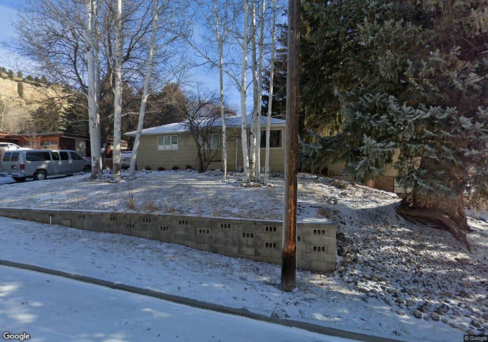
3009 E Macdonald Dr Billings, MT 59102
North Central Billings NeighborhoodEstimated Value: $383,098 - $425,000
5
Beds
2
Baths
2,472
Sq Ft
$162/Sq Ft
Est. Value
About This Home
This home is located at 3009 E Macdonald Dr, Billings, MT 59102 and is currently estimated at $401,275, approximately $162 per square foot. 3009 E Macdonald Dr is a home located in Yellowstone County with nearby schools including Poly Drive School, Will James Junior High School, and Billings Senior High School.
Ownership History
Date
Name
Owned For
Owner Type
Purchase Details
Closed on
Mar 30, 2012
Sold by
Bower Damon E and Bower Tennyson A
Bought by
Lehfeldt Drew J
Current Estimated Value
Home Financials for this Owner
Home Financials are based on the most recent Mortgage that was taken out on this home.
Original Mortgage
$169,850
Outstanding Balance
$117,096
Interest Rate
3.87%
Mortgage Type
FHA
Estimated Equity
$284,179
Create a Home Valuation Report for This Property
The Home Valuation Report is an in-depth analysis detailing your home's value as well as a comparison with similar homes in the area
Home Values in the Area
Average Home Value in this Area
Purchase History
| Date | Buyer | Sale Price | Title Company |
|---|---|---|---|
| Lehfeldt Drew J | -- | St |
Source: Public Records
Mortgage History
| Date | Status | Borrower | Loan Amount |
|---|---|---|---|
| Open | Lehfeldt Drew J | $169,850 |
Source: Public Records
Tax History
| Year | Tax Paid | Tax Assessment Tax Assessment Total Assessment is a certain percentage of the fair market value that is determined by local assessors to be the total taxable value of land and additions on the property. | Land | Improvement |
|---|---|---|---|---|
| 2025 | $3,058 | $385,900 | $60,832 | $325,068 |
| 2024 | $3,058 | $309,600 | $57,692 | $251,908 |
| 2023 | $3,074 | $309,600 | $57,692 | $251,908 |
| 2022 | $2,977 | $264,800 | $0 | $0 |
| 2021 | $2,827 | $264,800 | $0 | $0 |
| 2020 | $2,736 | $245,100 | $0 | $0 |
| 2019 | $2,615 | $245,100 | $0 | $0 |
| 2018 | $2,461 | $225,600 | $0 | $0 |
| 2017 | $2,088 | $225,600 | $0 | $0 |
| 2016 | $2,310 | $221,100 | $0 | $0 |
| 2015 | $2,258 | $221,100 | $0 | $0 |
| 2014 | $2,009 | $103,827 | $0 | $0 |
Source: Public Records
Map
Nearby Homes
- 3540 Masterson Cir
- 2644 Rimrock Rd
- 2646 Rimrock Rd
- 2504 Rancho Rd
- 2721 Louise Ln
- 3441 Masterson Cir
- 2748 Palm Dr
- 3135 Sycamore Ln
- 2815 Palm Dr
- 2756 Gregory Dr N
- 3065 Gregory Dr W
- 2829 Poly Dr
- 2117 Fairway Dr
- 2406 Woody Dr
- 3311 Harlou Dr
- 3210 Durland Dr
- 3226 Country Club Cir
- 2103 Poly Dr
- 3201 Leeann Blvd
- 3103 Silverwood St
- 3003 E Macdonald Dr
- 3015 E Macdonald Dr
- 3010 Brentwood Ln
- 3004 Brentwood Ln
- 2925 E Macdonald Dr
- 3021 E Macdonald Dr
- 2928 Brentwood Ln
- 3016 Brentwood Ln
- 2944 E Macdonald Dr
- 2946 E Macdonald Dr
- 2455 Cascade Ave
- 3107 E Macdonald Dr
- 2920 Brentwood Ln
- 2909 E Macdonald Dr
- 3104 E Macdonald Dr
- 2454 Teton Ave
- 2921 W Macdonald Dr
- 2451 Cascade Ave
- 2921 Brentwood Ln
- 3003 W Macdonald Dr
Your Personal Tour Guide
Ask me questions while you tour the home.