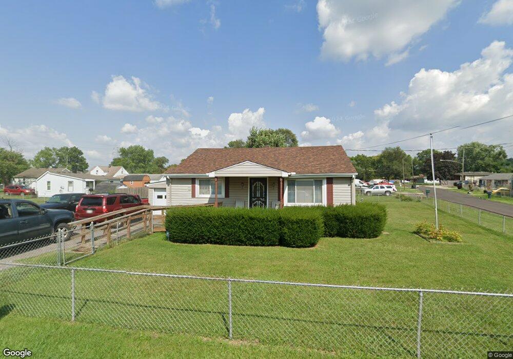
3009 Locust St Middletown, OH 45044
Estimated Value: $338,000 - $405,000
3
Beds
2
Baths
3,578
Sq Ft
$101/Sq Ft
Est. Value
About This Home
This home is located at 3009 Locust St, Middletown, OH 45044 and is currently estimated at $359,974, approximately $100 per square foot. 3009 Locust St is a home located in Butler County with nearby schools including Amanda Elementary School, Highview 6th Grade Center, and Middletown Middle School.
Ownership History
Date
Name
Owned For
Owner Type
Purchase Details
Closed on
Feb 22, 2007
Sold by
Picard William R
Bought by
Trousdale Dennis and Trousdale Debora
Current Estimated Value
Home Financials for this Owner
Home Financials are based on the most recent Mortgage that was taken out on this home.
Original Mortgage
$212,000
Interest Rate
9.45%
Mortgage Type
Balloon
Purchase Details
Closed on
Jan 30, 2006
Sold by
Picard William R
Bought by
Trousdale Dennis and Trousdale Debra
Home Financials for this Owner
Home Financials are based on the most recent Mortgage that was taken out on this home.
Original Mortgage
$214,000
Interest Rate
6.2%
Mortgage Type
Seller Take Back
Create a Home Valuation Report for This Property
The Home Valuation Report is an in-depth analysis detailing your home's value as well as a comparison with similar homes in the area
Home Values in the Area
Average Home Value in this Area
Purchase History
| Date | Buyer | Sale Price | Title Company |
|---|---|---|---|
| Trousdale Dennis | $212,000 | Attorney | |
| Trousdale Dennis | $219,000 | None Available |
Source: Public Records
Mortgage History
| Date | Status | Borrower | Loan Amount |
|---|---|---|---|
| Closed | Trousdale Dennis | $212,000 | |
| Closed | Trousdale Dennis | $214,000 |
Source: Public Records
Tax History Compared to Growth
Tax History
| Year | Tax Paid | Tax Assessment Tax Assessment Total Assessment is a certain percentage of the fair market value that is determined by local assessors to be the total taxable value of land and additions on the property. | Land | Improvement |
|---|---|---|---|---|
| 2024 | $4,834 | $93,590 | $14,510 | $79,080 |
| 2023 | $4,806 | $92,340 | $14,510 | $77,830 |
| 2022 | $3,613 | $62,170 | $14,510 | $47,660 |
| 2021 | $3,475 | $62,170 | $14,510 | $47,660 |
| 2020 | $3,620 | $62,170 | $14,510 | $47,660 |
| 2019 | $3,870 | $53,390 | $14,330 | $39,060 |
| 2018 | $3,368 | $53,390 | $14,330 | $39,060 |
| 2017 | $3,374 | $53,390 | $14,330 | $39,060 |
| 2016 | $3,398 | $51,490 | $14,330 | $37,160 |
| 2015 | $3,348 | $51,490 | $14,330 | $37,160 |
| 2014 | $2,839 | $51,490 | $14,330 | $37,160 |
| 2013 | $2,839 | $47,540 | $14,330 | $33,210 |
Source: Public Records
Map
Nearby Homes
- 3109 Locust St
- 720 Diamond Loop
- 580 Diamond Loop
- 514 Granada Ave
- 0 Jackson St Unit 895859
- 0 Jackson St Unit 1780028
- 712 Buena Ave
- 1102 Forrer St
- 3620 S Main St
- 3004 Judy Dr
- 2004 Minnesota St
- 3107 Rufus St
- 3113 Rufus St
- 3209 Rufus St
- 2900 Morgan St
- 504 16th Ave
- 707 Nathan Dr
- 608 15th Ave
- 1613 Sheridan Ave
- 4510 Trenton Franklin Rd
- 3009 Locust St
- 405 Manitee St
- 400 Hickory Ave
- 402 Hickory Ave
- 407 Manitee St
- 400 Manitee St
- 3008 Locust St
- 3008 Locust St
- 409 Manitee St
- 404 Hickory Ave
- 406 Hickory Ave
- 3101 Locust St
- 3002 Locust St
- 408 Hickory Ave
- 345 Manitee St
- 3014 Locust St
- 3103 Locust St
- 411 Manitee St
- 411 Manitee St
- 406 Manitee St