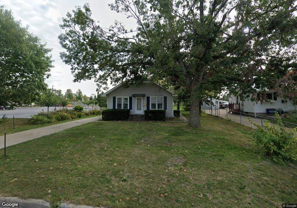
301 1st Ave Hiawatha, IA 52233
Estimated Value: $134,000 - $172,000
3
Beds
1
Bath
912
Sq Ft
$165/Sq Ft
Est. Value
About This Home
This home is located at 301 1st Ave, Hiawatha, IA 52233 and is currently estimated at $150,868, approximately $165 per square foot. 301 1st Ave is a home located in Linn County with nearby schools including T.C. Cherry Elementary School, Nixon Elementary School, and Ponderosa Elementary School.
Ownership History
Date
Name
Owned For
Owner Type
Purchase Details
Closed on
Sep 1, 2016
Sold by
Goetzinger James D and Goetzinger Janice M
Bought by
Ballas Eric W and Lindsey Ballas Dana M
Current Estimated Value
Purchase Details
Closed on
Aug 14, 2006
Sold by
Goetzinger James D and Goetzinger Janice M
Bought by
Ballas Eric W and Lindsey Ballas Dana M
Home Financials for this Owner
Home Financials are based on the most recent Mortgage that was taken out on this home.
Original Mortgage
$69,900
Interest Rate
5%
Mortgage Type
Seller Take Back
Create a Home Valuation Report for This Property
The Home Valuation Report is an in-depth analysis detailing your home's value as well as a comparison with similar homes in the area
Home Values in the Area
Average Home Value in this Area
Purchase History
| Date | Buyer | Sale Price | Title Company |
|---|---|---|---|
| Ballas Eric W | -- | None Available | |
| Ballas Eric W | $70,000 | None Available |
Source: Public Records
Mortgage History
| Date | Status | Borrower | Loan Amount |
|---|---|---|---|
| Previous Owner | Ballas Eric W | $69,900 |
Source: Public Records
Tax History Compared to Growth
Tax History
| Year | Tax Paid | Tax Assessment Tax Assessment Total Assessment is a certain percentage of the fair market value that is determined by local assessors to be the total taxable value of land and additions on the property. | Land | Improvement |
|---|---|---|---|---|
| 2025 | $1,930 | $140,700 | $21,100 | $119,600 |
| 2024 | $2,096 | $127,900 | $21,100 | $106,800 |
| 2023 | $2,096 | $127,900 | $21,100 | $106,800 |
| 2022 | $2,068 | $112,200 | $21,100 | $91,100 |
| 2021 | $1,996 | $112,200 | $21,100 | $91,100 |
| 2020 | $1,996 | $101,700 | $21,100 | $80,600 |
| 2019 | $1,854 | $101,700 | $21,100 | $80,600 |
| 2018 | $1,818 | $95,500 | $21,100 | $74,400 |
| 2017 | $1,938 | $97,100 | $21,100 | $76,000 |
| 2016 | $2,074 | $97,100 | $21,100 | $76,000 |
| 2015 | $2,078 | $97,100 | $21,100 | $76,000 |
| 2014 | $1,892 | $97,100 | $21,100 | $76,000 |
| 2013 | $1,838 | $97,100 | $21,100 | $76,000 |
Source: Public Records
Map
Nearby Homes
- 105 W Willman St
- 5455 Blairs Ferry Rd NE
- 109 E Willman St
- 1 N Center Point Rd
- 3 N Center Point Rd
- 250 Cimarron Dr Unit 311
- 114 Northwood Dr
- 6505 Brookview Ln NE
- 306 10th Ave
- 780 Ryan Ave
- 0 Council St NE
- 4609 White Pine Dr NE
- 1638 47th St NE
- 4761 Westchester Dr NE Unit C
- 4745 Westchester Dr NE Unit A
- 1006 Messina Dr NE
- 1138 Messina Dr NE
- 4645 Westchester Dr NE Unit A
- 4216 Marilyn Dr NE
- 327 Meadows Field Dr NE