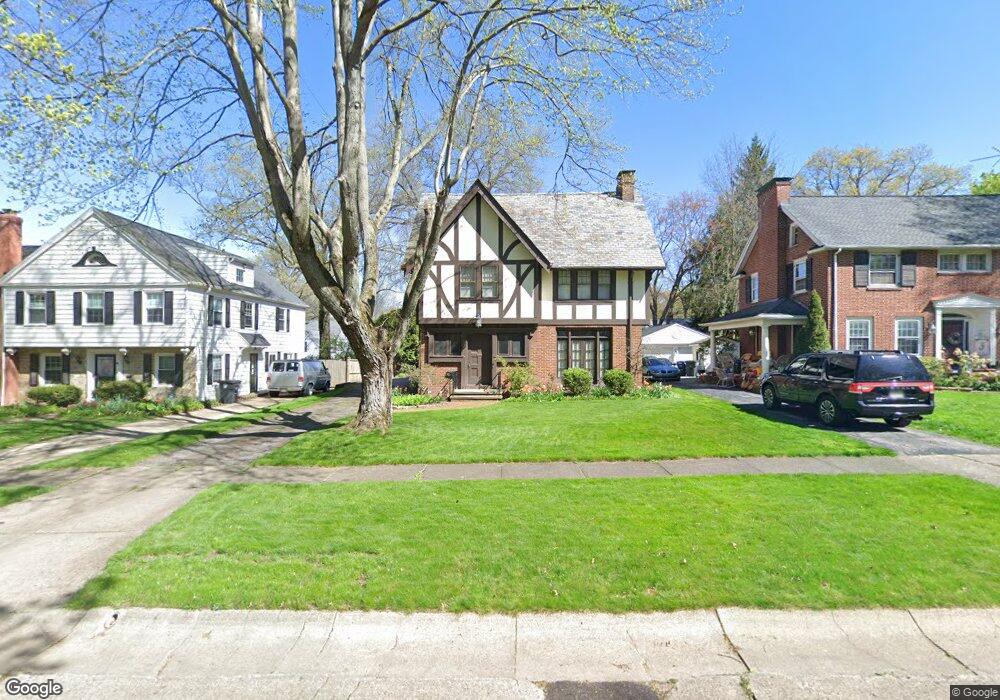
301 Afton Ave Akron, OH 44313
West Akron NeighborhoodEstimated Value: $288,156 - $306,000
4
Beds
3
Baths
2,384
Sq Ft
$125/Sq Ft
Est. Value
About This Home
This home is located at 301 Afton Ave, Akron, OH 44313 and is currently estimated at $298,289, approximately $125 per square foot. 301 Afton Ave is a home located in Summit County with nearby schools including Summit Academy School, Our Lady Of The Elms Elementary School, and Julie Billiart School Akron.
Ownership History
Date
Name
Owned For
Owner Type
Purchase Details
Closed on
Sep 14, 2009
Sold by
Roush Daniel L and Roush Carrie M
Bought by
Burkart Karl W and Larue Dionne R
Current Estimated Value
Home Financials for this Owner
Home Financials are based on the most recent Mortgage that was taken out on this home.
Original Mortgage
$195,360
Interest Rate
5.27%
Mortgage Type
FHA
Purchase Details
Closed on
Jan 27, 2004
Sold by
Cureton Donald E
Bought by
Roush Daniel L and Roush Carrie M
Home Financials for this Owner
Home Financials are based on the most recent Mortgage that was taken out on this home.
Original Mortgage
$163,200
Interest Rate
5.91%
Mortgage Type
Purchase Money Mortgage
Purchase Details
Closed on
Sep 24, 2002
Sold by
Cureton Donald E and Vetter Patricia A
Bought by
Cureton Donald E and The Donald E Cureton Revocable Trust
Create a Home Valuation Report for This Property
The Home Valuation Report is an in-depth analysis detailing your home's value as well as a comparison with similar homes in the area
Home Values in the Area
Average Home Value in this Area
Purchase History
| Date | Buyer | Sale Price | Title Company |
|---|---|---|---|
| Burkart Karl W | $199,000 | Abby Title | |
| Roush Daniel L | $204,000 | Wigley Title Agency Inc | |
| Cureton Donald E | -- | -- |
Source: Public Records
Mortgage History
| Date | Status | Borrower | Loan Amount |
|---|---|---|---|
| Closed | Burkart Karl W | $195,360 | |
| Closed | Roush Daniel L | $163,200 | |
| Closed | Roush Daniel L | $10,000 |
Source: Public Records
Tax History Compared to Growth
Tax History
| Year | Tax Paid | Tax Assessment Tax Assessment Total Assessment is a certain percentage of the fair market value that is determined by local assessors to be the total taxable value of land and additions on the property. | Land | Improvement |
|---|---|---|---|---|
| 2025 | $5,232 | $82,121 | $14,375 | $67,746 |
| 2024 | $4,333 | $82,121 | $14,375 | $67,746 |
| 2023 | $4,333 | $82,121 | $14,375 | $67,746 |
| 2022 | $4,442 | $66,227 | $11,592 | $54,635 |
| 2021 | $4,447 | $66,227 | $11,592 | $54,635 |
| 2020 | $4,379 | $66,230 | $11,590 | $54,640 |
| 2019 | $4,160 | $57,070 | $11,590 | $45,480 |
| 2018 | $4,104 | $57,070 | $11,590 | $45,480 |
| 2017 | $3,756 | $57,070 | $11,590 | $45,480 |
| 2016 | $3,759 | $51,220 | $11,590 | $39,630 |
| 2015 | $3,756 | $51,220 | $11,590 | $39,630 |
| 2014 | $3,726 | $51,220 | $11,590 | $39,630 |
| 2013 | $3,546 | $49,720 | $11,590 | $38,130 |
Source: Public Records
Map
Nearby Homes
- 141 Storer Ave
- 398 Crestview Ave
- 80 Clemmer Ave
- 1192 Sunset View Dr
- 1184 Sunset View Dr
- 166 Marvin Ave
- 1300 Culpepper Dr Unit 4A
- 42 Gloucester Ct Unit 3A
- 25 Berkshire Ct Unit 3A
- 138 Marvin Ave
- S/L 12 W Sunrise View Dr
- S/L 39 W Sunset View Dr
- S/L 37 W Sunset View Dr
- S/L 38 W Sunset View Dr
- S/L 40 W Sunset View Dr
- 74 Maplewood Ave
- 101 Marvin Ave
- 985 Bloomfield Ave
- 286 Alhambra Way
- 0 S Hawkins Ave Unit 5162400