Estimated Value: $225,000 - $237,000
--
Bed
2
Baths
1,695
Sq Ft
$136/Sq Ft
Est. Value
About This Home
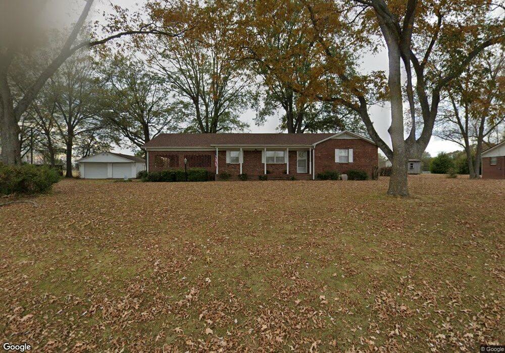
This home is located at 301 Cypress Rd, Alamo, TN 38001 and is currently estimated at $230,717, approximately $136 per square foot. 301 Cypress Rd is a home located in Crockett County with nearby schools including Alamo Elementary School.
Ownership History
Date
Name
Owned For
Owner Type
Purchase Details
Closed on
Mar 14, 2025
Sold by
Heath Imer P
Bought by
Sanders Stephen A
Current Estimated Value
Home Financials for this Owner
Home Financials are based on the most recent Mortgage that was taken out on this home.
Original Mortgage
$186,159
Outstanding Balance
$185,221
Interest Rate
6.95%
Mortgage Type
Credit Line Revolving
Estimated Equity
$45,496
Purchase Details
Closed on
Mar 28, 1969
Bought by
Heath Weldon T and Heath Imer P
Create a Home Valuation Report for This Property
The Home Valuation Report is an in-depth analysis detailing your home's value as well as a comparison with similar homes in the area
Home Values in the Area
Average Home Value in this Area
Purchase History
| Date | Buyer | Sale Price | Title Company |
|---|---|---|---|
| Sanders Stephen A | $235,050 | None Listed On Document | |
| Heath Weldon T | -- | -- |
Source: Public Records
Mortgage History
| Date | Status | Borrower | Loan Amount |
|---|---|---|---|
| Open | Sanders Stephen A | $186,159 |
Source: Public Records
Tax History Compared to Growth
Tax History
| Year | Tax Paid | Tax Assessment Tax Assessment Total Assessment is a certain percentage of the fair market value that is determined by local assessors to be the total taxable value of land and additions on the property. | Land | Improvement |
|---|---|---|---|---|
| 2024 | -- | $35,925 | $3,000 | $32,925 |
| 2023 | $800 | $35,925 | $3,000 | $32,925 |
| 2022 | $1,188 | $35,925 | $3,000 | $32,925 |
| 2021 | $1,020 | $25,575 | $2,275 | $23,300 |
| 2020 | $661 | $25,575 | $2,275 | $23,300 |
| 2019 | $1,038 | $25,575 | $2,275 | $23,300 |
| 2018 | $1,038 | $25,575 | $2,275 | $23,300 |
| 2017 | $1,038 | $25,575 | $2,275 | $23,300 |
| 2016 | $959 | $25,575 | $2,275 | $23,300 |
| 2015 | $939 | $25,575 | $2,275 | $23,300 |
| 2014 | $939 | $25,734 | $0 | $0 |
Source: Public Records
Map
Nearby Homes
- 272 E Vine St
- 375 E Park St
- 484 E Main St
- 735 E Main St
- 588 E Church St
- 207 S Johnson St
- 0 Bells St S
- 120 W Lincoln St
- 73 W Lincoln St
- 87 Aaron Dr
- 220 S Branch St
- 109 S Burns St
- 316 N Bells St
- 348 N Bells St
- 492 Lee Cir
- 0 U S Highway 412
- 153 County Farm Rd
- 285 Pete Tinsley Rd
- 165 Harris Grove Cemetery Rd
- 0 Pete Tinsley Rd
- 281 Cypress Rd
- 331 Cypress Rd
- 270 Cypress Rd
- 261 Cypress Rd
- 232 Cypress Rd
- 225 Cypress Rd
- 387 Cypress Rd
- 404 Cypress Rd
- 418 Cypress Rd
- 161 Cypress Rd
- 148 Cypress Rd
- 114 Cypress Rd
- 121 Cypress Rd
- 407 Cypress Rd
- 92 Cypress Rd
- 99 Cypress Rd
- 421 Cypress Rd
- 434 Cypress Rd
- 117 Mulberry Street Extension
- 177 Mulberry Street Extension