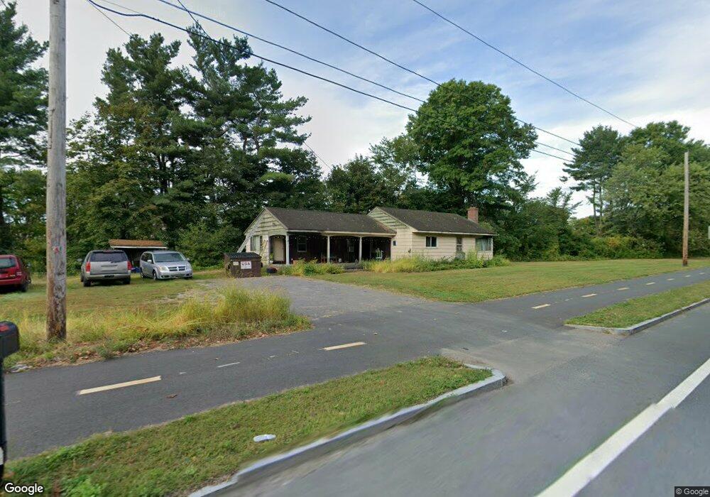
301 Damon Rd Northampton, MA 01060
Estimated Value: $233,000 - $376,000
2
Beds
1
Bath
1,436
Sq Ft
$222/Sq Ft
Est. Value
About This Home
This home is located at 301 Damon Rd, Northampton, MA 01060 and is currently estimated at $319,439, approximately $222 per square foot. 301 Damon Rd is a home located in Hampshire County with nearby schools including Northampton High School, The Montessori School of Northampton, and Lander Grinspoon Academy.
Ownership History
Date
Name
Owned For
Owner Type
Purchase Details
Closed on
Dec 5, 2018
Sold by
Janet R Krok Funding T
Bought by
Janet R Krok Lt
Current Estimated Value
Purchase Details
Closed on
Jan 10, 1992
Sold by
Kubasek Anna and Kubasek Laura S
Bought by
Krok Janet M and Krok Joseph P
Create a Home Valuation Report for This Property
The Home Valuation Report is an in-depth analysis detailing your home's value as well as a comparison with similar homes in the area
Home Values in the Area
Average Home Value in this Area
Purchase History
| Date | Buyer | Sale Price | Title Company |
|---|---|---|---|
| Janet R Krok Lt | -- | -- | |
| Janet R Krok Lt | -- | -- | |
| Krok Janet M | $5,000 | -- |
Source: Public Records
Tax History Compared to Growth
Tax History
| Year | Tax Paid | Tax Assessment Tax Assessment Total Assessment is a certain percentage of the fair market value that is determined by local assessors to be the total taxable value of land and additions on the property. | Land | Improvement |
|---|---|---|---|---|
| 2025 | $3,239 | $232,500 | $137,600 | $94,900 |
| 2024 | $3,848 | $253,300 | $157,700 | $95,600 |
| 2023 | $3,350 | $211,500 | $143,300 | $68,200 |
| 2022 | $3,106 | $173,600 | $133,900 | $39,700 |
| 2021 | $3,312 | $190,700 | $130,000 | $60,700 |
| 2020 | $3,204 | $190,700 | $130,000 | $60,700 |
| 2019 | $3,253 | $187,300 | $130,000 | $57,300 |
| 2018 | $3,144 | $184,500 | $130,000 | $54,500 |
| 2017 | $3,079 | $184,500 | $130,000 | $54,500 |
| 2016 | $2,982 | $184,500 | $130,000 | $54,500 |
| 2015 | $2,729 | $172,700 | $122,500 | $50,200 |
| 2014 | $2,658 | $172,700 | $122,500 | $50,200 |
Source: Public Records
Map
Nearby Homes
- 59 Day Ave
- 8 View Ave Unit A
- 8 View Ave Unit B
- 41 Old Ferry Rd
- 50 Walnut St
- 74 Barrett St Unit 105
- 13 1/2 Finn St
- 26 Russell St Unit A-B
- 30 Cherry St
- 30 Cherry St Unit A
- 30 Cherry St Unit B
- 9 Walnut St Unit B
- 5 Prospect Ct
- 37 Finn St
- 215 State St
- 30 Graves Ave Unit B
- 76 Crescent St Unit 2
- 58 Phillips Place
- 76 Cooke Ave
- 51 Phillips Place Unit 1
- 301 Damon Rd
- 307 Damon Rd
- 311 Damon Rd
- 244 Damon Rd
- 139B Damon Rd Unit 1
- 139B Damon Rd Unit 11
- 139B Damon Rd Unit 10
- 139B Damon Rd Unit 5
- 139B Damon Rd Unit 3
- 139B Damon Rd Unit 2
- 139B Damon Rd
- 230 Damon Rd
- 98 Crosby St
- 212 Damon Rd
- 32 Industrial Dr E Unit 1
- 51 Marshall St
- 371 Damon Rd
- 80 Crosby St
- 45 Marshall St
- 0 Damon Rd