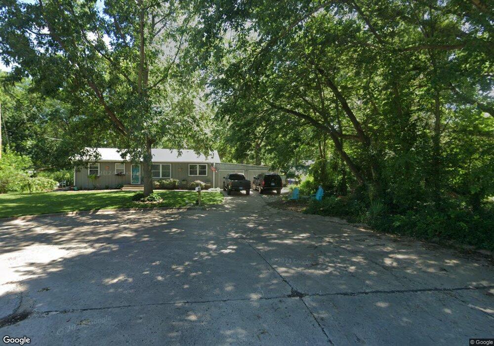
301 E 15th Place Lawrence, KS 66044
Barker NeighborhoodEstimated Value: $264,000 - $322,000
3
Beds
2
Baths
1,144
Sq Ft
$252/Sq Ft
Est. Value
About This Home
This home is located at 301 E 15th Place, Lawrence, KS 66044 and is currently estimated at $288,384, approximately $252 per square foot. 301 E 15th Place is a home located in Douglas County with nearby schools including Cordley Elementary School, Liberty Memorial Central Middle School, and Lawrence High School.
Ownership History
Date
Name
Owned For
Owner Type
Purchase Details
Closed on
Oct 30, 2023
Sold by
Thakker Aaron A and Thakker Kore A
Bought by
Phelps Joshua M and Phelps Brooke A
Current Estimated Value
Purchase Details
Closed on
Apr 8, 2009
Sold by
Davis Paul A and Davis Jill C
Bought by
Davis Paul A
Home Financials for this Owner
Home Financials are based on the most recent Mortgage that was taken out on this home.
Original Mortgage
$144,993
Interest Rate
5.16%
Mortgage Type
FHA
Purchase Details
Closed on
Jun 7, 2002
Sold by
Waller Thomas J and Waller Catherine A
Bought by
Davis Paul A and Davis Jill C
Home Financials for this Owner
Home Financials are based on the most recent Mortgage that was taken out on this home.
Original Mortgage
$101,250
Interest Rate
6.77%
Create a Home Valuation Report for This Property
The Home Valuation Report is an in-depth analysis detailing your home's value as well as a comparison with similar homes in the area
Home Values in the Area
Average Home Value in this Area
Purchase History
| Date | Buyer | Sale Price | Title Company |
|---|---|---|---|
| Phelps Joshua M | -- | Kansas Secured Title | |
| Davis Paul A | -- | First American Title | |
| Davis Paul A | -- | Douglas County Title Co |
Source: Public Records
Mortgage History
| Date | Status | Borrower | Loan Amount |
|---|---|---|---|
| Previous Owner | Davis Paul A | $144,993 | |
| Previous Owner | Davis Paul A | $101,250 |
Source: Public Records
Tax History
| Year | Tax Paid | Tax Assessment Tax Assessment Total Assessment is a certain percentage of the fair market value that is determined by local assessors to be the total taxable value of land and additions on the property. | Land | Improvement |
|---|---|---|---|---|
| 2025 | $4,241 | $34,420 | $9,200 | $25,220 |
| 2024 | $3,940 | $32,051 | $8,625 | $23,426 |
| 2023 | $3,782 | $29,578 | $6,900 | $22,678 |
| 2022 | $3,351 | $26,082 | $4,600 | $21,482 |
| 2021 | $3,082 | $23,161 | $4,368 | $18,793 |
| 2020 | $3,032 | $22,907 | $4,368 | $18,539 |
| 2019 | $2,882 | $21,815 | $3,798 | $18,017 |
| 2018 | $2,738 | $20,585 | $3,571 | $17,014 |
| 2017 | $2,771 | $20,597 | $3,571 | $17,026 |
| 2016 | $2,510 | $19,515 | $4,884 | $14,631 |
| 2015 | $2,470 | $19,205 | $4,884 | $14,321 |
| 2014 | $2,553 | $20,033 | $4,884 | $15,149 |
Source: Public Records
Map
Nearby Homes
- 414 Forrest Ave
- 1644 Barker Ave
- 1634 Rhode Island St
- 1341 Rhode Island St
- 1327 New Jersey St
- 5701 Johnson Ave
- 5804 Johnson Ave
- 903 Anna Tappan Way
- 907 Anna Tappan Way
- 931 Lasalle St
- 1215 New Jersey St
- 717 Beatnik Ct
- 1226 Delaware St Unit 12
- 1141 Connecticut St
- 1616 Louisiana St
- 2016 New Hampshire St
- 917 E 13th St
- 1128 Pennsylvania St
- 1111 New Jersey St
- 1923 Tennessee St
- 305 E 15th Place
- 1602 Barker Ave
- 309 E 15th Place
- 1540 Barker Ave
- 1610 Barker Ave
- 302 E 15th Place
- 424 Forrest Ave
- 306 E 15th Place
- 313 E 15th Place
- 410 Forrest Ave
- 428 Forrest Ave
- 1536 Barker Ave
- 432 Forrest Ave
- 1607 Learnard Ave
- 310 E 15th Place
- 1611 Learnard Ave
- 401 E 15th Place
- 442 Forrest Ave
- 314 E 15th Place
- 1601 Barker Ave
Your Personal Tour Guide
Ask me questions while you tour the home.