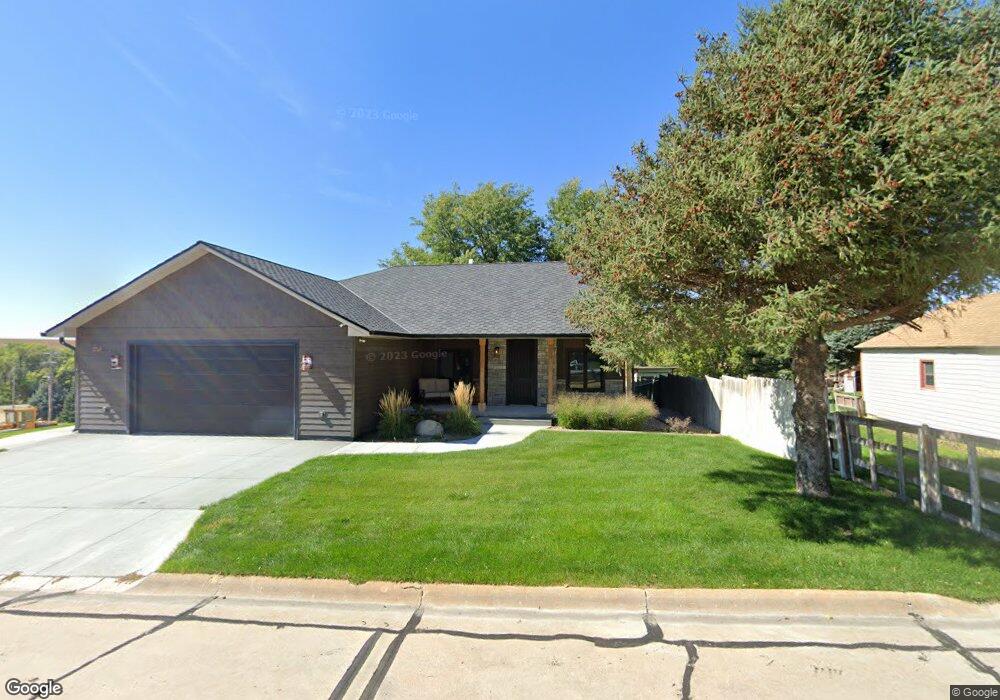
301 N Clay St Eustis, NE 69028
Estimated Value: $255,000 - $317,897
4
Beds
4
Baths
1,480
Sq Ft
$190/Sq Ft
Est. Value
About This Home
This home is located at 301 N Clay St, Eustis, NE 69028 and is currently estimated at $281,299, approximately $190 per square foot. 301 N Clay St is a home located in Frontier County with nearby schools including Elementary School at Eustis and Eustis-Farnam High School.
Ownership History
Date
Name
Owned For
Owner Type
Purchase Details
Closed on
Sep 27, 2009
Sold by
Huffman Thomas E and Huffman Joyce E
Bought by
Breen Jeanie
Current Estimated Value
Home Financials for this Owner
Home Financials are based on the most recent Mortgage that was taken out on this home.
Original Mortgage
$170,000
Outstanding Balance
$110,553
Interest Rate
5%
Mortgage Type
USDA
Estimated Equity
$170,746
Create a Home Valuation Report for This Property
The Home Valuation Report is an in-depth analysis detailing your home's value as well as a comparison with similar homes in the area
Purchase History
| Date | Buyer | Sale Price | Title Company |
|---|---|---|---|
| Breen Jeanie | $2,222 | -- |
Source: Public Records
Mortgage History
| Date | Status | Borrower | Loan Amount |
|---|---|---|---|
| Open | Breen Jeanie | $170,000 |
Source: Public Records
Tax History
| Year | Tax Paid | Tax Assessment Tax Assessment Total Assessment is a certain percentage of the fair market value that is determined by local assessors to be the total taxable value of land and additions on the property. | Land | Improvement |
|---|---|---|---|---|
| 2025 | $2,870 | $286,330 | $19,600 | $266,730 |
| 2024 | $3,746 | $286,330 | $19,600 | $266,730 |
| 2023 | $3,069 | $260,816 | $9,800 | $251,016 |
| 2022 | $3,069 | $222,378 | $9,800 | $212,578 |
| 2021 | $1,344 | $107,269 | $9,800 | $97,469 |
| 2020 | $1,215 | $97,023 | $5,600 | $91,423 |
| 2019 | $1,168 | $97,023 | $5,600 | $91,423 |
| 2018 | $1,147 | $97,023 | $5,600 | $91,423 |
| 2017 | $1,105 | $97,023 | $5,600 | $91,423 |
| 2016 | $860 | $72,680 | $6,440 | $66,240 |
| 2015 | $865 | $72,680 | $6,440 | $66,240 |
| 2014 | $802 | $58,505 | $6,440 | $52,065 |
Source: Public Records
Map
Nearby Homes
- 406 N Clay St
- 502 W Hendricks St
- 602 W Cameron
- 406 N Hamilton St
- 4 W Plum Creek Canyon Uebele
- 16 Burkholder Dr
- Lot 1 Reddington Farms Subdivision
- Lot 13 Reddington Farms Subdivision
- Lot 2 Reddington Farms Subdivision
- Lot 12 Reddington Farms Subdivision
- Lot 16 Reddington Farms Subdivision
- Lot 14 Reddington Farms Subdivision
- Lot 3 Reddington Farms Subdivision
- Lot 11 Reddington Farms Subdivision
- Lot 6 Reddington Farms Subdivision
- Lot 15 Reddington Farms Subdivision
- Lot 5 Reddington Farms Subdivision
- Lot 8 Reddington Farms Subdivision
- Lot 4 Reddington Farms Subdivision
- 85 Lakeview Acres Dr
- 303 N Clay St
- 302 N Clay St
- 302 N Wright St
- 402 W Anthony St
- 202 N Hamilton St
- 400 W Anthony St
- 403 N Clay St
- 402 W Cameron St
- 403 W Anthony St
- 402 N Clay St
- 402 N Wright St
- 305 N Hamilton St
- 307 N Hamilton St
- 303 N Hamilton St
- 309 N Hamilton St
- 202 N Clay St
- 404 N Clay St
- 301 N Hamilton St
- 407 N Clay St
- 207 N Hamilton St
Your Personal Tour Guide
Ask me questions while you tour the home.