Estimated Value: $129,374 - $139,000
3
Beds
1
Bath
1,440
Sq Ft
$94/Sq Ft
Est. Value
About This Home
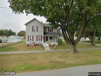
This home is located at 301 N Union St, Edon, OH 43518 and is currently estimated at $135,594, approximately $94 per square foot. 301 N Union St is a home located in Williams County with nearby schools including Edon Elementary School, Edon Elementary School, and Alvarado School.
Ownership History
Date
Name
Owned For
Owner Type
Purchase Details
Closed on
Apr 30, 2010
Sold by
Pine Lane Ltd
Bought by
Brigle Kyle K and Brigle Tami J
Current Estimated Value
Home Financials for this Owner
Home Financials are based on the most recent Mortgage that was taken out on this home.
Original Mortgage
$68,600
Outstanding Balance
$47,302
Interest Rate
5.02%
Mortgage Type
New Conventional
Estimated Equity
$86,607
Purchase Details
Closed on
Feb 25, 2010
Sold by
Herr Hollie M and Dailey Joelle D
Bought by
Pine Lane Ltd
Purchase Details
Closed on
Mar 31, 2008
Sold by
Cogswell Richard D and Cogswell Laura M
Bought by
Heer Hollie M and Dailey Joelle D
Home Financials for this Owner
Home Financials are based on the most recent Mortgage that was taken out on this home.
Original Mortgage
$79,273
Interest Rate
6.32%
Mortgage Type
FHA
Purchase Details
Closed on
Jul 3, 1990
Bought by
Cogswell Richard D and Cogswell Laura M
Create a Home Valuation Report for This Property
The Home Valuation Report is an in-depth analysis detailing your home's value as well as a comparison with similar homes in the area
Home Values in the Area
Average Home Value in this Area
Purchase History
| Date | Buyer | Sale Price | Title Company |
|---|---|---|---|
| Brigle Kyle K | $66,000 | Upland Title Agency Llc | |
| Pine Lane Ltd | $35,000 | Upland Title Agency Llc | |
| Heer Hollie M | $79,750 | Upland Title Agency Llc | |
| Cogswell Richard D | $32,500 | -- |
Source: Public Records
Mortgage History
| Date | Status | Borrower | Loan Amount |
|---|---|---|---|
| Open | Brigle Kyle K | $68,600 | |
| Previous Owner | Heer Hollie M | $79,273 | |
| Previous Owner | Cogswell Richard D | $28,489 |
Source: Public Records
Tax History Compared to Growth
Tax History
| Year | Tax Paid | Tax Assessment Tax Assessment Total Assessment is a certain percentage of the fair market value that is determined by local assessors to be the total taxable value of land and additions on the property. | Land | Improvement |
|---|---|---|---|---|
| 2024 | $1,366 | $36,720 | $3,190 | $33,530 |
| 2023 | $1,366 | $26,780 | $2,940 | $23,840 |
| 2022 | $1,112 | $26,780 | $2,940 | $23,840 |
| 2021 | $1,113 | $26,780 | $2,940 | $23,840 |
| 2020 | $1,052 | $24,330 | $2,660 | $21,670 |
| 2019 | $1,036 | $24,330 | $2,660 | $21,670 |
| 2018 | $1,054 | $24,330 | $2,660 | $21,670 |
| 2017 | $882 | $21,000 | $2,660 | $18,340 |
| 2016 | $770 | $21,000 | $2,660 | $18,340 |
| 2015 | $802 | $21,000 | $2,660 | $18,340 |
| 2014 | $802 | $21,000 | $2,660 | $18,340 |
| 2013 | $815 | $21,000 | $2,660 | $18,340 |
Source: Public Records
Map
Nearby Homes
- 305 Walz St
- 104 S Summit St
- 201 W Franklin St
- 202 N Main St
- 202 Woodville St
- 709 W Indiana St
- 801 W Indiana St
- 4028 County Road H
- 0 Cr81 and Cr G Unit 11434036
- 3170 S 800 E
- 00 County Road 8
- 00 Ohio 49
- County Road E 600
- 8485 County Road G
- 8007 County Road 8m
- 707 N Michigan Ave
- 6690 S State Road 1
- 1995 Ln 120 Hamilton Lake
- 2000 120 Ln
- 1900 Lane 120 Hamilton Lake