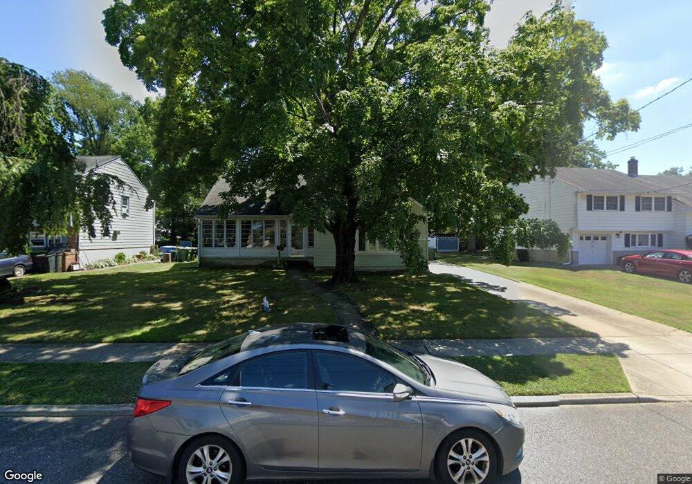
301 N Woodstock Dr Cherry Hill, NJ 08034
Estimated Value: $399,597 - $493,000
--
Bed
--
Bath
1,737
Sq Ft
$263/Sq Ft
Est. Value
About This Home
This home is located at 301 N Woodstock Dr, Cherry Hill, NJ 08034 and is currently estimated at $456,399, approximately $262 per square foot. 301 N Woodstock Dr is a home located in Camden County with nearby schools including Horace Mann Elementary School, John A Carusi Middle School, and Cherry Hill High-West High School.
Ownership History
Date
Name
Owned For
Owner Type
Purchase Details
Closed on
Aug 12, 2010
Sold by
Cooney Hannon Theresa E
Bought by
Hannon Theresa E and Hannon Timothy L
Current Estimated Value
Home Financials for this Owner
Home Financials are based on the most recent Mortgage that was taken out on this home.
Original Mortgage
$192,230
Outstanding Balance
$128,425
Interest Rate
4.75%
Mortgage Type
FHA
Estimated Equity
$327,974
Purchase Details
Closed on
Oct 24, 2000
Sold by
Kind Eleanora M
Bought by
Cooney Theresa E
Home Financials for this Owner
Home Financials are based on the most recent Mortgage that was taken out on this home.
Original Mortgage
$133,932
Interest Rate
7.81%
Mortgage Type
FHA
Create a Home Valuation Report for This Property
The Home Valuation Report is an in-depth analysis detailing your home's value as well as a comparison with similar homes in the area
Home Values in the Area
Average Home Value in this Area
Purchase History
| Date | Buyer | Sale Price | Title Company |
|---|---|---|---|
| Hannon Theresa E | -- | -- | |
| Cooney Theresa E | $134,000 | -- |
Source: Public Records
Mortgage History
| Date | Status | Borrower | Loan Amount |
|---|---|---|---|
| Open | Hannon Theresa E | $192,230 | |
| Previous Owner | Cooney Theresa E | $133,932 |
Source: Public Records
Tax History Compared to Growth
Tax History
| Year | Tax Paid | Tax Assessment Tax Assessment Total Assessment is a certain percentage of the fair market value that is determined by local assessors to be the total taxable value of land and additions on the property. | Land | Improvement |
|---|---|---|---|---|
| 2025 | $9,556 | $214,300 | $61,800 | $152,500 |
| 2024 | $9,005 | $214,300 | $61,800 | $152,500 |
| 2023 | $9,005 | $214,300 | $61,800 | $152,500 |
| 2022 | $8,756 | $214,300 | $61,800 | $152,500 |
| 2021 | $8,784 | $214,300 | $61,800 | $152,500 |
| 2020 | $8,677 | $214,300 | $61,800 | $152,500 |
| 2019 | $8,673 | $214,300 | $61,800 | $152,500 |
| 2018 | $8,649 | $214,300 | $61,800 | $152,500 |
| 2017 | $8,531 | $214,300 | $61,800 | $152,500 |
| 2016 | $7,695 | $195,900 | $61,800 | $134,100 |
| 2015 | $7,573 | $195,900 | $61,800 | $134,100 |
| 2014 | $7,489 | $195,900 | $61,800 | $134,100 |
Source: Public Records
Map
Nearby Homes
- 316 N Woodstock Dr
- 140 Uxbridge Unit C0140
- 290 Tavistock
- 301 Tavistock
- 204 Tavistock
- 175 Mansfield Blvd N
- 127 Oakdale Rd
- 412 E Summit Ave
- 29 Moore Ave
- 301 Reillywood Ave
- 300 Portsmouth Rd
- 16 Moore Ave
- 225 Spruce St
- 35 Colonial Ridge Dr
- 95 Lane of Acres
- 307 Provincetown Cir
- 1010 Salem Rd
- 130 Centre St
- 166 Ellis St
- 311 Lincoln Ave
- 223 N Woodstock Dr
- 305 N Woodstock Dr
- 300 S Woodstock Dr
- 221 N Woodstock Dr
- 302 S Woodstock Dr
- 220 S Woodstock Dr
- 304 S Woodstock Dr
- 302 N Woodstock Dr
- 220 N Woodstock Dr
- 307 N Woodstock Dr
- 219 N Woodstock Dr
- 304 N Woodstock Dr
- 218 N Woodstock Dr
- 218 S Woodstock Dr
- 306 S Woodstock Dr
- 306 N Woodstock Dr
- 309 N Woodstock Dr
- 217 N Woodstock Dr
- 216 N Woodstock Dr
- 216 S Woodstock Dr