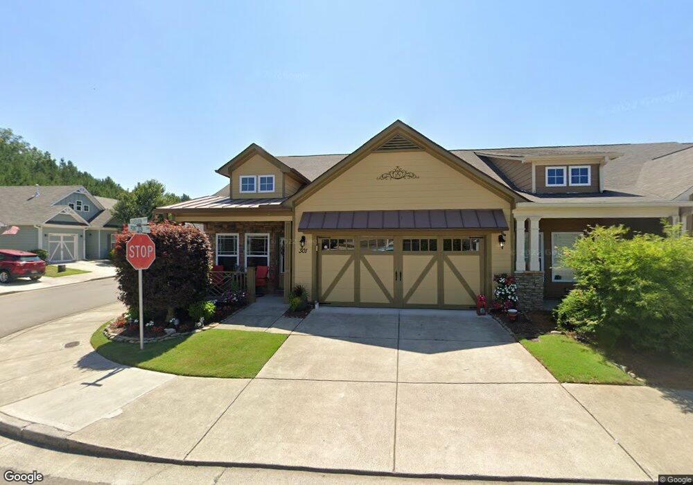
301 Overview Dr Canton, GA 30114
Estimated Value: $336,476 - $371,000
2
Beds
2
Baths
1,372
Sq Ft
$258/Sq Ft
Est. Value
About This Home
This home is located at 301 Overview Dr, Canton, GA 30114 and is currently estimated at $353,738, approximately $257 per square foot. 301 Overview Dr is a home located in Cherokee County with nearby schools including Hasty Elementary School Fine Arts Academy, Teasley Middle School, and Cherokee High School.
Ownership History
Date
Name
Owned For
Owner Type
Purchase Details
Closed on
Aug 11, 2016
Sold by
Lori A
Bought by
Cain L Alton and Cain Brenda
Current Estimated Value
Purchase Details
Closed on
Mar 25, 2016
Sold by
Evans Michael D
Bought by
Oconnor Lori A
Home Financials for this Owner
Home Financials are based on the most recent Mortgage that was taken out on this home.
Original Mortgage
$145,800
Interest Rate
3.62%
Create a Home Valuation Report for This Property
The Home Valuation Report is an in-depth analysis detailing your home's value as well as a comparison with similar homes in the area
Home Values in the Area
Average Home Value in this Area
Purchase History
| Date | Buyer | Sale Price | Title Company |
|---|---|---|---|
| Cain L Alton | -- | -- | |
| Oconnor Lori A | $162,000 | -- |
Source: Public Records
Mortgage History
| Date | Status | Borrower | Loan Amount |
|---|---|---|---|
| Previous Owner | Oconnor Lori A | $145,800 |
Source: Public Records
Tax History Compared to Growth
Tax History
| Year | Tax Paid | Tax Assessment Tax Assessment Total Assessment is a certain percentage of the fair market value that is determined by local assessors to be the total taxable value of land and additions on the property. | Land | Improvement |
|---|---|---|---|---|
| 2025 | $337 | $126,024 | $28,000 | $98,024 |
| 2024 | $331 | $119,800 | $25,200 | $94,600 |
| 2023 | $198 | $115,096 | $25,200 | $89,896 |
| 2022 | $285 | $90,756 | $16,000 | $74,756 |
| 2021 | $298 | $78,452 | $16,000 | $62,452 |
| 2020 | $275 | $74,188 | $16,000 | $58,188 |
| 2019 | $275 | $70,120 | $16,000 | $54,120 |
| 2018 | $282 | $66,840 | $15,200 | $51,640 |
| 2017 | $290 | $154,800 | $14,400 | $47,520 |
| 2016 | $294 | $128,200 | $11,200 | $40,080 |
| 2015 | $272 | $115,400 | $10,000 | $36,160 |
| 2014 | $245 | $104,200 | $10,000 | $31,680 |
Source: Public Records
Map
Nearby Homes
- 111 Point View Dr
- 3492 A Ball Ground Hwy
- 3492 Ball Ground Hwy
- 1547 York Dr
- 3365 Confederate Point
- 345 Roland Dr
- - Bluffs Pkwy
- 5916 Governors Walk Dr
- 618 Old Doss Dr
- 707 Evergreen Ln
- 513 Forest Ln
- 519 River Estates Pkwy
- 0 Governors Walk Dr Unit 7294252
- 1735 Nations Dr
- 581 Nations Dr
- 1204 Tahoe Place
- 202 Brooke Place Unit 1
- The Burton B Plan at The Bluffs
- The Oconee B Plan at The Bluffs
- The Russell B Plan at The Bluffs
- 303 Overview Dr
- 303 Overview Dr
- 305 Overview Dr
- 400 Rockview Dr
- 402 Rockview Dr
- 402 Rockview Dr Unit 88
- 404 Rockview Dr
- 404 Rockview Dr Unit 87
- 125 Point View Dr
- 307 Overview Dr
- 123 Point View Dr
- 127 Point View Dr
- 121 Point View Dr
- 129 Point View Dr
- 302 Overview Dr
- 309 Overview Dr
- 406 Rockview Dr
- 119 Point View Dr
- 304 Overview Dr
- 408 Rockview Dr