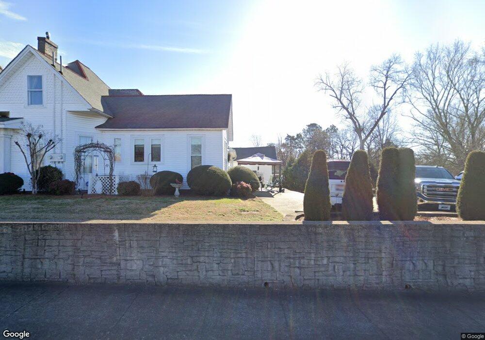
301 Pulaski St Lawrenceburg, TN 38464
Estimated Value: $234,847 - $313,000
--
Bed
4
Baths
2,132
Sq Ft
$135/Sq Ft
Est. Value
About This Home
This home is located at 301 Pulaski St, Lawrenceburg, TN 38464 and is currently estimated at $288,712, approximately $135 per square foot. 301 Pulaski St is a home located in Lawrence County with nearby schools including Ingram Sowell Elementary School, Lawrenceburg Public Elementary School, and David Crockett Elementary School.
Ownership History
Date
Name
Owned For
Owner Type
Purchase Details
Closed on
Nov 10, 2003
Sold by
Gobbell Charles H
Bought by
State Of Tennessee
Current Estimated Value
Purchase Details
Closed on
Jul 1, 1992
Bought by
Gobbell Charles H
Purchase Details
Closed on
Aug 11, 1990
Bought by
Estes Jane K and Kelly Nancy K M Wm C
Purchase Details
Closed on
Aug 10, 1990
Bought by
Estes Jane K and Kelly Nancy K M Wm C
Purchase Details
Closed on
May 8, 1986
Purchase Details
Closed on
Jul 3, 1971
Bought by
Kelly Larimore and Kelly Nell
Create a Home Valuation Report for This Property
The Home Valuation Report is an in-depth analysis detailing your home's value as well as a comparison with similar homes in the area
Home Values in the Area
Average Home Value in this Area
Purchase History
| Date | Buyer | Sale Price | Title Company |
|---|---|---|---|
| State Of Tennessee | -- | -- | |
| Gobbell Charles H | $20,000 | -- | |
| Estes Jane K | -- | -- | |
| Estes Jane K | -- | -- | |
| -- | $8,000 | -- | |
| Kelly Larimore | -- | -- |
Source: Public Records
Tax History Compared to Growth
Tax History
| Year | Tax Paid | Tax Assessment Tax Assessment Total Assessment is a certain percentage of the fair market value that is determined by local assessors to be the total taxable value of land and additions on the property. | Land | Improvement |
|---|---|---|---|---|
| 2025 | $1,467 | $47,200 | $0 | $0 |
| 2024 | $1,467 | $47,200 | $3,750 | $43,450 |
| 2023 | $1,467 | $47,200 | $3,750 | $43,450 |
| 2022 | $1,467 | $47,200 | $3,750 | $43,450 |
| 2021 | $1,466 | $33,350 | $3,750 | $29,600 |
| 2020 | $1,466 | $33,350 | $3,750 | $29,600 |
| 2019 | $1,466 | $33,350 | $3,750 | $29,600 |
| 2018 | $1,466 | $33,350 | $3,750 | $29,600 |
| 2017 | $1,466 | $33,350 | $3,750 | $29,600 |
| 2016 | $1,466 | $33,350 | $3,750 | $29,600 |
| 2015 | $1,388 | $33,350 | $3,750 | $29,600 |
| 2014 | $1,378 | $33,100 | $3,200 | $29,900 |
Source: Public Records
Map
Nearby Homes
- 213 Pulaski St
- 220 Jackson Ave
- 511 S Locust Ave
- 0 Stewart St
- 220 Lafayette Ave
- 336 Jackson Ave
- 316 S Military Ave
- 513 Parrish St
- 113 W Taylor St
- 215 Depot St
- 219 Waterloo St
- 0 Woodland Dr Unit RTC2772580
- 409 N Military Ave
- 108 Buffalo Rd
- 604 2nd Ave
- 222 Groh St
- 439 4th St
- 330 Cocke St
- 1291 S Locust Ave
- 815 1st Ave
- 309 Pulaski St
- 116 S Locust Ave
- 120 S Locust Ave
- 315 Pulaski St
- 130 S Locust Ave
- 119 College Ave
- 129 S Locust Ave
- 329 Pulaski St
- 121 College Ave
- 317 Pulaski St
- 133 College Ave
- 326 Pulaski St
- 246 Pulaski St
- 334 Pulaski St
- 253 E Taylor St
- 235 Pulaski St
- 245 E Gaines St
- 336 Pulaski St
- 234 Pulaski St
- 229 Pulaski St