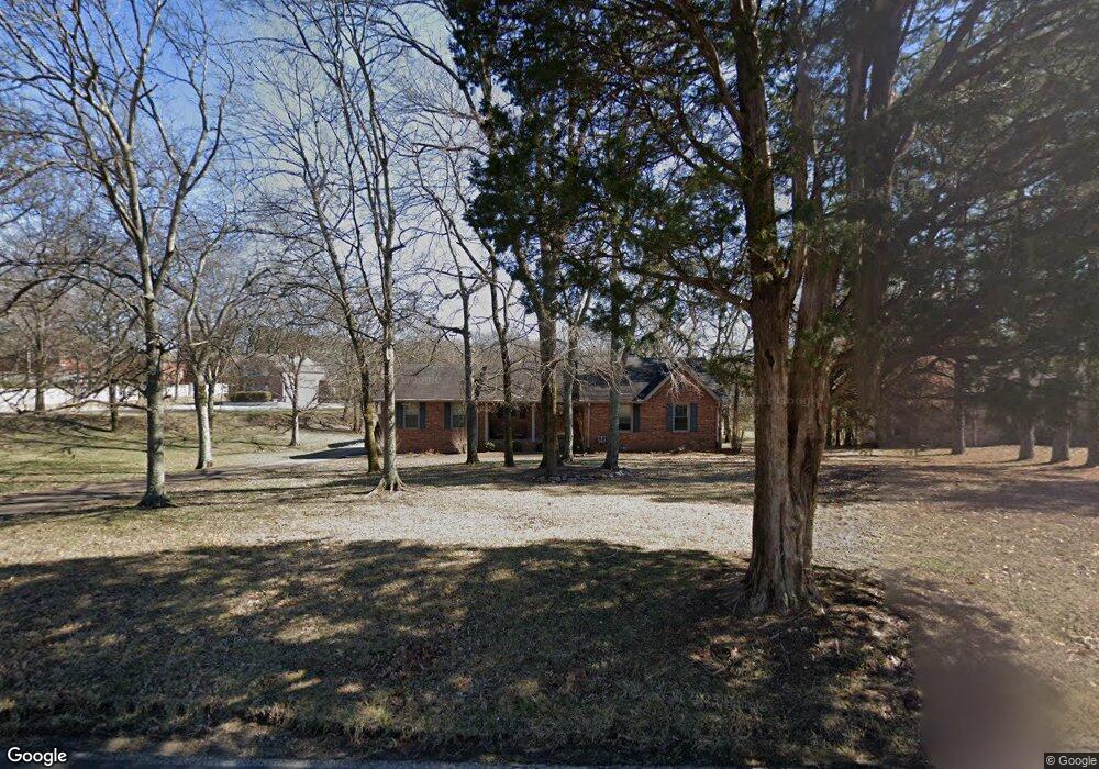
301 Quarry Rd Mount Juliet, TN 37122
Estimated Value: $343,699 - $453,000
--
Bed
2
Baths
1,291
Sq Ft
$325/Sq Ft
Est. Value
About This Home
This home is located at 301 Quarry Rd, Mount Juliet, TN 37122 and is currently estimated at $419,925, approximately $325 per square foot. 301 Quarry Rd is a home located in Wilson County with nearby schools including Stoner Creek Elementary School, West Wilson Middle School, and Mt. Juliet High School.
Ownership History
Date
Name
Owned For
Owner Type
Purchase Details
Closed on
Aug 10, 2013
Bought by
Miller Ladonna Kay
Current Estimated Value
Home Financials for this Owner
Home Financials are based on the most recent Mortgage that was taken out on this home.
Original Mortgage
$92,000
Outstanding Balance
$68,906
Interest Rate
4.57%
Mortgage Type
Commercial
Estimated Equity
$351,019
Purchase Details
Closed on
Feb 28, 2005
Sold by
Hamsley Steven D
Bought by
Poe Michael E
Home Financials for this Owner
Home Financials are based on the most recent Mortgage that was taken out on this home.
Original Mortgage
$135,120
Interest Rate
5.6%
Purchase Details
Closed on
Apr 25, 1991
Bought by
Hamsley Steven D
Purchase Details
Closed on
Jan 31, 1990
Bought by
Lightfoot Todd G
Purchase Details
Closed on
Apr 11, 1988
Bought by
Powers Joe D and Powers Ola
Create a Home Valuation Report for This Property
The Home Valuation Report is an in-depth analysis detailing your home's value as well as a comparison with similar homes in the area
Home Values in the Area
Average Home Value in this Area
Purchase History
| Date | Buyer | Sale Price | Title Company |
|---|---|---|---|
| Miller Ladonna Kay | -- | -- | |
| Miller Ladonna Kay | -- | -- | |
| Poe Michael E | $168,900 | -- | |
| Hamsley Steven D | $87,900 | -- | |
| Lightfoot Todd G | $85,900 | -- | |
| Powers Joe D | -- | -- |
Source: Public Records
Mortgage History
| Date | Status | Borrower | Loan Amount |
|---|---|---|---|
| Open | Miller Ladonna Kay | $92,000 | |
| Previous Owner | Powers Joe D | $135,120 |
Source: Public Records
Tax History Compared to Growth
Tax History
| Year | Tax Paid | Tax Assessment Tax Assessment Total Assessment is a certain percentage of the fair market value that is determined by local assessors to be the total taxable value of land and additions on the property. | Land | Improvement |
|---|---|---|---|---|
| 2024 | $1,143 | $59,900 | $14,425 | $45,475 |
| 2022 | $1,108 | $58,050 | $14,425 | $43,625 |
| 2021 | $1,108 | $58,050 | $14,425 | $43,625 |
| 2020 | $1,077 | $58,050 | $14,425 | $43,625 |
| 2019 | $1,077 | $42,775 | $11,125 | $31,650 |
| 2018 | $1,077 | $42,775 | $11,125 | $31,650 |
| 2017 | $1,077 | $42,775 | $11,125 | $31,650 |
| 2016 | $1,077 | $42,775 | $11,125 | $31,650 |
| 2015 | $1,099 | $42,775 | $11,125 | $31,650 |
| 2014 | $1,028 | $40,000 | $0 | $0 |
Source: Public Records
Map
Nearby Homes
- 0 Lebanon Rd Unit RTC2820443
- 0 Lebanon Rd Unit RTC2760492
- 0 Lebanon Rd Unit RTC2505567
- 2895 Landon Dr
- 3 Lebanon Rd
- 0 Lebanon Rd
- 1 Landon Dr
- 228 Limestone Way
- 223 Limestone Way
- 226 Limestone Way
- 224 Limestone Way
- 220 Limestone Way
- 215 Limestone Way
- Livingston Plan at Cades Bluff
- Bledsoe Plan at Cades Bluff
- Brentley Plan at Cades Bluff
- Montgomery Plan at Cades Bluff
- Westmore Plan at Cades Bluff
- Brunswick Plan at Cades Bluff
- Bartlett Plan at Cades Bluff
- 323 Quarry Rd
- 273 Quarry Rd
- 245 Quarry Rd
- 391 Quarry Road (Cm6)
- 231 Quarry Rd
- 399 Quarry Road (Cm8)
- 306 Quarry Rd
- 400 Quarry Rd
- 445 Quarry Rd
- 446 Quarry Rd
- 448 Quarry Rd
- 511 Quarry Rd
- 506 Quarry Rd
- 84 Quarry Rd
- 67 Quarry Rd
- 368 Quarry Loop Rd
- 537 Quarry Rd
- 540 Quarry Rd
- 450 Quarry Rd
- 450 Quarry Rd Unit .