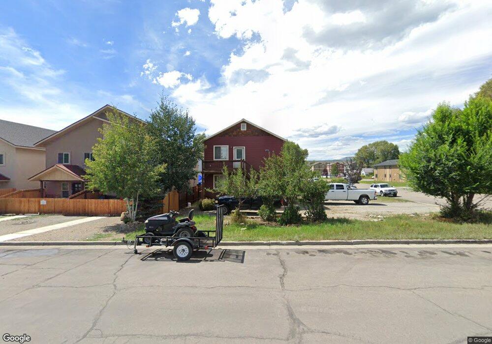
301 S 12th St Gunnison, CO 81230
Estimated Value: $544,000 - $728,000
2
Beds
4
Baths
1,167
Sq Ft
$538/Sq Ft
Est. Value
About This Home
This home is located at 301 S 12th St, Gunnison, CO 81230 and is currently estimated at $628,217, approximately $538 per square foot. 301 S 12th St is a home located in Gunnison County with nearby schools including Gunnison Elementary School, Gunnison Middle School, and Crested Butte Community School.
Ownership History
Date
Name
Owned For
Owner Type
Purchase Details
Closed on
Oct 29, 2010
Sold by
First Horizon Home Loans
Bought by
Swift Randy A and Swift Joan M
Current Estimated Value
Purchase Details
Closed on
Mar 17, 2010
Sold by
Strahl Patrick D
Bought by
First Horizon Home Loans
Purchase Details
Closed on
Dec 13, 2007
Sold by
Martineau Robert Tyler
Bought by
Strahl Patrick D
Home Financials for this Owner
Home Financials are based on the most recent Mortgage that was taken out on this home.
Original Mortgage
$204,400
Interest Rate
6.27%
Mortgage Type
Construction
Create a Home Valuation Report for This Property
The Home Valuation Report is an in-depth analysis detailing your home's value as well as a comparison with similar homes in the area
Home Values in the Area
Average Home Value in this Area
Purchase History
| Date | Buyer | Sale Price | Title Company |
|---|---|---|---|
| Swift Randy A | $137,000 | None Available | |
| First Horizon Home Loans | $176,000 | None Available | |
| Strahl Patrick D | $80,000 | None Available |
Source: Public Records
Mortgage History
| Date | Status | Borrower | Loan Amount |
|---|---|---|---|
| Previous Owner | Strahl Patrick D | $204,400 |
Source: Public Records
Tax History Compared to Growth
Tax History
| Year | Tax Paid | Tax Assessment Tax Assessment Total Assessment is a certain percentage of the fair market value that is determined by local assessors to be the total taxable value of land and additions on the property. | Land | Improvement |
|---|---|---|---|---|
| 2024 | $2,022 | $42,600 | $11,590 | $31,010 |
| 2023 | $2,022 | $38,910 | $10,580 | $28,330 |
| 2022 | $2,163 | $36,280 | $4,640 | $31,640 |
| 2021 | $1,970 | $37,730 | $4,830 | $32,900 |
| 2020 | $1,562 | $28,190 | $4,740 | $23,450 |
| 2019 | $1,527 | $28,190 | $4,740 | $23,450 |
| 2018 | $1,564 | $28,120 | $4,580 | $23,540 |
| 2017 | $1,584 | $28,120 | $4,580 | $23,540 |
| 2016 | $2,050 | $36,620 | $3,150 | $33,470 |
Source: Public Records
Map
Nearby Homes
- 308 S 11th St Unit 1
- 718 W New York Ave
- 417 S Boulevard St Unit A
- Lots 13-16 Us Highway 50 Frontage Rd
- 220 N Boulevard St Unit 17
- 114 N 8th St
- 215 S 7th St
- TBD S 6th St
- 304 N 9th St Unit 2A
- 000 Us Highway 50
- 109 N 7th St
- 1208 W Tomichi Ave Unit 4
- 302 S 5th St
- 314 S 5th St
- 288 S 5th St
- 436 N 11th St
- 700 U S 50
- 1314 W Tomichi Ave Unit 19
- 1310 W Tomichi Ave Unit 23
- 1412 W Gunnison Ave
- 309 S 12th St Unit D
- 309 S 12th St Unit C
- 309 S 12th St Unit A
- 302 S 11th St
- 304 S 11th St
- 313 S 12th St
- 308 S 11th St Unit 6
- 308 S 11th St
- 308 S 11th St
- 308 S 11th St
- 308 S 11th St
- 308 S 11th St
- 308 S 11th St
- 308 S 11th St
- 308 S 11th St Unit 5
- 308 S 11th St Unit 8
- 308 S 11th St Unit 6
- 308 S 11th St Unit 8
- 308 S 11th St Unit 5
- 308 S 11th St Unit 2