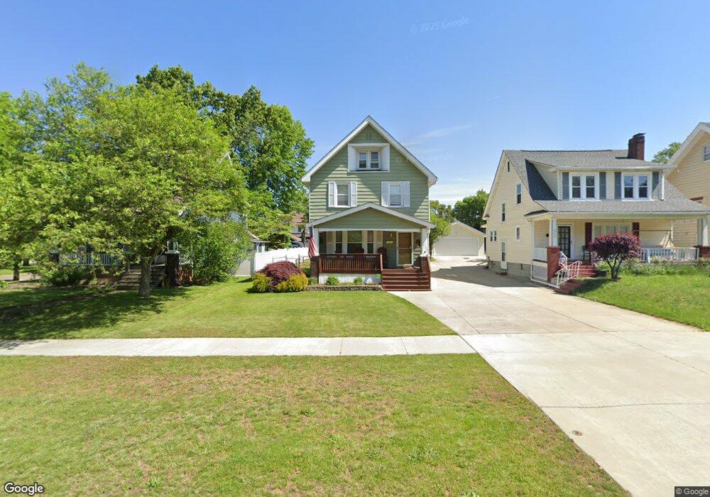
301 S Firestone Blvd Akron, OH 44301
Firestone Park NeighborhoodEstimated Value: $136,391 - $171,000
3
Beds
1
Bath
1,373
Sq Ft
$112/Sq Ft
Est. Value
About This Home
This home is located at 301 S Firestone Blvd, Akron, OH 44301 and is currently estimated at $153,598, approximately $111 per square foot. 301 S Firestone Blvd is a home located in Summit County with nearby schools including Firestone Park Elementary School, Kenmore Garfield Community Learning Center, and Main Preparatory Academy.
Ownership History
Date
Name
Owned For
Owner Type
Purchase Details
Closed on
Jun 2, 2014
Sold by
Lancione Maureen R and Lancione Michael J
Bought by
Lancione Maureen R and Lancione Michael J
Current Estimated Value
Purchase Details
Closed on
Feb 6, 2004
Sold by
Breiding Thomas J
Bought by
Shoenfelt Maureen R
Home Financials for this Owner
Home Financials are based on the most recent Mortgage that was taken out on this home.
Original Mortgage
$70,000
Interest Rate
5.88%
Mortgage Type
Purchase Money Mortgage
Purchase Details
Closed on
Apr 2, 2001
Sold by
Linger Robert L and Linger Pauline S
Bought by
Breiding Thomas J
Home Financials for this Owner
Home Financials are based on the most recent Mortgage that was taken out on this home.
Original Mortgage
$73,800
Interest Rate
7.05%
Create a Home Valuation Report for This Property
The Home Valuation Report is an in-depth analysis detailing your home's value as well as a comparison with similar homes in the area
Home Values in the Area
Average Home Value in this Area
Purchase History
| Date | Buyer | Sale Price | Title Company |
|---|---|---|---|
| Lancione Maureen R | -- | None Available | |
| Shoenfelt Maureen R | $98,700 | Lake Erie Title Agency Inc | |
| Breiding Thomas J | $82,000 | Bond & Associates Title Agen |
Source: Public Records
Mortgage History
| Date | Status | Borrower | Loan Amount |
|---|---|---|---|
| Previous Owner | Shoenfelt Maureen R | $70,000 | |
| Previous Owner | Breiding Thomas J | $73,800 |
Source: Public Records
Tax History Compared to Growth
Tax History
| Year | Tax Paid | Tax Assessment Tax Assessment Total Assessment is a certain percentage of the fair market value that is determined by local assessors to be the total taxable value of land and additions on the property. | Land | Improvement |
|---|---|---|---|---|
| 2025 | $1,957 | $35,470 | $9,377 | $26,093 |
| 2024 | $1,957 | $35,470 | $9,377 | $26,093 |
| 2023 | $1,957 | $35,470 | $9,377 | $26,093 |
| 2022 | $1,891 | $26,870 | $7,102 | $19,768 |
| 2021 | $1,891 | $26,870 | $7,102 | $19,768 |
| 2020 | $1,866 | $26,870 | $7,100 | $19,770 |
| 2019 | $1,697 | $22,640 | $6,610 | $16,030 |
| 2018 | $1,674 | $22,640 | $6,610 | $16,030 |
| 2017 | $1,701 | $22,640 | $6,610 | $16,030 |
| 2016 | $1,702 | $22,640 | $6,610 | $16,030 |
| 2015 | $1,701 | $22,640 | $6,610 | $16,030 |
| 2014 | $1,687 | $22,640 | $6,610 | $16,030 |
| 2013 | $1,714 | $23,520 | $6,610 | $16,910 |
Source: Public Records
Map
Nearby Homes
- 1459 Holly Ave
- 1500 Beardsley St
- 197 E Wilbeth Rd
- 440 Palm Ave
- 1614 Glenmount Ave
- 361 Mission Dr
- 437 Palmetto Ave
- 369 Mission Dr
- 1362 Wilbur Ave
- 1367 Girard St
- 1637 Rockford St
- 1595 Evergreen Ave
- 484 Reed Ave
- 342 E Archwood Ave
- 1349 Grant St
- 132 Crescent Dr
- 1345 Bellows St
- 0 Beardsley St
- 1571 Redwood Ave
- 1635 Brown St
- 305 S Firestone Blvd
- 297 S Firestone Blvd
- 311 S Firestone Blvd
- 306 Palm Ave
- 315 S Firestone Blvd
- 302 Palm Ave
- 316 Palm Ave
- 302 S Firestone Blvd
- 308 S Firestone Blvd
- 296 S Firestone Blvd
- 326 Palm Ave
- 312 S Firestone Blvd
- 325 S Firestone Blvd
- 316 S Firestone Blvd
- 330 Palm Ave
- 286 S Firestone Blvd
- 1542 Aster Ave
- 322 S Firestone Blvd
- 1571 Girard St
- 280 S Firestone Blvd