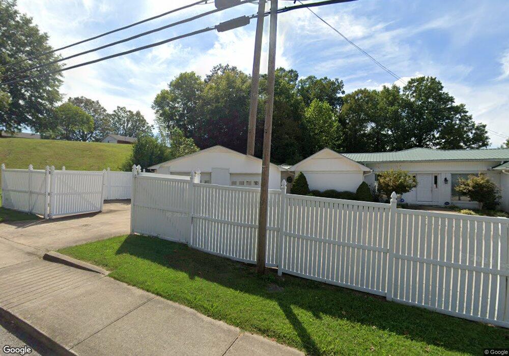
301 S Mill St Linden, TN 37096
Estimated Value: $289,002 - $606,000
5
Beds
3
Baths
2,700
Sq Ft
$156/Sq Ft
Est. Value
About This Home
This home is located at 301 S Mill St, Linden, TN 37096 and is currently estimated at $421,751, approximately $156 per square foot. 301 S Mill St is a home located in Perry County.
Ownership History
Date
Name
Owned For
Owner Type
Purchase Details
Closed on
Mar 15, 2022
Sold by
Leigh Rhodes Kristie
Bought by
Pace Timothy Carter
Current Estimated Value
Purchase Details
Closed on
Mar 3, 2017
Sold by
Jones Richard
Bought by
Jones Richard and Jones Frances
Purchase Details
Closed on
Feb 12, 1999
Bought by
Jones Richard and Jones Frances
Purchase Details
Closed on
Oct 21, 1996
Bought by
Johnson Alex
Purchase Details
Closed on
Jul 23, 1996
Bought by
Patterson Virginia
Purchase Details
Closed on
Jan 12, 1994
Bought by
Johnson Freddy and Johnson Nancy
Purchase Details
Closed on
Jun 12, 1992
Bought by
Hobdy Dill H and Hobdy Margaret
Purchase Details
Closed on
Oct 18, 1991
Bought by
First State Bank
Purchase Details
Closed on
Nov 27, 1985
Bought by
Monroe Jimmy and Monroe Peggy
Create a Home Valuation Report for This Property
The Home Valuation Report is an in-depth analysis detailing your home's value as well as a comparison with similar homes in the area
Home Values in the Area
Average Home Value in this Area
Purchase History
| Date | Buyer | Sale Price | Title Company |
|---|---|---|---|
| Pace Timothy Carter | $261,250 | Moore Katerina V | |
| Jones Richard | $147,100 | -- | |
| Jones Richard | $147,100 | -- | |
| Rhodes Kristie Leigh | $147,148 | None Available | |
| Jones Richard | $120,000 | -- | |
| Johnson Alex | $79,800 | -- | |
| Patterson Virginia | $80,000 | -- | |
| Johnson Freddy | $85,000 | -- | |
| Hobdy Dill H | -- | -- | |
| First State Bank | -- | -- | |
| Monroe Jimmy | -- | -- |
Source: Public Records
Tax History Compared to Growth
Tax History
| Year | Tax Paid | Tax Assessment Tax Assessment Total Assessment is a certain percentage of the fair market value that is determined by local assessors to be the total taxable value of land and additions on the property. | Land | Improvement |
|---|---|---|---|---|
| 2025 | $1,331 | $47,525 | $0 | $0 |
| 2024 | $1,331 | $47,525 | $3,250 | $44,275 |
| 2023 | $1,091 | $47,525 | $3,250 | $44,275 |
| 2022 | $1,330 | $47,525 | $3,250 | $44,275 |
| 2021 | $1,330 | $47,525 | $3,250 | $44,275 |
| 2020 | $1,091 | $47,525 | $3,250 | $44,275 |
| 2019 | $1,320 | $44,225 | $3,250 | $40,975 |
| 2018 | $1,320 | $44,225 | $3,250 | $40,975 |
| 2017 | $1,307 | $44,225 | $3,250 | $40,975 |
| 2016 | $1,307 | $44,225 | $3,250 | $40,975 |
| 2015 | $1,285 | $44,225 | $3,250 | $40,975 |
| 2014 | $1,285 | $44,225 | $3,250 | $40,975 |
| 2013 | $1,292 | $44,526 | $0 | $0 |
Source: Public Records
Map
Nearby Homes
- 122 Shelton St
- 130 Elm Ln
- 245 S Mill St
- 141 Maple St
- 107 Possum Trot Ln
- 0 Church St
- 218 Cedar Ave
- 628 Starlight Dr
- 0 Treadwell Prong Unit RTC2707562
- 8884 U S Highway 412
- Lot 5 Campers Ln
- Lot 4 Campers Ln
- Lot 8 Campers Ln
- Lot 9 Campers Ln
- Lot 7 Campers Ln
- Lot 6 Campers Ln
- Lot 15 Campers Ln
- Lot 10 Campers Ln
- Lot 11 Campers Ln
- Lot 17 Campers Ln
- 905 S Mill St
- 0 S Mill St
- 101 W Brooklyn St
- 109 W Brooklyn St
- 100 Elm Ln
- 115 Shelton St
- 113 W Brooklyn St
- 308 S Mill St
- 106 Elm Ln
- 117 W Brooklyn St
- 112 Brookside Dr
- 106 W Brooklyn St
- 100 W Brooklyn St
- 119 W Brooklyn Ave
- 110 W Brooklyn St
- 119 W Brooklyn St
- 107 Brookside Dr
- 114 W Brooklyn St
- 112 Averret Ln
- 116 Brookside Dr