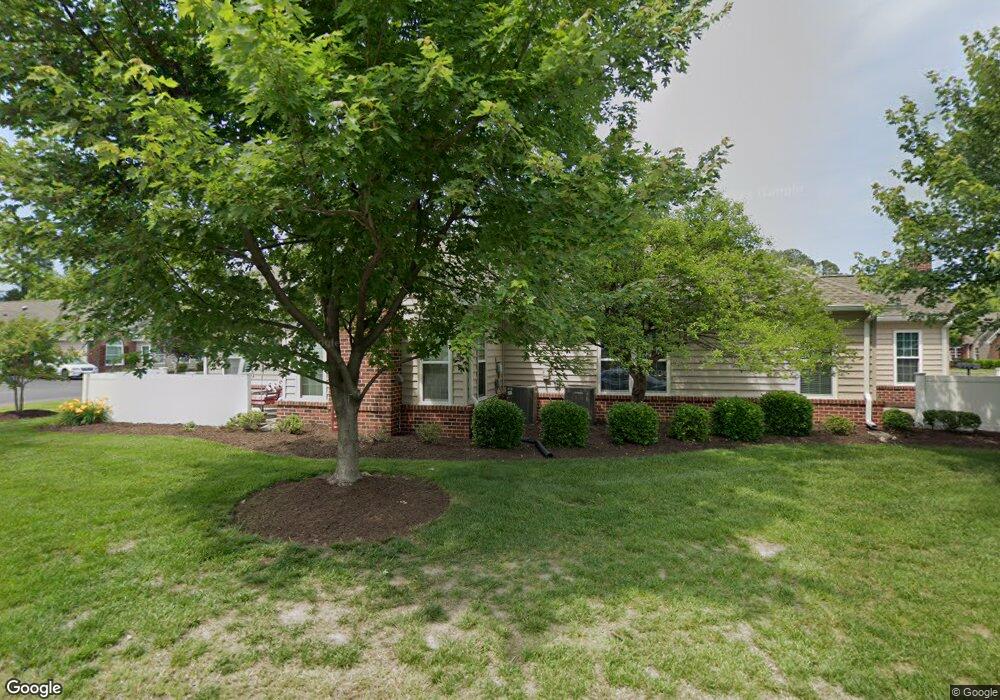
301 Tabb Smith Trail Yorktown, VA 23693
Tabb NeighborhoodEstimated Value: $366,000 - $400,666
3
Beds
3
Baths
1,858
Sq Ft
$209/Sq Ft
Est. Value
About This Home
This home is located at 301 Tabb Smith Trail, Yorktown, VA 23693 and is currently estimated at $388,917, approximately $209 per square foot. 301 Tabb Smith Trail is a home located in York County with nearby schools including Tabb Elementary School, Tabb Middle School, and Tabb High School.
Ownership History
Date
Name
Owned For
Owner Type
Purchase Details
Closed on
Mar 19, 2009
Sold by
Meyer David C
Bought by
Marston Aron C
Current Estimated Value
Home Financials for this Owner
Home Financials are based on the most recent Mortgage that was taken out on this home.
Original Mortgage
$260,482
Outstanding Balance
$166,682
Interest Rate
5.25%
Mortgage Type
New Conventional
Estimated Equity
$222,235
Purchase Details
Closed on
May 31, 2005
Sold by
Villas On Shady B
Bought by
Meyer David C
Home Financials for this Owner
Home Financials are based on the most recent Mortgage that was taken out on this home.
Original Mortgage
$157,850
Interest Rate
5.83%
Mortgage Type
New Conventional
Create a Home Valuation Report for This Property
The Home Valuation Report is an in-depth analysis detailing your home's value as well as a comparison with similar homes in the area
Home Values in the Area
Average Home Value in this Area
Purchase History
| Date | Buyer | Sale Price | Title Company |
|---|---|---|---|
| Marston Aron C | $255,000 | -- | |
| Meyer David C | $197,345 | -- |
Source: Public Records
Mortgage History
| Date | Status | Borrower | Loan Amount |
|---|---|---|---|
| Open | Marston Aron C | $260,482 | |
| Previous Owner | Meyer David C | $157,850 |
Source: Public Records
Tax History Compared to Growth
Tax History
| Year | Tax Paid | Tax Assessment Tax Assessment Total Assessment is a certain percentage of the fair market value that is determined by local assessors to be the total taxable value of land and additions on the property. | Land | Improvement |
|---|---|---|---|---|
| 2025 | $2,634 | $355,900 | $80,000 | $275,900 |
| 2024 | $2,634 | $355,900 | $80,000 | $275,900 |
| 2023 | $2,134 | $277,200 | $80,000 | $197,200 |
| 2022 | $2,162 | $277,200 | $80,000 | $197,200 |
| 2021 | $2,024 | $254,600 | $72,000 | $182,600 |
| 2020 | $2,024 | $254,600 | $72,000 | $182,600 |
| 2019 | $2,868 | $251,600 | $69,000 | $182,600 |
| 2018 | $2,868 | $251,600 | $69,000 | $182,600 |
| 2017 | $1,876 | $249,600 | $0 | $249,600 |
| 2016 | $1,876 | $249,600 | $0 | $249,600 |
| 2015 | -- | $240,500 | $0 | $240,500 |
| 2014 | -- | $240,500 | $0 | $240,500 |
Source: Public Records
Map
Nearby Homes
- 111 Hautz Way
- 604 Tabb Smith Trail
- 129 Ponsonby Dr
- 323 Vista Point Dr
- 209 Cattail Ln
- 104 Camden Way Unit G
- 104 Camden Way
- 201 Amersham Dr Unit B
- 205 Amersham Dr
- 205 Amersham Dr Unit B
- 301 Derby Run
- 14 Firefly Ln
- 105 Overlook Point
- 6+ AC Vista Point Dr
- 200 Clay Pipe Ln
- 102 Corwin Cir
- 3017 Hampton Hwy
- 123 Locust Ln
- 90 Madison Chase
- 55 Madison Chase
- 303 Tabb Smith Trail
- 403 Tabb Smith Trail
- 405-Z Tabb Smith Trail
- 109Z1 Saint George Dr
- 211 Tabb Smith Trail
- 213 Tabb Smith Trail
- 213 Tabb Smith Trail Unit none
- 101 Tee Reach
- 100 Marshland View
- 402-Z Tabb Smith Trail
- 409 Tabb Smith Trail
- 112 Hautz Way
- 112 Hautz Way Unit 3
- 114 Hautz Way
- 100 Tee Reach
- 101 Wandering Doe Trail
- 404 Tabb Smith Trail
- 515 Tabb Smith Trail
- 507 Tabb Smith Trail
- 103 Tee Reach