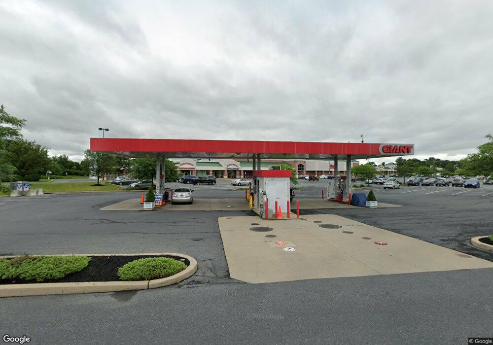
301 Town Center Blvd Easton, PA 18040
Estimated Value: $38,203,572
--
Bed
--
Bath
6,400
Sq Ft
$5,969/Sq Ft
Est. Value
About This Home
This home is located at 301 Town Center Blvd, Easton, PA 18040 and is currently estimated at $38,203,572, approximately $5,969 per square foot. 301 Town Center Blvd is a home located in Northampton County with nearby schools including Francis A. March Elementary School, Easton Area Middle School, and Easton Area High School.
Ownership History
Date
Name
Owned For
Owner Type
Purchase Details
Closed on
Oct 3, 2017
Sold by
Inland Western Easton Forks Town Dst
Bought by
Shoppes At Muncy Creek Lp and Forks Town Bar Lp
Current Estimated Value
Home Financials for this Owner
Home Financials are based on the most recent Mortgage that was taken out on this home.
Original Mortgage
$18,000,000
Interest Rate
3.89%
Mortgage Type
Future Advance Clause Open End Mortgage
Purchase Details
Closed on
Jul 21, 2004
Sold by
Forks & Faston L L C
Bought by
Inland Western
Purchase Details
Closed on
Nov 7, 2001
Bought by
Forks-Easton Llc
Create a Home Valuation Report for This Property
The Home Valuation Report is an in-depth analysis detailing your home's value as well as a comparison with similar homes in the area
Home Values in the Area
Average Home Value in this Area
Purchase History
| Date | Buyer | Sale Price | Title Company |
|---|---|---|---|
| Shoppes At Muncy Creek Lp | -- | Residential Title & Escrow C | |
| Inland Western | $18,900,000 | -- | |
| Forks-Easton Llc | $1,777,000 | -- |
Source: Public Records
Mortgage History
| Date | Status | Borrower | Loan Amount |
|---|---|---|---|
| Previous Owner | Shoppes At Muncy Creek Lp | $18,000,000 |
Source: Public Records
Tax History Compared to Growth
Tax History
| Year | Tax Paid | Tax Assessment Tax Assessment Total Assessment is a certain percentage of the fair market value that is determined by local assessors to be the total taxable value of land and additions on the property. | Land | Improvement |
|---|---|---|---|---|
| 2025 | $52,504 | $4,861,500 | $551,100 | $4,310,400 |
| 2024 | $425,965 | $4,861,500 | $551,100 | $4,310,400 |
| 2023 | $419,499 | $4,861,500 | $551,100 | $4,310,400 |
| 2022 | $290,283 | $3,415,900 | $551,100 | $2,864,800 |
| 2021 | $289,327 | $3,415,900 | $551,100 | $2,864,800 |
| 2020 | $289,156 | $3,415,900 | $551,100 | $2,864,800 |
| 2019 | $285,023 | $3,415,900 | $551,100 | $2,864,800 |
| 2018 | $298,738 | $3,642,700 | $605,300 | $3,037,400 |
| 2017 | $289,777 | $3,642,700 | $605,300 | $3,037,400 |
| 2016 | -- | $3,642,700 | $605,300 | $3,037,400 |
| 2015 | -- | $3,642,700 | $605,300 | $3,037,400 |
| 2014 | -- | $3,642,700 | $605,300 | $3,037,400 |
Source: Public Records
Map
Nearby Homes
- 15 Canterbury Ct
- 1360 Toboggan Trail
- 507 Apple Blossom Rd
- 1421 Sullivan Trail
- 55 Penny Ln
- 797 Heather Ln
- 69 Penny Ln
- 851 Mohican Dr
- 21 Abbey Rd
- 2037 Huntington Ln
- 2121 Huntington Ln
- 1122 Sullivan Trail
- 2201 Huntington Ln
- 613 Raub St
- 1360 Hennaberry Ln
- 202 Park Ridge Dr
- 815 Wilbur St
- 2194 Steuben Ln
- 823 W Lafayette St
- 195 Park Ridge Dr
- 456 Heather Ln
- 1509 Marigold Dr
- 1507 Marigold Dr
- 457 Heather Ln
- 1503 Marigold Dr
- 1514 Marigold Dr
- 1510 Marigold Dr
- 1417 Marigold Dr
- 501 Heather Ln
- 1506 Marigold Dr
- 1500 Marigold Dr
- 504 Heather Ln
- 503 Primrose Path
- 1413 Marigold Dr
- 504 Primrose Path
- 503 Heather Ln
- 505 Periwinkle Place
- 1418 Marigold Dr
- 1600 Sullivan Trail
- 1409 Marigold Dr