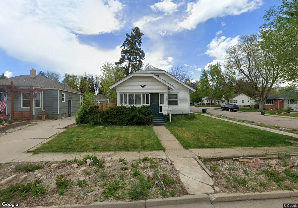
301 W 12th St Loveland, CO 80537
Estimated Value: $379,144 - $453,000
4
Beds
2
Baths
936
Sq Ft
$458/Sq Ft
Est. Value
About This Home
This home is located at 301 W 12th St, Loveland, CO 80537 and is currently estimated at $429,036, approximately $458 per square foot. 301 W 12th St is a home located in Larimer County with nearby schools including Truscott Elementary School, Bill Reed Middle School, and Loveland High School.
Ownership History
Date
Name
Owned For
Owner Type
Purchase Details
Closed on
Mar 29, 2021
Sold by
Ascott Katherine E and Ascott Phillip E
Bought by
Acott Katherine E
Current Estimated Value
Purchase Details
Closed on
Mar 13, 2000
Sold by
Cleveland Katherine E
Bought by
Acott Katherine E and Acott Phillip E
Purchase Details
Closed on
Nov 14, 1997
Sold by
Inman Laura Ann
Bought by
Cleveland Katherine E
Home Financials for this Owner
Home Financials are based on the most recent Mortgage that was taken out on this home.
Original Mortgage
$115,075
Interest Rate
7.28%
Mortgage Type
FHA
Create a Home Valuation Report for This Property
The Home Valuation Report is an in-depth analysis detailing your home's value as well as a comparison with similar homes in the area
Home Values in the Area
Average Home Value in this Area
Purchase History
| Date | Buyer | Sale Price | Title Company |
|---|---|---|---|
| Acott Katherine E | -- | None Available | |
| Acott Katherine E | -- | -- | |
| Cleveland Katherine E | $116,000 | -- |
Source: Public Records
Mortgage History
| Date | Status | Borrower | Loan Amount |
|---|---|---|---|
| Previous Owner | Cleveland Katherine E | $115,075 |
Source: Public Records
Tax History Compared to Growth
Tax History
| Year | Tax Paid | Tax Assessment Tax Assessment Total Assessment is a certain percentage of the fair market value that is determined by local assessors to be the total taxable value of land and additions on the property. | Land | Improvement |
|---|---|---|---|---|
| 2025 | $1,966 | $28,321 | $3,216 | $25,105 |
| 2024 | $1,896 | $28,321 | $3,216 | $25,105 |
| 2022 | $1,730 | $21,740 | $3,336 | $18,404 |
| 2021 | $1,778 | $22,365 | $3,432 | $18,933 |
| 2020 | $1,630 | $20,506 | $3,432 | $17,074 |
| 2019 | $1,603 | $20,506 | $3,432 | $17,074 |
| 2018 | $1,315 | $15,984 | $3,456 | $12,528 |
| 2017 | $1,133 | $15,984 | $3,456 | $12,528 |
| 2016 | $993 | $13,540 | $3,821 | $9,719 |
| 2015 | $985 | $13,540 | $3,820 | $9,720 |
| 2014 | $888 | $11,810 | $3,820 | $7,990 |
Source: Public Records
Map
Nearby Homes
- 416 W 12th St
- 1336 Arthur Ave
- 0 W Eisenhower Blvd
- 905 Harrison Ave
- 643 W 10th St
- 1034 N Cleveland Ave
- 1512 Jackson Ave
- 125 E 15th St
- 1534 Jackson Ave
- 1031 N Lincoln Ave
- 1204 N Lincoln Ave
- 1700 N Garfield Ave
- 604 W 9th St
- 1612 N Cleveland Ave
- 720 Roosevelt Ave
- 411 E 10th St
- 1312 N Washington Ave
- 1550 N Jefferson Ave
- 625 Harrison Ave
- 770 N Lincoln Ave