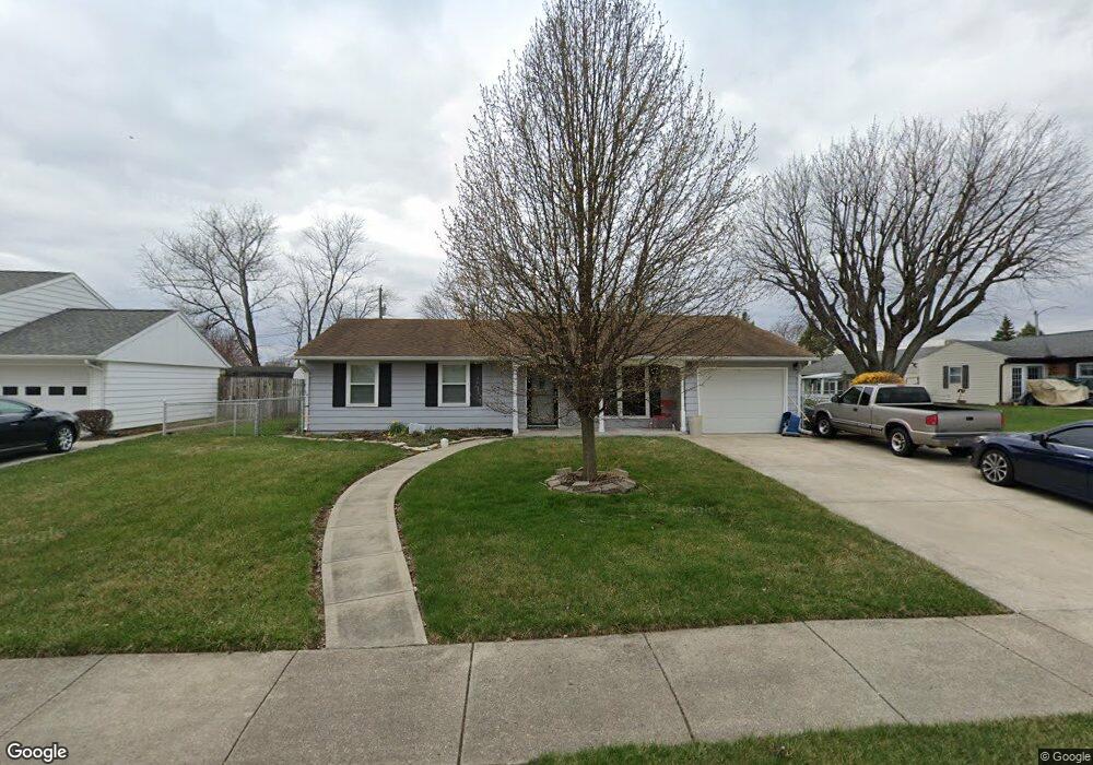
3011 Cavins Dr Springfield, OH 45503
Estimated Value: $193,662 - $196,000
3
Beds
2
Baths
1,251
Sq Ft
$156/Sq Ft
Est. Value
About This Home
This home is located at 3011 Cavins Dr, Springfield, OH 45503 and is currently estimated at $195,166, approximately $156 per square foot. 3011 Cavins Dr is a home located in Clark County with nearby schools including Kenton Elementary School, Roosevelt Middle School, and Springfield High School.
Ownership History
Date
Name
Owned For
Owner Type
Purchase Details
Closed on
Jun 22, 2004
Sold by
Woloszyn Timothy and Woloszyn Andrea
Bought by
Montgomery Shaun L
Current Estimated Value
Home Financials for this Owner
Home Financials are based on the most recent Mortgage that was taken out on this home.
Original Mortgage
$95,900
Outstanding Balance
$48,319
Interest Rate
6.46%
Mortgage Type
Purchase Money Mortgage
Estimated Equity
$146,847
Create a Home Valuation Report for This Property
The Home Valuation Report is an in-depth analysis detailing your home's value as well as a comparison with similar homes in the area
Home Values in the Area
Average Home Value in this Area
Purchase History
| Date | Buyer | Sale Price | Title Company |
|---|---|---|---|
| Montgomery Shaun L | $95,900 | -- |
Source: Public Records
Mortgage History
| Date | Status | Borrower | Loan Amount |
|---|---|---|---|
| Open | Montgomery Shaun L | $95,900 |
Source: Public Records
Tax History Compared to Growth
Tax History
| Year | Tax Paid | Tax Assessment Tax Assessment Total Assessment is a certain percentage of the fair market value that is determined by local assessors to be the total taxable value of land and additions on the property. | Land | Improvement |
|---|---|---|---|---|
| 2024 | $1,797 | $37,280 | $9,300 | $27,980 |
| 2023 | $1,797 | $37,280 | $9,300 | $27,980 |
| 2022 | $1,840 | $37,280 | $9,300 | $27,980 |
| 2021 | $1,761 | $32,900 | $6,990 | $25,910 |
| 2020 | $1,765 | $32,900 | $6,990 | $25,910 |
| 2019 | $1,770 | $32,900 | $6,990 | $25,910 |
| 2018 | $1,592 | $28,470 | $7,410 | $21,060 |
| 2017 | $1,591 | $29,285 | $7,413 | $21,872 |
| 2016 | $1,593 | $29,285 | $7,413 | $21,872 |
| 2015 | $1,540 | $28,865 | $6,993 | $21,872 |
| 2014 | $1,533 | $28,865 | $6,993 | $21,872 |
| 2013 | $1,517 | $28,865 | $6,993 | $21,872 |
Source: Public Records
Map
Nearby Homes
- 1225 Vester Ave
- 2933 Bahia Dr
- 1506 Hyannis Dr
- 2683 Home Orchard Dr
- 2933 Stonehaven Dr
- 2541 Derr Rd
- 2907 Mystic Ln
- 3129 Haverhill St
- 3029 Bradford Dr Unit 46
- 1732 Falmouth Ave
- 647 Villa Rd Unit A
- 3032 Armsgate Rd Unit 25
- 2813 Wellsford Dr
- 2524 Home Orchard Dr
- 732 Grandview Dr Unit 732
- 1939 Providence Ave
- 542 Villa Rd
- 3046 Brixton Dr W Unit 173
- 1811 Devon Dr
- 2677 Carousel Dr
- 3007 Cavins Dr
- 1325 Providence Ave
- 1307 Providence Ave
- 2926 Derr Rd
- 2941 Cavins Dr
- 2924 Derr Rd
- 3012 Cavins Dr
- 2928 Derr Rd
- 3022 Cavins Dr
- 2935 Cavins Dr
- 1406 Marinette Dr
- 2920 Derr Rd
- 1405 Providence Ave
- 1322 Providence Ave
- 2929 Cavins Dr
- 1306 Providence Ave
- 1330 Providence Ave
- 1405 Marinette Dr
- 1338 Providence Ave
- 2918 Derr Rd