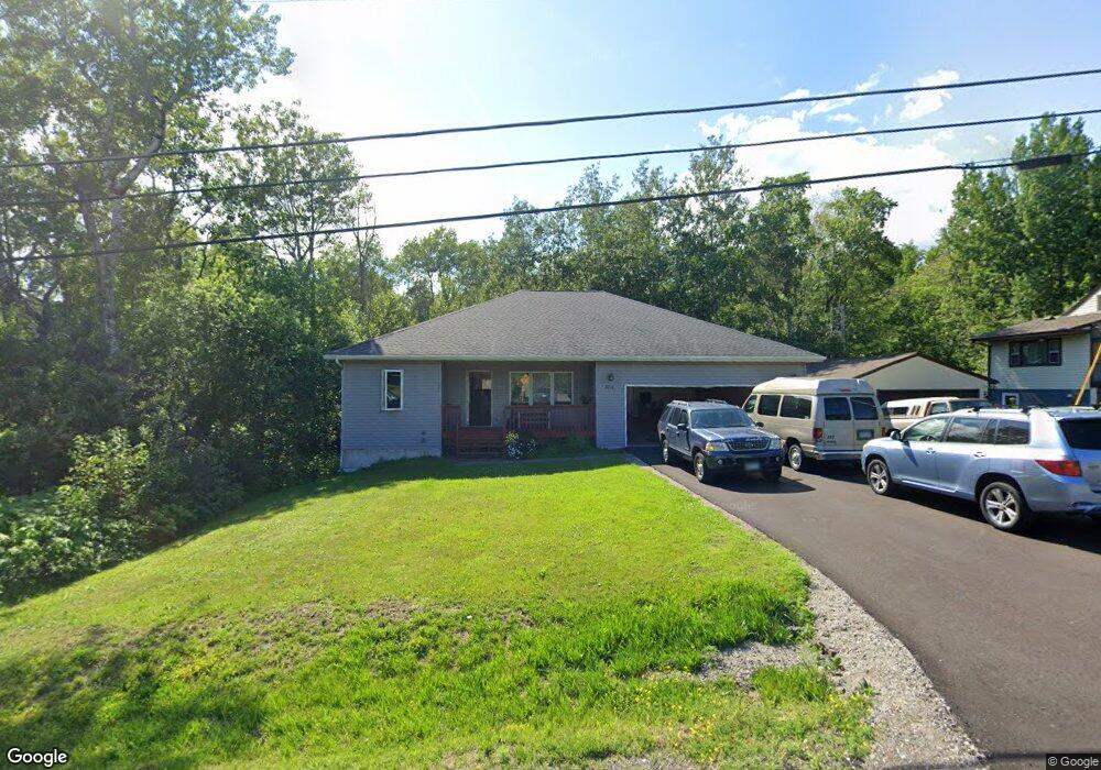
3011 N Blackman Ave Duluth, MN 55811
Kenwood NeighborhoodEstimated Value: $452,216 - $608,000
4
Beds
3
Baths
2,360
Sq Ft
$217/Sq Ft
Est. Value
About This Home
This home is located at 3011 N Blackman Ave, Duluth, MN 55811 and is currently estimated at $512,054, approximately $216 per square foot. 3011 N Blackman Ave is a home located in St. Louis County with nearby schools including Lowell Elementary School, Lincoln Park Middle School, and Denfeld High School.
Ownership History
Date
Name
Owned For
Owner Type
Purchase Details
Closed on
Dec 22, 2020
Sold by
926 North 8Th Inc
Bought by
Capgrow Holdings Jv Sub V Llc
Current Estimated Value
Purchase Details
Closed on
Mar 12, 2003
Sold by
Conrad Nicole E and Conrad Curt
Bought by
926 North 8Th Inc
Create a Home Valuation Report for This Property
The Home Valuation Report is an in-depth analysis detailing your home's value as well as a comparison with similar homes in the area
Home Values in the Area
Average Home Value in this Area
Purchase History
We collect this data history from publicly available records. To have your information removed, we recommend requesting removal directly through your county’s website.
| Date | Buyer | Sale Price | Title Company |
|---|---|---|---|
| Capgrow Holdings Jv Sub V Llc | $3,395,000 | First National T&E | |
| 926 North 8Th Inc | $245,000 | Ati Title Company |
Source: Public Records
Tax History
| Year | Tax Paid | Tax Assessment Tax Assessment Total Assessment is a certain percentage of the fair market value that is determined by local assessors to be the total taxable value of land and additions on the property. | Land | Improvement |
|---|---|---|---|---|
| 2024 | $6,128 | $426,600 | $57,700 | $368,900 |
| 2023 | $5,850 | $434,900 | $57,700 | $377,200 |
| 2022 | $5,512 | $403,900 | $54,000 | $349,900 |
| 2021 | $5,398 | $334,200 | $44,600 | $289,600 |
| 2020 | $5,450 | $334,200 | $44,600 | $289,600 |
| 2019 | $4,864 | $327,900 | $44,600 | $283,300 |
| 2018 | $4,550 | $294,700 | $44,600 | $250,100 |
| 2017 | $4,062 | $294,700 | $44,600 | $250,100 |
| 2016 | $3,962 | $263,200 | $40,900 | $222,300 |
| 2015 | $3,640 | $236,700 | $29,700 | $207,000 |
| 2014 | $3,640 | $236,700 | $29,700 | $207,000 |
Source: Public Records
Map
Nearby Homes
- 208 Mitchell Cir Unit 47D
- 2360 Apple Ridge Dr
- 714 Creekside Cir
- 2718 Northridge Dr
- 1625 Linzie Rd
- 1938 Middle Ln
- 1944 Chinook Dr
- 1802 Rice Lake Rd
- 18 Howard Gnesen Rd
- 1722 North Rd
- 1804 Rice Lake Rd
- 20xx Stanford Ave
- 1113 Butternut Ave
- 510 Crystal Dr
- 530 W Marble St
- 1206 Woodrich Cir
- 129 Artavia St
- 154 E Buffalo St
- 1524 Boulevard Place
- 1540 N 7th Ave E
- 3021 N Blackman Ave
- 3027 N Blackman Ave
- 2621 Englewood Dr
- 2611 Englewood Dr
- 2612 Englewood Dr
- 3037 N Blackman Ave
- XXX Englewood Dr
- 2602 Englewood Dr
- 3044 N Blackman Ave
- 3043 N Blackman Ave
- 2933 N Blackman Ave
- 2605 Englewood Dr
- 2520 Englewood Dr
- 3102 N Blackman Ave
- 3101 N Blackman Ave
- 2925 N Blackman Ave
- 3108 N Blackman Ave
- 2917 N Blackman Ave
- 2511 Englewood Dr
- 3124 N Blackman Ave
Your Personal Tour Guide
Ask me questions while you tour the home.