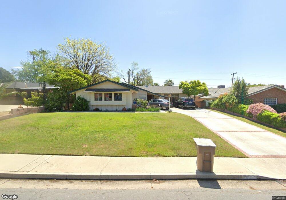
3013 Christmas Tree Ln Bakersfield, CA 93306
College Heights NeighborhoodEstimated Value: $327,606 - $361,000
3
Beds
2
Baths
1,635
Sq Ft
$210/Sq Ft
Est. Value
About This Home
This home is located at 3013 Christmas Tree Ln, Bakersfield, CA 93306 and is currently estimated at $342,902, approximately $209 per square foot. 3013 Christmas Tree Ln is a home located in Kern County with nearby schools including Colonel Howard Nichols Elementary School, Chipman Junior High School, and East Bakersfield High School.
Ownership History
Date
Name
Owned For
Owner Type
Purchase Details
Closed on
Nov 29, 1999
Sold by
Gundry Francis J 1989 Revocable Trust and Frank J
Bought by
Gundry Thomas S and Gundry Jane M
Current Estimated Value
Home Financials for this Owner
Home Financials are based on the most recent Mortgage that was taken out on this home.
Original Mortgage
$101,844
Interest Rate
7.69%
Mortgage Type
FHA
Create a Home Valuation Report for This Property
The Home Valuation Report is an in-depth analysis detailing your home's value as well as a comparison with similar homes in the area
Home Values in the Area
Average Home Value in this Area
Purchase History
| Date | Buyer | Sale Price | Title Company |
|---|---|---|---|
| Gundry Thomas S | $102,000 | First American Title Co |
Source: Public Records
Mortgage History
| Date | Status | Borrower | Loan Amount |
|---|---|---|---|
| Closed | Gundry Thomas S | $101,844 |
Source: Public Records
Tax History
| Year | Tax Paid | Tax Assessment Tax Assessment Total Assessment is a certain percentage of the fair market value that is determined by local assessors to be the total taxable value of land and additions on the property. | Land | Improvement |
|---|---|---|---|---|
| 2025 | $2,433 | $156,744 | $53,780 | $102,964 |
| 2024 | $2,378 | $153,672 | $52,726 | $100,946 |
| 2023 | $2,378 | $150,660 | $51,693 | $98,967 |
| 2022 | $2,317 | $147,707 | $50,680 | $97,027 |
| 2021 | $2,207 | $144,812 | $49,687 | $95,125 |
| 2020 | $2,170 | $143,328 | $49,178 | $94,150 |
| 2019 | $2,126 | $143,328 | $49,178 | $94,150 |
| 2018 | $2,077 | $137,764 | $47,269 | $90,495 |
| 2017 | $2,063 | $135,064 | $46,343 | $88,721 |
| 2016 | $1,898 | $132,417 | $45,435 | $86,982 |
| 2015 | $1,885 | $130,429 | $44,753 | $85,676 |
| 2014 | $1,823 | $127,875 | $43,877 | $83,998 |
Source: Public Records
Map
Nearby Homes
- 2931 Crest Dr
- 2913 Harmony Dr
- 2831 Crest Dr
- 3701 Wenatchee Ave
- 3206 Candlewood Dr
- 3319 Crest Dr
- 3313 Century Dr
- 2848 Summit Cir
- 3516 Harmony Dr
- 4200 Boise St Unit 21B
- 2801 Kaibab Ave
- 3612 Christmas Tree Ln
- 3516 Dana St Unit 3
- 3516 Dana St Unit 10
- 3901 Noel Place
- 3616 Century Dr
- 2701 Kaibab Ave
- 3708 Harmony Dr
- 3707 Panorama Dr
- 2819 Renegade Ave
- 3007 Christmas Tree Ln
- 3010 Harmony Dr
- 3014 Harmony Dr
- 3025 Christmas Tree Ln
- 3001 Christmas Tree Ln
- 3006 Harmony Dr
- 3018 Harmony Dr
- 3012 Christmas Tree Ln
- 3018 Christmas Tree Ln
- 3006 Christmas Tree Ln
- 3000 Harmony Dr
- 3000 Christmas Tree Ln
- 3024 Christmas Tree Ln
- 2918 Harmony Dr
- 2924 Christmas Tree Ln
- 3009 Harmony Dr
- 3001 Harmony Dr
- 3001 Crest Dr
- 3007 Crest Dr
- 3101 Christmas Tree Ln
Your Personal Tour Guide
Ask me questions while you tour the home.