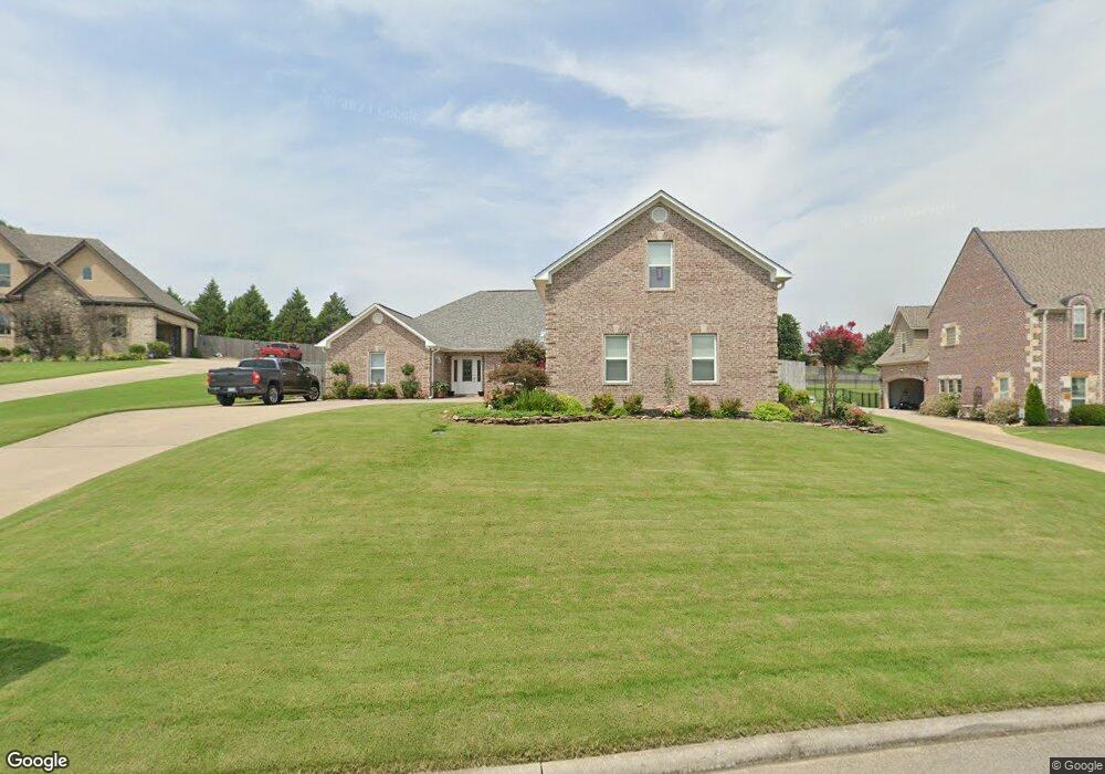
3013 Prestwick Cir Jonesboro, AR 72401
Estimated Value: $426,367 - $477,000
4
Beds
5
Baths
2,814
Sq Ft
$163/Sq Ft
Est. Value
About This Home
This home is located at 3013 Prestwick Cir, Jonesboro, AR 72401 and is currently estimated at $457,842, approximately $162 per square foot. 3013 Prestwick Cir is a home located in Craighead County with nearby schools including Brookland Elementary School, Brookland Middle School, and Brookland Junior High School.
Ownership History
Date
Name
Owned For
Owner Type
Purchase Details
Closed on
May 6, 2009
Sold by
Farris Jim and Farris Linda
Bought by
Hutchison Harry L and Hutchison Laurie E
Current Estimated Value
Home Financials for this Owner
Home Financials are based on the most recent Mortgage that was taken out on this home.
Original Mortgage
$207,920
Outstanding Balance
$131,298
Interest Rate
4.84%
Mortgage Type
New Conventional
Estimated Equity
$326,544
Purchase Details
Closed on
Feb 24, 2003
Bought by
Farris
Create a Home Valuation Report for This Property
The Home Valuation Report is an in-depth analysis detailing your home's value as well as a comparison with similar homes in the area
Home Values in the Area
Average Home Value in this Area
Purchase History
| Date | Buyer | Sale Price | Title Company |
|---|---|---|---|
| Hutchison Harry L | $260,000 | Professional Title Services | |
| Farris | $29,000 | -- |
Source: Public Records
Mortgage History
| Date | Status | Borrower | Loan Amount |
|---|---|---|---|
| Open | Hutchison Harry L | $207,920 |
Source: Public Records
Tax History Compared to Growth
Tax History
| Year | Tax Paid | Tax Assessment Tax Assessment Total Assessment is a certain percentage of the fair market value that is determined by local assessors to be the total taxable value of land and additions on the property. | Land | Improvement |
|---|---|---|---|---|
| 2025 | $2,786 | $72,069 | $12,400 | $59,669 |
| 2024 | $2,786 | $72,069 | $12,400 | $59,669 |
| 2023 | $2,276 | $72,069 | $12,400 | $59,669 |
| 2022 | $2,326 | $72,069 | $12,400 | $59,669 |
| 2021 | $2,411 | $57,920 | $10,600 | $47,320 |
| 2020 | $2,411 | $57,920 | $10,600 | $47,320 |
| 2019 | $2,411 | $57,920 | $10,600 | $47,320 |
| 2018 | $2,377 | $57,920 | $10,600 | $47,320 |
| 2017 | $2,253 | $57,920 | $10,600 | $47,320 |
| 2016 | $2,129 | $51,540 | $5,600 | $45,940 |
| 2015 | $2,479 | $51,540 | $5,600 | $45,940 |
| 2014 | $2,129 | $51,540 | $5,600 | $45,940 |
Source: Public Records
Map
Nearby Homes
- 8 the Meadows Sub
- 21 the Meadows Sub
- 4 the Meadows Sub
- 3 the Meadows Sub
- 17 the Meadows Sub
- 25 the Meadows Sub
- 16 the Meadows Sub
- 20 the Meadows Sub
- 5700 Morgan Dr
- 6 the Meadows Sub
- 12 the Meadows Sub
- 5 the Meadows Sub
- 15 the Meadows Sub
- 10 the Meadows Sub
- 1100 Jonathan Dr
- 14 the Meadows Sub
- 22 the Meadows Sub
- 18 the Meadows Sub
- 24 the Meadows Sub
- 2 the Meadows Sub
- 3009 Prestwick Cir
- 3017 Prestwick Cir
- 3005 Prestwick Cir
- 3004 Berkshire Cove
- 3101 Prestwick Cir
- 3008 Berkshire Cove
- 3127 Prestwick Cir
- 3100 Prestwick Cir
- 3105 Prestwick Cir
- 3001 Prestwick Cir
- 3109 Prestwick Cir
- 3104 Prestwick Cir
- 3000 Prestwick Cir
- 3005 Berkshire Cove
- 3113 Prestwick Cir
- 3108 Prestwick Cir
- 3000 Berkshire Cove
- 3316 Prestwick Cir
- 4305 Clubhouse Dr
- 3001 Berkshire Cove