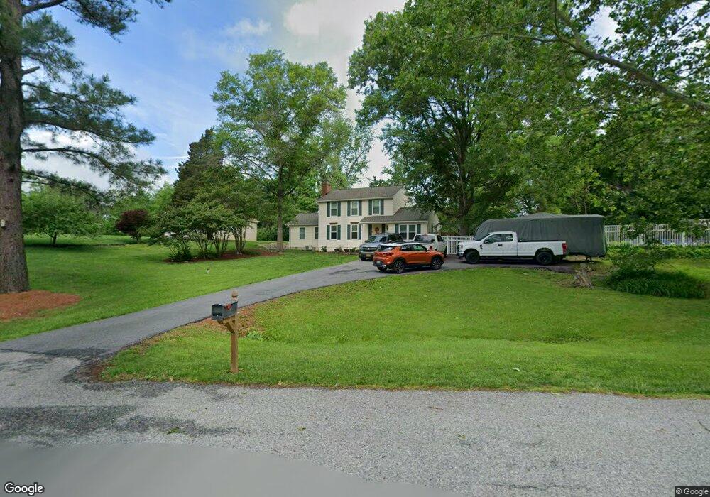
3017 Ashwood Dr Dunkirk, MD 20754
Estimated Value: $550,890 - $643,000
3
Beds
3
Baths
1,856
Sq Ft
$314/Sq Ft
Est. Value
About This Home
This home is located at 3017 Ashwood Dr, Dunkirk, MD 20754 and is currently estimated at $582,473, approximately $313 per square foot. 3017 Ashwood Dr is a home located in Calvert County with nearby schools including Mount Harmony Elementary School, Northern Middle School, and Northern High School.
Ownership History
Date
Name
Owned For
Owner Type
Purchase Details
Closed on
Mar 14, 1993
Sold by
Butler Clyde M and Butler Debra R
Bought by
Whittington James A and Whittington Beverly J
Current Estimated Value
Home Financials for this Owner
Home Financials are based on the most recent Mortgage that was taken out on this home.
Original Mortgage
$162,000
Interest Rate
7.47%
Purchase Details
Closed on
Apr 10, 1986
Sold by
Smith Charles Robert
Bought by
Butler Clyde M and Butler Debra R
Home Financials for this Owner
Home Financials are based on the most recent Mortgage that was taken out on this home.
Original Mortgage
$109,000
Interest Rate
9.99%
Purchase Details
Closed on
Feb 4, 1983
Sold by
Chesapeake & Patuxent Homes Inc
Bought by
Smith Charles Robert
Home Financials for this Owner
Home Financials are based on the most recent Mortgage that was taken out on this home.
Original Mortgage
$62,000
Interest Rate
13.06%
Create a Home Valuation Report for This Property
The Home Valuation Report is an in-depth analysis detailing your home's value as well as a comparison with similar homes in the area
Home Values in the Area
Average Home Value in this Area
Purchase History
| Date | Buyer | Sale Price | Title Company |
|---|---|---|---|
| Whittington James A | $180,000 | -- | |
| Butler Clyde M | $122,000 | -- | |
| Smith Charles Robert | $91,000 | -- |
Source: Public Records
Mortgage History
| Date | Status | Borrower | Loan Amount |
|---|---|---|---|
| Closed | Whittington James A | $162,000 | |
| Previous Owner | Butler Clyde M | $109,000 | |
| Previous Owner | Smith Charles Robert | $62,000 |
Source: Public Records
Tax History
| Year | Tax Paid | Tax Assessment Tax Assessment Total Assessment is a certain percentage of the fair market value that is determined by local assessors to be the total taxable value of land and additions on the property. | Land | Improvement |
|---|---|---|---|---|
| 2025 | $4,796 | $423,900 | $170,200 | $253,700 |
| 2024 | $4,461 | $393,367 | $0 | $0 |
| 2023 | $3,984 | $362,833 | $0 | $0 |
| 2022 | $3,664 | $332,300 | $170,200 | $162,100 |
| 2021 | $3,594 | $328,467 | $0 | $0 |
| 2020 | $3,594 | $324,633 | $0 | $0 |
| 2019 | $3,567 | $320,800 | $170,200 | $150,600 |
| 2018 | $3,534 | $318,833 | $0 | $0 |
| 2017 | $3,557 | $316,867 | $0 | $0 |
| 2016 | -- | $314,900 | $0 | $0 |
| 2015 | $3,432 | $314,900 | $0 | $0 |
| 2014 | $3,432 | $314,900 | $0 | $0 |
Source: Public Records
Map
Nearby Homes
- 3120 Lacrosse Ct
- 11432 Diantha Ct
- 11820 Cedarwood Dr
- 2850 Dunleigh Dr
- 3050 Hickory Ridge Rd
- 11223 Country Rd
- 2950 Chaney Rd
- 10401 Three Doctors Rd
- 12124 Palisades Dr
- 10623 Fielder Ct
- 249 Jaguar Dr
- 243 Jaguar Dr
- 12441 Uncle Charlies Spur
- 3312 Smithville Dr
- 65 Cob Ct
- 12672 Legacy Dr
- 1071 Lower Pindell Rd
- 12732 Legacy Dr
- 6380 Mallard Ln
- 4020 Chaney Cove Ct
- 3019 Ashwood Dr
- 11803 Crown Dr
- 3015 Ashwood Dr
- 11861 Lexington Dr
- 11851 Lexington Dr
- 3013 Ashwood Dr
- 11802 Crown Dr
- 3101 Ashwood Dr
- 11901 Crown Dr
- 11721 Beechwood Dr
- 3011 Ashwood Dr
- 11850 Lexington Dr
- 3400 King Dr
- 11871 Lexington Dr
- 11860 Lexington Dr
- 3111 Ashwood Dr
- 3100 Ashwood Dr
- 3009 Ashwood Dr
- 3010 Ashwood Dr
- 3401 King Dr
Your Personal Tour Guide
Ask me questions while you tour the home.