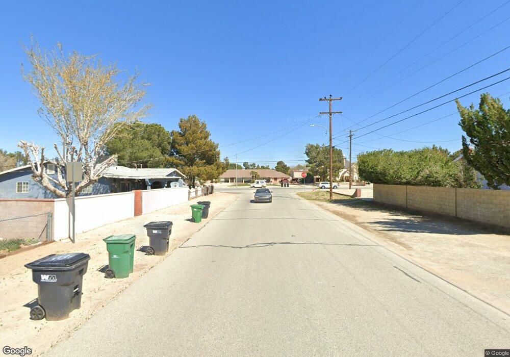
3017 W Avenue l6 Lancaster, CA 93536
West Lancaster NeighborhoodEstimated Value: $334,335 - $435,000
2
Beds
1
Bath
990
Sq Ft
$395/Sq Ft
Est. Value
About This Home
This home is located at 3017 W Avenue l6, Lancaster, CA 93536 and is currently estimated at $390,584, approximately $394 per square foot. 3017 W Avenue l6 is a home located in Los Angeles County with nearby schools including Valley View Elementary School, Joe Walker Middle School, and Lancaster High School.
Ownership History
Date
Name
Owned For
Owner Type
Purchase Details
Closed on
Nov 1, 2013
Sold by
Hughes Michael C
Bought by
Hughes Michael C and Hughes Wanda J
Current Estimated Value
Purchase Details
Closed on
Jan 8, 2004
Sold by
Hughes Georgia Z and The Francis & Georgia Hughes 2
Bought by
Hughes Georgia Z and The Francis & Georgia Hughes 2001 Trust
Purchase Details
Closed on
Nov 12, 2001
Sold by
Hughes Francis M and Hughes Georgia Z
Bought by
Hughes Francis M
Create a Home Valuation Report for This Property
The Home Valuation Report is an in-depth analysis detailing your home's value as well as a comparison with similar homes in the area
Home Values in the Area
Average Home Value in this Area
Purchase History
| Date | Buyer | Sale Price | Title Company |
|---|---|---|---|
| Hughes Michael C | -- | None Available | |
| Hughes Michael C | -- | None Available | |
| Hughes Michael C | -- | None Available | |
| Hughes Georgia Z | -- | -- | |
| Hughes Francis M | -- | -- |
Source: Public Records
Tax History Compared to Growth
Tax History
| Year | Tax Paid | Tax Assessment Tax Assessment Total Assessment is a certain percentage of the fair market value that is determined by local assessors to be the total taxable value of land and additions on the property. | Land | Improvement |
|---|---|---|---|---|
| 2025 | $1,731 | $41,119 | $10,504 | $30,615 |
| 2024 | $1,731 | $40,314 | $10,299 | $30,015 |
| 2023 | $1,703 | $39,525 | $10,098 | $29,427 |
| 2022 | $1,545 | $38,750 | $9,900 | $28,850 |
| 2021 | $1,182 | $37,991 | $9,706 | $28,285 |
| 2019 | $1,161 | $36,866 | $9,419 | $27,447 |
| 2018 | $1,148 | $36,144 | $9,235 | $26,909 |
| 2016 | $1,101 | $34,742 | $8,877 | $25,865 |
| 2015 | $1,092 | $34,221 | $8,744 | $25,477 |
| 2014 | $1,124 | $33,551 | $8,573 | $24,978 |
Source: Public Records
Map
Nearby Homes
- 42545 30th St W
- 30 W Cor 30th Stw Ave Unit L8
- 42626 32nd St W
- 2706 W Avenue l4
- 42719 30th St W
- 42662 28th St W
- 3330 W Avenue l4
- 3224 W Avenue L
- 3137 Peachwood Dr
- 3143 Peachwood Dr
- 0 Corner of 27th St W and L
- 42926 Pearlwood Dr
- 42935 Lemonwood Dr
- 3340 Brittany Ln
- 3122 Softwood Ct
- 0 W Avenue l10 Unit 25006351
- W Avenue L-8
- 42634 25th St W
- 42962 Burlwood Dr
- 0 Desert Rose Dr Unit 25004440
- 3021 W Avenue l6
- 42505 30th St W
- 3043 Avenue L-6
- 3029 W Avenue l6
- 42515 30th St W
- 3014 W Avenue l6
- 42501 30th St W
- 3023 W Avenue l6
- 42453 30th St W
- 3022 W Avenue l6
- 3028 W Avenue l6
- 42527 30th St W
- 3037 W Avenue l6
- 3043 W Avenue L-6
- 3038 W Avenue l6
- 42443 30th St W
- 0 L 6 30th St W Unit 16001770
- 0 Vac Ave L6 Vic 31st Unit 1202335
- 3044 W Avenue l6
- 3051 W Avenue l6
