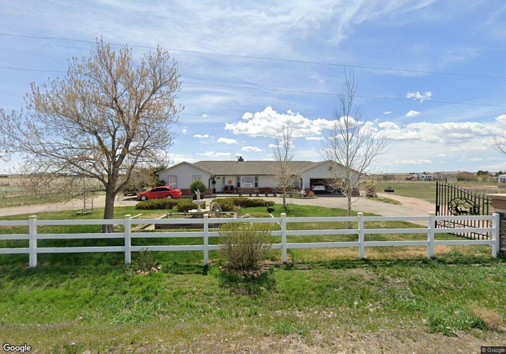
30188 E 131st Ave Commerce City, CO 80022
Estimated Value: $503,000 - $703,000
4
Beds
3
Baths
1,990
Sq Ft
$314/Sq Ft
Est. Value
About This Home
This home is located at 30188 E 131st Ave, Commerce City, CO 80022 and is currently estimated at $625,838, approximately $314 per square foot. 30188 E 131st Ave is a home located in Adams County with nearby schools including Henderson Elementary School, Otho E Stuart Middle School, and Prairie View High School.
Ownership History
Date
Name
Owned For
Owner Type
Purchase Details
Closed on
Mar 15, 2006
Sold by
Humphrey Frederick L and Humphrey Sheila M
Bought by
Loya Hugo R and Loya Maria L
Current Estimated Value
Purchase Details
Closed on
Apr 12, 1999
Sold by
Humphrey Frederick L and Humphrey Frederick L
Bought by
Humphrey Frederick L and Humphrey Sheila M
Home Financials for this Owner
Home Financials are based on the most recent Mortgage that was taken out on this home.
Original Mortgage
$157,500
Interest Rate
6.99%
Purchase Details
Closed on
Aug 22, 1997
Sold by
Humphrey Judy H
Bought by
Humphrey Frederick L
Purchase Details
Closed on
Feb 3, 1997
Sold by
Humphrey Judy H
Bought by
Humphrey Frederick L
Create a Home Valuation Report for This Property
The Home Valuation Report is an in-depth analysis detailing your home's value as well as a comparison with similar homes in the area
Home Values in the Area
Average Home Value in this Area
Purchase History
| Date | Buyer | Sale Price | Title Company |
|---|---|---|---|
| Loya Hugo R | $234,000 | Utc Colorado | |
| Humphrey Frederick L | -- | -- | |
| Humphrey Frederick L | -- | -- | |
| Humphrey Frederick L | -- | -- |
Source: Public Records
Mortgage History
| Date | Status | Borrower | Loan Amount |
|---|---|---|---|
| Previous Owner | Humphrey Frederick L | $157,500 |
Source: Public Records
Tax History Compared to Growth
Tax History
| Year | Tax Paid | Tax Assessment Tax Assessment Total Assessment is a certain percentage of the fair market value that is determined by local assessors to be the total taxable value of land and additions on the property. | Land | Improvement |
|---|---|---|---|---|
| 2024 | $4,124 | $39,940 | $7,560 | $32,380 |
| 2023 | $4,104 | $43,370 | $7,280 | $36,090 |
| 2022 | $3,384 | $32,790 | $7,010 | $25,780 |
| 2021 | $3,152 | $32,790 | $7,010 | $25,780 |
| 2020 | $2,329 | $25,290 | $7,210 | $18,080 |
| 2019 | $2,332 | $25,290 | $7,210 | $18,080 |
| 2018 | $1,977 | $21,430 | $4,920 | $16,510 |
| 2017 | $1,974 | $21,430 | $4,920 | $16,510 |
| 2016 | $1,738 | $18,800 | $5,110 | $13,690 |
| 2015 | $1,734 | $18,800 | $5,110 | $13,690 |
| 2014 | $1,497 | $16,480 | $4,840 | $11,640 |
Source: Public Records
Map
Nearby Homes
- 32350 E 137th Way
- 32501 E 137th Way
- 31200 E 145th Ave
- 14651 Hayesmount Rd
- 16590 Watkins Rd
- 32650 E 143rd Ave
- 30522 E 148th Ct
- 14955 Lanewood St
- 6816 E 149th Ave
- 34308 E 139th Ct
- 13350 Imboden Rd
- 2 Imboden Rd
- 15415 Gadsden Dr
- 13400 Harvest Rd
- 0 Harvest Rd Unit REC9194952
- 0 E 152nd Ave
- 30350 E 161st Ave Unit 25
- 30460 E 161st Ave
- 28550 E 159th Ave
- 30355 E 161st Ave
- 30147 E 131st Ave
- 30187 E 131st Ave
- 30266 E 131st Ave
- 30086 E 131st Ave
- 30067 E 131st Ave
- 30267 E 131st Ave
- 30366 E 131st Ave
- 30068 E 131st Ave
- 30337 E 131st Ave
- 29987 E 131st Ave
- 29966 E 131st Ave
- 29966 E 131st Ave
- 30387 E 131st Ave
- 29967 E 131st Ave
- 30467 E 131st Ave
- 13065 Lanewood St
- 29947 E 131st Ave
- 12985 Lanewood St
- 29846 E 131st Ave
- 12980 Hayesmount Rd