Estimated Value: $2,641,532 - $3,017,000
4
Beds
4
Baths
2,744
Sq Ft
$1,025/Sq Ft
Est. Value
About This Home
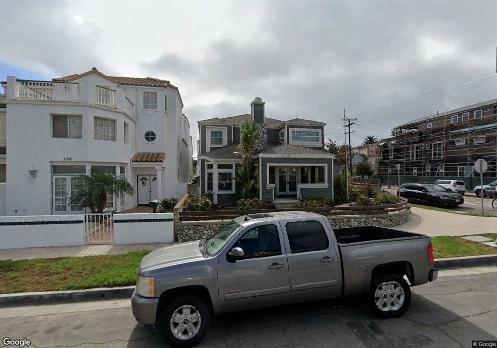
This home is located at 302 13th St, Huntington Beach, CA 92648 and is currently estimated at $2,811,633, approximately $1,024 per square foot. 302 13th St is a home located in Orange County with nearby schools including Agnes L. Smith Elementary, Ethel Dwyer Middle, and Huntington Beach High School.
Ownership History
Date
Name
Owned For
Owner Type
Purchase Details
Closed on
Nov 4, 2004
Sold by
Long Marian K
Bought by
Marlon Ltd
Current Estimated Value
Home Financials for this Owner
Home Financials are based on the most recent Mortgage that was taken out on this home.
Original Mortgage
$170,540
Interest Rate
5.79%
Mortgage Type
Purchase Money Mortgage
Purchase Details
Closed on
May 4, 2004
Sold by
Hectrick James K
Bought by
Long Marian K
Home Financials for this Owner
Home Financials are based on the most recent Mortgage that was taken out on this home.
Original Mortgage
$1,000,000
Interest Rate
4%
Mortgage Type
Purchase Money Mortgage
Purchase Details
Closed on
Mar 25, 2004
Sold by
Reloaction
Bought by
Long Marian K
Home Financials for this Owner
Home Financials are based on the most recent Mortgage that was taken out on this home.
Original Mortgage
$1,000,000
Interest Rate
4%
Mortgage Type
Purchase Money Mortgage
Purchase Details
Closed on
Mar 12, 2004
Sold by
Beers Gary William and Watson Leslie Noelle
Bought by
Reloaction
Home Financials for this Owner
Home Financials are based on the most recent Mortgage that was taken out on this home.
Original Mortgage
$1,000,000
Interest Rate
4%
Mortgage Type
Purchase Money Mortgage
Purchase Details
Closed on
Dec 17, 1998
Sold by
Lander Joel and Lander Sherrill L
Bought by
Beers Gary William and Watson Leslie Noelle
Home Financials for this Owner
Home Financials are based on the most recent Mortgage that was taken out on this home.
Original Mortgage
$460,000
Interest Rate
6.75%
Purchase Details
Closed on
Apr 15, 1998
Sold by
Lander Joel
Bought by
Lander Joel and Lander Sherrill L
Home Financials for this Owner
Home Financials are based on the most recent Mortgage that was taken out on this home.
Original Mortgage
$50,000
Interest Rate
7.13%
Purchase Details
Closed on
Aug 29, 1995
Sold by
Backlund Hans D and Backlund Sven E
Bought by
Lander Joel
Home Financials for this Owner
Home Financials are based on the most recent Mortgage that was taken out on this home.
Original Mortgage
$400,000
Interest Rate
7.8%
Purchase Details
Closed on
Feb 14, 1995
Sold by
Backlund Herta L
Bought by
Backlund Herta Lovisa and Backlund Hertha Lovisa
Create a Home Valuation Report for This Property
The Home Valuation Report is an in-depth analysis detailing your home's value as well as a comparison with similar homes in the area
Home Values in the Area
Average Home Value in this Area
Purchase History
| Date | Buyer | Sale Price | Title Company |
|---|---|---|---|
| Marlon Ltd | -- | -- | |
| Long Marian K | -- | Old Republic Title Company | |
| Long Marian K | $1,450,000 | Old Republic Title Company | |
| Reloaction | -- | Old Republic Title Company | |
| Beers Gary William | $575,000 | Guardian Title Company | |
| Lander Joel | -- | Southland Title Corporation | |
| Lander Joel | $445,000 | Commonwealth Land Title | |
| Backlund Herta Lovisa | -- | -- |
Source: Public Records
Mortgage History
| Date | Status | Borrower | Loan Amount |
|---|---|---|---|
| Previous Owner | Marlon Ltd | $170,540 | |
| Previous Owner | Long Marian K | $1,000,000 | |
| Previous Owner | Beers Gary William | $460,000 | |
| Previous Owner | Lander Joel | $50,000 | |
| Previous Owner | Lander Joel | $400,000 |
Source: Public Records
Tax History Compared to Growth
Tax History
| Year | Tax Paid | Tax Assessment Tax Assessment Total Assessment is a certain percentage of the fair market value that is determined by local assessors to be the total taxable value of land and additions on the property. | Land | Improvement |
|---|---|---|---|---|
| 2025 | $22,239 | $2,021,172 | $1,565,600 | $455,572 |
| 2024 | $22,239 | $1,981,542 | $1,534,902 | $446,640 |
| 2023 | $18,719 | $1,667,157 | $1,306,303 | $360,854 |
| 2022 | $18,232 | $1,634,468 | $1,280,689 | $353,779 |
| 2021 | $17,892 | $1,602,420 | $1,255,577 | $346,843 |
| 2020 | $17,959 | $1,602,420 | $1,255,577 | $346,843 |
| 2019 | $17,740 | $1,571,000 | $1,230,957 | $340,043 |
| 2018 | $17,808 | $1,571,000 | $1,230,957 | $340,043 |
| 2017 | $15,781 | $1,380,000 | $1,039,957 | $340,043 |
| 2016 | $15,362 | $1,380,000 | $1,039,957 | $340,043 |
| 2015 | $15,446 | $1,380,000 | $1,039,957 | $340,043 |
| 2014 | $13,510 | $1,205,299 | $865,256 | $340,043 |
Source: Public Records
Map
Nearby Homes
- 228 12th St Unit 1113 Olive Av
- 1111 Olive Ave Unit A & B
- 319 14th St Unit B
- 413 14th St Unit D
- 1200 Pacific Coast Hwy Unit 102
- 1200 Pacific Coast Hwy
- 1200 Pacific Coast Hwy Unit 214
- 416 15th St
- 221 10th St
- 116 11th St
- 1102 Pacific Coast Hwy Unit Lot 4
- 521 12th St
- 427 10th St
- 526 12th St
- 1516 Pacific Coast Hwy Unit 101
- 306 17th St
- 613 13th St
- 125 16th St
- 309 8th St
- 304 18th St