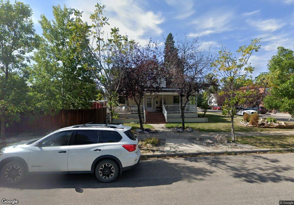
302 7th Ave S Lewistown, MT 59457
Estimated Value: $445,000 - $669,000
5
Beds
3
Baths
2,688
Sq Ft
$190/Sq Ft
Est. Value
About This Home
This home is located at 302 7th Ave S, Lewistown, MT 59457 and is currently estimated at $511,904, approximately $190 per square foot. 302 7th Ave S is a home located in Fergus County with nearby schools including Fergus High School.
Ownership History
Date
Name
Owned For
Owner Type
Purchase Details
Closed on
May 9, 2024
Sold by
Benton Norman Dale and Benton Stacey
Bought by
Benton Norman Dale and Benton Stacey
Current Estimated Value
Purchase Details
Closed on
Sep 9, 2021
Sold by
Benton Norman Dale
Bought by
Benton Norman Dale and Benton Stacey
Home Financials for this Owner
Home Financials are based on the most recent Mortgage that was taken out on this home.
Original Mortgage
$198,400
Interest Rate
3.09%
Mortgage Type
New Conventional
Purchase Details
Closed on
Apr 10, 1997
Bought by
Benton Norman Dale and Benton Stacey
Home Financials for this Owner
Home Financials are based on the most recent Mortgage that was taken out on this home.
Original Mortgage
$157,300
Interest Rate
7.66%
Mortgage Type
New Conventional
Create a Home Valuation Report for This Property
The Home Valuation Report is an in-depth analysis detailing your home's value as well as a comparison with similar homes in the area
Home Values in the Area
Average Home Value in this Area
Purchase History
| Date | Buyer | Sale Price | Title Company |
|---|---|---|---|
| Benton Norman Dale | -- | None Listed On Document | |
| Benton Norman Dale | -- | New Title Company Name | |
| Benton Norman Dale | -- | -- |
Source: Public Records
Mortgage History
| Date | Status | Borrower | Loan Amount |
|---|---|---|---|
| Previous Owner | Benton Norman Dale | $198,400 | |
| Previous Owner | Benton Norman Dale | $157,300 |
Source: Public Records
Tax History Compared to Growth
Tax History
| Year | Tax Paid | Tax Assessment Tax Assessment Total Assessment is a certain percentage of the fair market value that is determined by local assessors to be the total taxable value of land and additions on the property. | Land | Improvement |
|---|---|---|---|---|
| 2025 | $1,947 | $525,900 | $0 | $0 |
| 2024 | $1,439 | $383,600 | $0 | $0 |
| 2023 | $2,692 | $383,600 | $0 | $0 |
| 2022 | $1,706 | $264,765 | $0 | $0 |
| 2021 | $1,210 | $264,765 | $0 | $0 |
| 2020 | $1,238 | $236,300 | $0 | $0 |
| 2019 | $3,069 | $236,300 | $0 | $0 |
| 2018 | $3,055 | $233,740 | $0 | $0 |
| 2017 | $2,637 | $233,740 | $0 | $0 |
| 2016 | $2,962 | $232,260 | $0 | $0 |
| 2015 | $2,583 | $232,260 | $0 | $0 |
| 2014 | $2,549 | $128,472 | $0 | $0 |
Source: Public Records
Map
Nearby Homes
- 401 7th Ave S
- 115 7th Ave N
- 624 W Broadway St
- 506 Brassey St
- 1011 W Broadway St
- 1109 W Water St
- 1220 W Main St
- 112 Uranium Dr
- 318 W Evelyn St
- 113 15th Ave S
- 105 Hillcrest Dr
- 514 2nd Ave N
- 316 W Corcoran St
- 1201 3rd Ave S
- 1203 3rd Ave S
- 313 W Idaho St
- 307 E Janeaux St
- 210 S High St
- 412 W Huron St
- 211 Cedar St
- 709 W Watson St
- 312 7th Ave S
- 715 W Watson St
- 314 7th Ave S
- 712 W Water St
- 716 W Water St
- 710 W Watson St
- 716 W Watson St
- 301 7th Ave S
- 301 8th Ave S
- 624 W Water St
- 400 7th Ave N Unit 2
- 400 7th Ave N Unit 1
- 722 W Water St
- 722 W Water St Unit LEWISTOWN
- 724 W Watson St
- 618 W Water St
- 721 W Janeaux St
- 703 W Janeaux St
- 711 W Janeaux St