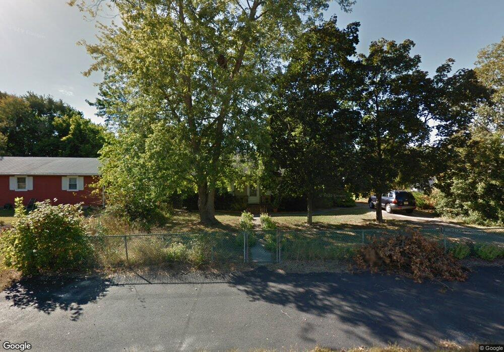
302 Apache Trail Browns Mills, NJ 08015
Estimated Value: $190,000 - $320,000
--
Bed
--
Bath
1,021
Sq Ft
$271/Sq Ft
Est. Value
About This Home
This home is located at 302 Apache Trail, Browns Mills, NJ 08015 and is currently estimated at $276,651, approximately $270 per square foot. 302 Apache Trail is a home located in Burlington County.
Ownership History
Date
Name
Owned For
Owner Type
Purchase Details
Closed on
Dec 1, 2006
Sold by
Mcevoy Kenneth P and Mcevoy Rose M
Bought by
Prendergast Kerry
Current Estimated Value
Home Financials for this Owner
Home Financials are based on the most recent Mortgage that was taken out on this home.
Original Mortgage
$7,255
Interest Rate
6.31%
Mortgage Type
Stand Alone Second
Purchase Details
Closed on
Nov 30, 1998
Sold by
Snellenberger Rickey J and Snellenberger Debora A
Bought by
Mcevoy Kenneth P and Mcevoy Rose M
Home Financials for this Owner
Home Financials are based on the most recent Mortgage that was taken out on this home.
Original Mortgage
$80,509
Interest Rate
6.8%
Mortgage Type
VA
Purchase Details
Closed on
May 31, 1995
Sold by
Va
Bought by
Snellenberger Rickey J and Snellenberger Debora A
Create a Home Valuation Report for This Property
The Home Valuation Report is an in-depth analysis detailing your home's value as well as a comparison with similar homes in the area
Home Values in the Area
Average Home Value in this Area
Purchase History
| Date | Buyer | Sale Price | Title Company |
|---|---|---|---|
| Prendergast Kerry | $187,000 | None Available | |
| Mcevoy Kenneth P | $78,900 | Surety Title Corporation | |
| Snellenberger Rickey J | $60,500 | Imperial Title |
Source: Public Records
Mortgage History
| Date | Status | Borrower | Loan Amount |
|---|---|---|---|
| Closed | Prendergast Kerry | $7,255 | |
| Open | Prendergast Kerry | $181,390 | |
| Previous Owner | Mcevoy Kenneth P | $80,509 |
Source: Public Records
Tax History Compared to Growth
Tax History
| Year | Tax Paid | Tax Assessment Tax Assessment Total Assessment is a certain percentage of the fair market value that is determined by local assessors to be the total taxable value of land and additions on the property. | Land | Improvement |
|---|---|---|---|---|
| 2025 | $4,098 | $133,700 | $37,800 | $95,900 |
| 2024 | $3,845 | $133,700 | $37,800 | $95,900 |
| 2023 | $3,845 | $133,700 | $37,800 | $95,900 |
| 2022 | $3,559 | $133,700 | $37,800 | $95,900 |
| 2021 | $3,413 | $133,700 | $37,800 | $95,900 |
| 2020 | $3,285 | $133,700 | $37,800 | $95,900 |
| 2019 | $3,146 | $133,700 | $37,800 | $95,900 |
| 2018 | $3,039 | $133,700 | $37,800 | $95,900 |
| 2017 | $2,976 | $133,700 | $37,800 | $95,900 |
| 2016 | $2,729 | $73,000 | $22,300 | $50,700 |
| 2015 | $2,707 | $73,000 | $22,300 | $50,700 |
| 2014 | $2,588 | $73,000 | $22,300 | $50,700 |
Source: Public Records
Map
Nearby Homes
- 306 Apache Trail
- 315 Algonquin Trail
- 208 Wichita Trail
- 310 Piute Trail
- 304 Spring Lake Blvd
- 304 Mohawk Trail
- 219 Chippewa Trail
- 224 Cherokee Dr
- 1714 Red Feather Trail
- 419 Chippewa Trail
- 13 Muskogean Trail
- 77 Sepulga Dr
- 22 Maricopa Trail
- 111 Huckleberry Ln
- 2 Kiowa Trail
- 1 S Branch Dr
- 505 Wisconsin Trail
- 307 Colorado Trail
- 209 Colorado Trail
- 500 New York Rd
- 304 Apache Trail
- 300 Apache Trail
- 303 Algonquin Trail
- 305 Algonquin Trail
- 303 Apache Trail
- 301 Algonquin Trail
- 800 Red Feather Trail
- 305 Apache Trail
- 307 Algonquin Trail
- 307 Apache Trail
- 802 Red Feather Trail
- 309 Algonquin Trail
- 705 Red Feather Trail
- 300 Algonquin Trail
- 703 Red Feather Trail
- 0 Algonquin Trail Unit 1005746082
- 0 Algonquin Trail Unit 5332712
- 302 Blackfoot Trail
- 309 Apache Trail
- 304 Blackfoot Trail