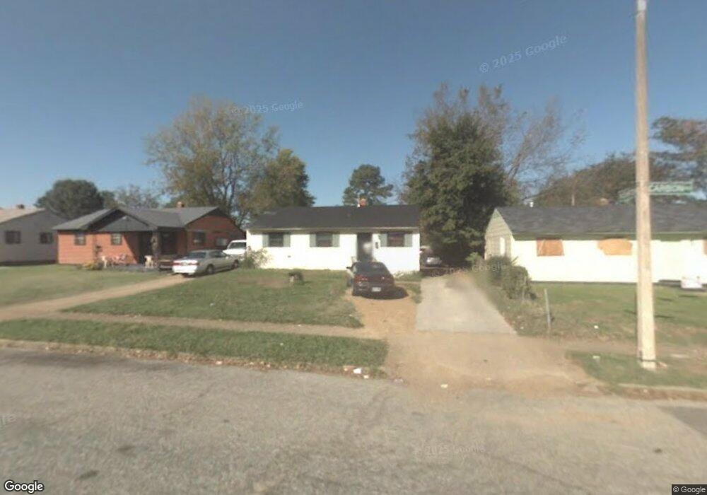
302 Carbon Rd Memphis, TN 38109
Westwood NeighborhoodEstimated Value: $61,000 - $74,000
3
Beds
1
Bath
816
Sq Ft
$84/Sq Ft
Est. Value
About This Home
This home is located at 302 Carbon Rd, Memphis, TN 38109 and is currently estimated at $68,271, approximately $83 per square foot. 302 Carbon Rd is a home located in Shelby County with nearby schools including Ford Road Elementary School, Chickasaw Middle School, and Mitchell High School.
Ownership History
Date
Name
Owned For
Owner Type
Purchase Details
Closed on
Feb 25, 1999
Sold by
Dandridge Linda
Bought by
Walker Debbie
Current Estimated Value
Home Financials for this Owner
Home Financials are based on the most recent Mortgage that was taken out on this home.
Original Mortgage
$38,800
Outstanding Balance
$9,422
Interest Rate
6.79%
Estimated Equity
$58,849
Purchase Details
Closed on
Dec 30, 1998
Sold by
L & S Enterprises Of Tennessee Llc
Bought by
Dandridge Linda
Home Financials for this Owner
Home Financials are based on the most recent Mortgage that was taken out on this home.
Original Mortgage
$38,800
Outstanding Balance
$9,422
Interest Rate
6.79%
Estimated Equity
$58,849
Purchase Details
Closed on
Dec 17, 1998
Sold by
Va
Bought by
L & S Enterprises Of Tn Llc
Purchase Details
Closed on
Apr 28, 1998
Sold by
Palmer Willie M and Palmer Ayers L
Bought by
Va
Create a Home Valuation Report for This Property
The Home Valuation Report is an in-depth analysis detailing your home's value as well as a comparison with similar homes in the area
Home Values in the Area
Average Home Value in this Area
Purchase History
| Date | Buyer | Sale Price | Title Company |
|---|---|---|---|
| Walker Debbie | $40,000 | -- | |
| Dandridge Linda | -- | Stewart Title Company | |
| L & S Enterprises Of Tn Llc | -- | -- | |
| Va | $22,072 | -- |
Source: Public Records
Mortgage History
| Date | Status | Borrower | Loan Amount |
|---|---|---|---|
| Open | Walker Debbie | $38,800 | |
| Closed | Walker Debbie | $3,500 |
Source: Public Records
Tax History Compared to Growth
Tax History
| Year | Tax Paid | Tax Assessment Tax Assessment Total Assessment is a certain percentage of the fair market value that is determined by local assessors to be the total taxable value of land and additions on the property. | Land | Improvement |
|---|---|---|---|---|
| 2025 | $200 | $12,450 | $1,775 | $10,675 |
| 2024 | $200 | $5,900 | $1,275 | $4,625 |
| 2023 | $359 | $5,900 | $1,275 | $4,625 |
| 2022 | $359 | $5,900 | $1,275 | $4,625 |
| 2021 | $364 | $5,900 | $1,275 | $4,625 |
| 2020 | $444 | $6,125 | $1,275 | $4,850 |
| 2019 | $444 | $6,125 | $1,275 | $4,850 |
| 2018 | $444 | $6,125 | $1,275 | $4,850 |
| 2017 | $252 | $6,125 | $1,275 | $4,850 |
| 2016 | $284 | $6,500 | $0 | $0 |
| 2014 | $284 | $6,500 | $0 | $0 |
Source: Public Records
Map
Nearby Homes
- 293 Carbon Rd
- 3461 Daggett Rd
- 380 Elder Rd
- 3571 Daggett Rd
- 3342 Alta Rd
- 511 Jenson Rd
- 3207 Gilmore Rd
- 518 Jenson Rd
- 3204 Millwood Rd
- 3193 Winslow Rd
- 48 W Belle Haven Rd
- 529 Deerskin Dr
- 12 E Emory Rd
- 630 King Ave
- 129 W Brooks Rd
- 3393 Berea Rd
- 3804 Glenburee St
- 11 W Rollins Rd
- 341 Dixie Rd
- 3807 Glenburee St