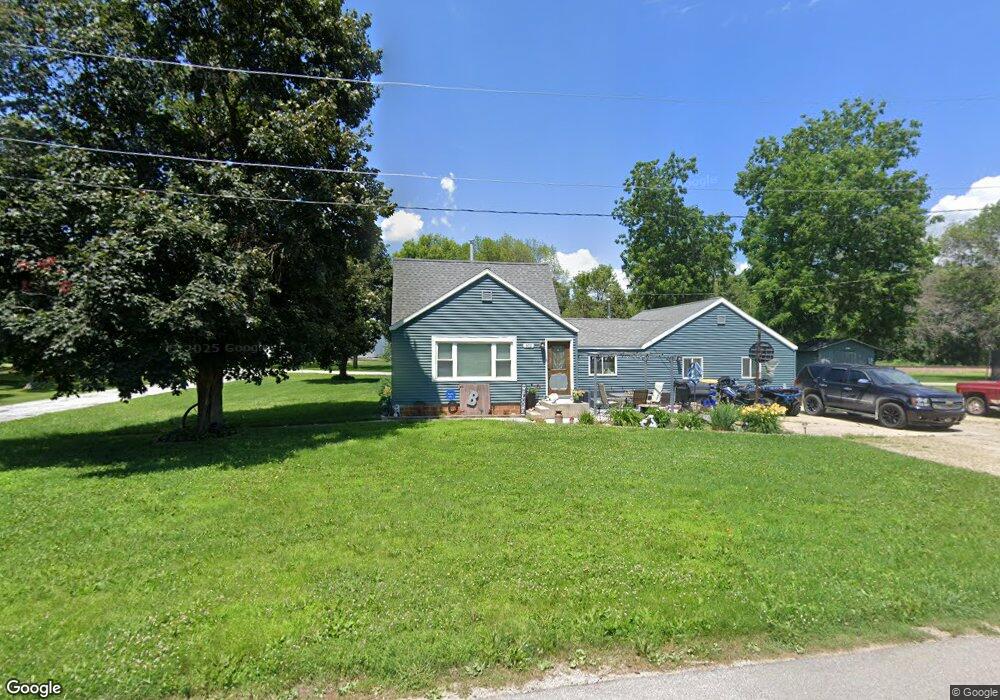
302 E 3rd St Hanlontown, IA 50444
Estimated Value: $100,000 - $180,000
2
Beds
1
Bath
1,596
Sq Ft
$77/Sq Ft
Est. Value
About This Home
This home is located at 302 E 3rd St, Hanlontown, IA 50444 and is currently estimated at $122,914, approximately $77 per square foot. 302 E 3rd St is a home with nearby schools including Central Springs High School.
Ownership History
Date
Name
Owned For
Owner Type
Purchase Details
Closed on
Feb 9, 2018
Sold by
Orlowski Steven C and Orlowski Terrie A
Bought by
Brower Anthony R
Current Estimated Value
Home Financials for this Owner
Home Financials are based on the most recent Mortgage that was taken out on this home.
Original Mortgage
$53,535
Outstanding Balance
$45,235
Interest Rate
3.99%
Mortgage Type
New Conventional
Estimated Equity
$77,679
Purchase Details
Closed on
Aug 7, 2012
Sold by
Hejna Eric J and Hejna Rachel L
Bought by
Orlowski Steven C and Orlowski Terrie A
Home Financials for this Owner
Home Financials are based on the most recent Mortgage that was taken out on this home.
Original Mortgage
$36,000
Interest Rate
3.6%
Mortgage Type
New Conventional
Create a Home Valuation Report for This Property
The Home Valuation Report is an in-depth analysis detailing your home's value as well as a comparison with similar homes in the area
Purchase History
| Date | Buyer | Sale Price | Title Company |
|---|---|---|---|
| Brower Anthony R | $52,500 | -- | |
| Orlowski Steven C | -- | None Available |
Source: Public Records
Mortgage History
| Date | Status | Borrower | Loan Amount |
|---|---|---|---|
| Open | Brower Anthony R | $53,535 | |
| Previous Owner | Orlowski Steven C | $36,000 |
Source: Public Records
Tax History
| Year | Tax Paid | Tax Assessment Tax Assessment Total Assessment is a certain percentage of the fair market value that is determined by local assessors to be the total taxable value of land and additions on the property. | Land | Improvement |
|---|---|---|---|---|
| 2025 | $1,012 | $88,700 | $10,080 | $78,620 |
| 2024 | $1,012 | $76,147 | $10,080 | $66,067 |
| 2023 | $902 | $76,147 | $10,080 | $66,067 |
| 2022 | $868 | $62,454 | $11,725 | $50,729 |
| 2021 | $774 | $62,454 | $11,725 | $50,729 |
| 2020 | $774 | $55,447 | $7,035 | $48,412 |
| 2019 | $700 | $55,447 | $7,035 | $48,412 |
| 2018 | $684 | $49,621 | $7,035 | $42,586 |
| 2017 | $684 | $49,621 | $7,035 | $42,586 |
| 2016 | $610 | $45,383 | $0 | $0 |
| 2015 | $610 | $37,489 | $0 | $0 |
| 2014 | $470 | $37,489 | $0 | $0 |
Source: Public Records
Map
Nearby Homes
- 105 Main St
- 203 Keerl St
- 207 Lake St
- 18493 Finch Ave
- 4 W South St
- 313 W Bosworth St
- 23870 400th St
- 304 W North St
- 217 W Elmore St
- 204 E Walnut St
- 215 Church St
- 1810 N 8th St
- 318 E Walnut St
- 1418 N 24th St
- 4403 Killdeer Ave
- 305 W 12th Ave N
- 17661 Eagle Ave
- 17 Plaza Dr Unit 17
- 1117 Buddy Holly Place
- 816 W 12th Ave N
- Lot 2 Lang St Unit Block 28
- Lot 4 Lang St Unit Block 27
- Lot 1 Lang St Unit Block 28
- Lot 3 Lang St Unit Block 28
- Lot 3 Lang St Unit Block 27
- Lot 5 Lang St Unit Block 27
- Lot 6 Lang St Unit Block 27
- 301 Lang St
- 307 E 3rd St
- 207 E 3rd St
- 204 E 3rd St
- 306 Lang St
- 304 E 4th St
- 202 E 3rd St
- 301 Danville St
- 208 E 4th St
- 308 E 4th St
- 201 Danville St
- 102 Lang St
- 305 Danville St
Your Personal Tour Guide
Ask me questions while you tour the home.