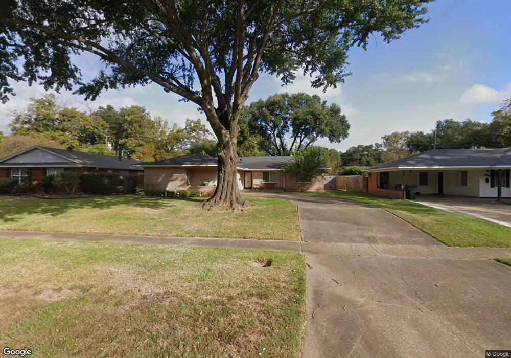
302 E Southfield Rd Shreveport, LA 71105
Broadmoor/Anderson Island/Shreve Isle NeighborhoodEstimated Value: $199,000 - $211,390
3
Beds
2
Baths
1,543
Sq Ft
$134/Sq Ft
Est. Value
About This Home
This home is located at 302 E Southfield Rd, Shreveport, LA 71105 and is currently estimated at $206,598, approximately $133 per square foot. 302 E Southfield Rd is a home located in Caddo Parish with nearby schools including Fairfield Magnet School, Judson Fundamental Elementary School, and Eden Gardens Fundamental Elementary School.
Ownership History
Date
Name
Owned For
Owner Type
Purchase Details
Closed on
Sep 17, 2010
Sold by
Cartermac Properties Llc
Bought by
Lanigan Kevin
Current Estimated Value
Purchase Details
Closed on
Nov 27, 2006
Sold by
Carter Monica Willaim
Bought by
Langishnm Timothy David
Home Financials for this Owner
Home Financials are based on the most recent Mortgage that was taken out on this home.
Original Mortgage
$141,000
Interest Rate
8.99%
Mortgage Type
Adjustable Rate Mortgage/ARM
Create a Home Valuation Report for This Property
The Home Valuation Report is an in-depth analysis detailing your home's value as well as a comparison with similar homes in the area
Home Values in the Area
Average Home Value in this Area
Purchase History
| Date | Buyer | Sale Price | Title Company |
|---|---|---|---|
| Lanigan Kevin | $5,375 | None Available | |
| Langishnm Timothy David | $141,000 | None Available |
Source: Public Records
Mortgage History
| Date | Status | Borrower | Loan Amount |
|---|---|---|---|
| Previous Owner | Langishnm Timothy David | $141,000 |
Source: Public Records
Tax History Compared to Growth
Tax History
| Year | Tax Paid | Tax Assessment Tax Assessment Total Assessment is a certain percentage of the fair market value that is determined by local assessors to be the total taxable value of land and additions on the property. | Land | Improvement |
|---|---|---|---|---|
| 2024 | $1,952 | $12,524 | $2,758 | $9,766 |
| 2023 | $1,996 | $12,524 | $2,758 | $9,766 |
| 2022 | $1,996 | $12,524 | $2,758 | $9,766 |
| 2021 | $1,966 | $12,524 | $2,758 | $9,766 |
| 2020 | $1,966 | $12,524 | $2,758 | $9,766 |
| 2019 | $2,010 | $12,430 | $2,758 | $9,672 |
| 2018 | $635 | $12,430 | $2,758 | $9,672 |
| 2017 | $2,042 | $12,430 | $2,758 | $9,672 |
| 2015 | $621 | $12,290 | $2,760 | $9,530 |
| 2014 | $626 | $12,290 | $2,760 | $9,530 |
| 2013 | -- | $12,290 | $2,760 | $9,530 |
Source: Public Records
Map
Nearby Homes
- 5702 River Rd
- 2049 River Rd
- 502 Mockingbird Ln
- 2045 Horton Ave
- 5822 River Rd
- 306 Oriole Ln
- 2013 E Kings Hwy
- 2005 E Kings Hwy
- 102 Justin Ave
- 1919 Audubon Place
- 154 Southfield Rd
- 138 Justin Ave
- 150 Justin Ave
- 522 Oriole Ln
- 1923 Bermuda St
- 334 Wayne Dr
- 1810 Captain Shreve Dr
- 142 Lynn Ave
- 1836 Bryan Place
- 6013 River Rd
- 306 E Southfield Rd
- 244 E Southfield Rd
- 238 E Southfield Rd
- 321 Haynes Ave
- 317 Haynes Ave
- 325 Haynes Ave
- 311 Haynes Ave
- 314 E Southfield Rd
- 314 E Southfield Rd
- 5702 River Rd
- 329 Haynes Ave
- 307 Haynes Ave
- 305 E Southfield Rd
- 222 E Southfield Rd
- 318 E Southfield Rd
- 5701 River Rd
- 315 E Southfield Rd
- 333 Haynes Ave
- 5706 River Rd
- 2054 Audubon Place