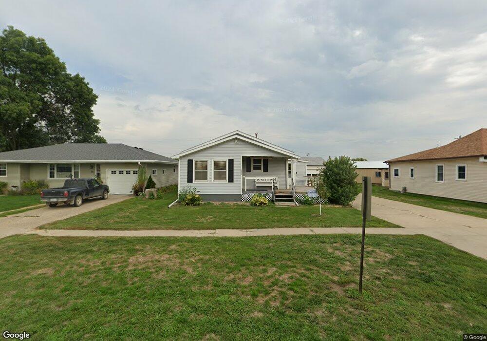
302 G St Sergeant Bluff, IA 51054
Estimated Value: $165,000 - $238,718
3
Beds
3
Baths
960
Sq Ft
$226/Sq Ft
Est. Value
About This Home
This home is located at 302 G St, Sergeant Bluff, IA 51054 and is currently estimated at $217,180, approximately $226 per square foot. 302 G St is a home located in Woodbury County with nearby schools including Sergeant Bluff-Luton Primary School, Sergeant Bluff-Luton Elementary School, and Sergeant Bluff-Luton Middle School.
Ownership History
Date
Name
Owned For
Owner Type
Purchase Details
Closed on
Apr 10, 2018
Sold by
Wendel Walter E and Wendel Beverly
Bought by
Thelander Properties Llc
Current Estimated Value
Home Financials for this Owner
Home Financials are based on the most recent Mortgage that was taken out on this home.
Original Mortgage
$126,637
Outstanding Balance
$108,931
Interest Rate
4.45%
Mortgage Type
New Conventional
Estimated Equity
$108,249
Create a Home Valuation Report for This Property
The Home Valuation Report is an in-depth analysis detailing your home's value as well as a comparison with similar homes in the area
Home Values in the Area
Average Home Value in this Area
Purchase History
| Date | Buyer | Sale Price | Title Company |
|---|---|---|---|
| Thelander Properties Llc | $126,000 | -- |
Source: Public Records
Mortgage History
| Date | Status | Borrower | Loan Amount |
|---|---|---|---|
| Open | Thelander Properties Llc | $126,637 |
Source: Public Records
Tax History
| Year | Tax Paid | Tax Assessment Tax Assessment Total Assessment is a certain percentage of the fair market value that is determined by local assessors to be the total taxable value of land and additions on the property. | Land | Improvement |
|---|---|---|---|---|
| 2025 | $3,066 | $209,030 | $8,820 | $200,210 |
| 2024 | $30 | $198,790 | $7,000 | $191,790 |
| 2023 | $2,618 | $198,790 | $7,000 | $191,790 |
| 2022 | $2,596 | $148,980 | $7,000 | $141,980 |
| 2021 | $2,596 | $148,980 | $7,000 | $141,980 |
| 2020 | $2,294 | $129,160 | $7,490 | $121,670 |
| 2019 | $2,180 | $129,160 | $7,490 | $121,670 |
| 2018 | $2,128 | $121,050 | $7,490 | $113,560 |
| 2017 | $2,128 | $121,050 | $7,490 | $113,560 |
| 2016 | $1,964 | $117,790 | $0 | $0 |
| 2015 | $2,051 | $102,680 | $7,000 | $95,680 |
| 2014 | $1,878 | $102,680 | $7,000 | $95,680 |
Source: Public Records
Map
Nearby Homes
Your Personal Tour Guide
Ask me questions while you tour the home.