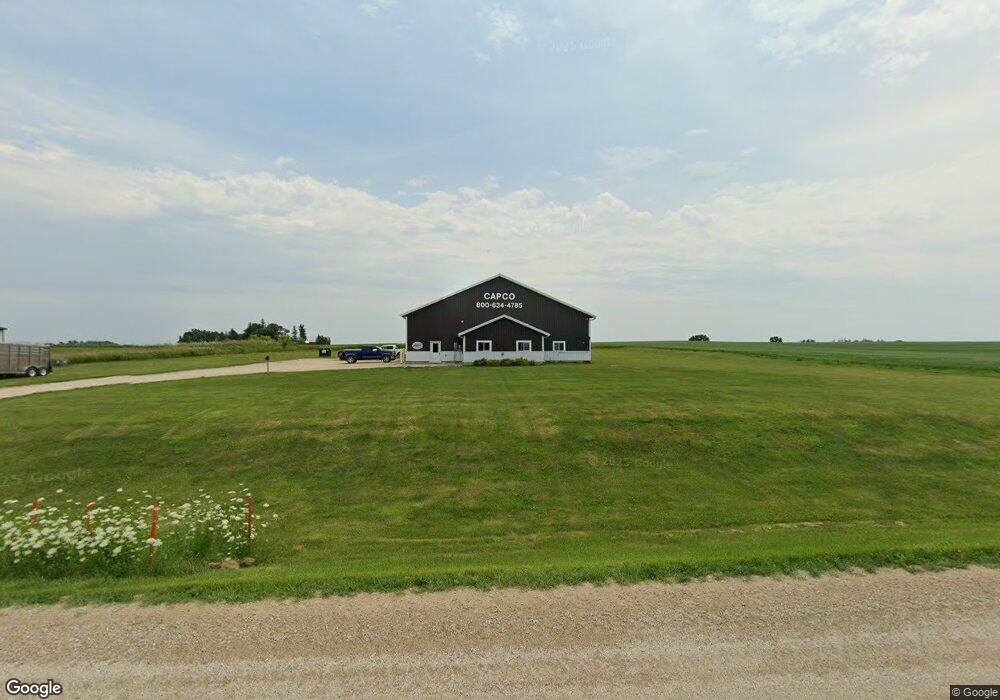
302 Highway 9 Waukon, IA 52172
--
Bed
--
Bath
5,088
Sq Ft
1.7
Acres
About This Home
This home is located at 302 Highway 9, Waukon, IA 52172. 302 Highway 9 is a home located in Allamakee County with nearby schools including West Campus Elementary School, East Campus Elementary School, and Waukon Middle School.
Ownership History
Date
Name
Owned For
Owner Type
Purchase Details
Closed on
Sep 16, 2022
Sold by
Miller Joseph M and Miller Tatum M
Bought by
Schulte Casey D
Home Financials for this Owner
Home Financials are based on the most recent Mortgage that was taken out on this home.
Original Mortgage
$324,000
Outstanding Balance
$308,888
Interest Rate
4.99%
Mortgage Type
New Conventional
Purchase Details
Closed on
Apr 15, 2020
Sold by
Thomas Robert A and Hurd Rita Rae
Bought by
Miller Joseph M and Miller Tatum M
Home Financials for this Owner
Home Financials are based on the most recent Mortgage that was taken out on this home.
Original Mortgage
$263,000
Interest Rate
3.3%
Mortgage Type
Future Advance Clause Open End Mortgage
Create a Home Valuation Report for This Property
The Home Valuation Report is an in-depth analysis detailing your home's value as well as a comparison with similar homes in the area
Home Values in the Area
Average Home Value in this Area
Purchase History
| Date | Buyer | Sale Price | Title Company |
|---|---|---|---|
| Schulte Casey D | $395,000 | -- | |
| Miller Joseph M | $225,000 | None Available |
Source: Public Records
Mortgage History
| Date | Status | Borrower | Loan Amount |
|---|---|---|---|
| Open | Schulte Casey D | $324,000 | |
| Previous Owner | Miller Joseph M | $263,000 |
Source: Public Records
Tax History Compared to Growth
Tax History
| Year | Tax Paid | Tax Assessment Tax Assessment Total Assessment is a certain percentage of the fair market value that is determined by local assessors to be the total taxable value of land and additions on the property. | Land | Improvement |
|---|---|---|---|---|
| 2025 | $4,966 | $327,900 | $67,500 | $260,400 |
| 2024 | $4,966 | $295,500 | $67,500 | $228,000 |
| 2023 | $4,814 | $295,500 | $67,500 | $228,000 |
| 2022 | $2,862 | $223,800 | $67,500 | $156,300 |
| 2021 | $2,764 | $223,800 | $67,500 | $156,300 |
| 2020 | $2,764 | $216,300 | $67,500 | $148,800 |
| 2019 | $2,854 | $219,400 | $0 | $0 |
| 2018 | $2,358 | $187,100 | $0 | $0 |
| 2017 | $2,358 | $187,100 | $0 | $0 |
| 2016 | $2,358 | $187,100 | $0 | $0 |
| 2015 | $2,358 | $175,200 | $0 | $0 |
| 2014 | $460 | $37,100 | $0 | $0 |
Source: Public Records
Map
Nearby Homes
- 104 6th Ave SW
- 0 SW 11th Ave Unit 20222752
- Allamakee Co. Ia Parcel Id#
- 525 4th St SE
- 306 Sw St
- 303 5th St SW
- 208 4th St SW
- 22 3rd Ave SE
- 605 1st Ave SW
- 0 Parcel Id#1031351007 Unit 20211899
- 0 Parcel Id#1506100051 Unit 20211897
- 0 Parcel Id#1031376012 Unit 20211905
- 0 Parcel Id#1031376013 Unit 20211902
- 0 Parcel Id#1031351004 Unit 20211906
- 0 Parcel Id#1031376005 Unit 20211907
- 0 Parcel Id#1031351006 Unit 20211900
- 607 W Main St
- 310 1st Ave NE
- 430 9th St NW
- 602 2nd St NW
- 1164 Breezy Corners Rd
- 2518 Breezy Corners Rd
- 2518 Breezy Corners Rd
- 2239 Rossville Rd
- 2418 9th St SW
- 794 Highway 9
- 0 Hwy 9 and Hwy 76 Unit 20202366
- 1159 N Fork Hollow Rd
- 979 Private Ln
- 1158 N Fork Hollow Rd
- 2450 Highway 76 SE
- 2528 Highway 76 SE
- 2620 Highway 76 SE
- 2246 Bluebird Rd
- 1163 Highway 76 SE
- 1155 Highway 76 SE
- 1505 9th St SW
- 1843 Old Threshing Rd
- 44 Logan St SW
- 1540 Highway 9