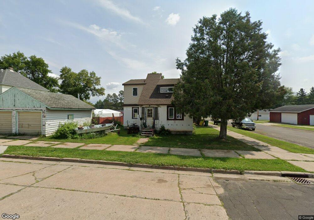
302 Maple Ave Kinney, MN 55758
Estimated Value: $50,000 - $132,000
3
Beds
3
Baths
1,138
Sq Ft
$90/Sq Ft
Est. Value
About This Home
This home is located at 302 Maple Ave, Kinney, MN 55758 and is currently estimated at $102,695, approximately $90 per square foot. 302 Maple Ave is a home located in St. Louis County with nearby schools including Merritt Elementary School and Mountain Iron-Buhl Secondary School.
Ownership History
Date
Name
Owned For
Owner Type
Purchase Details
Closed on
Sep 25, 2008
Sold by
Dircks Joseph and Dircks Janice
Bought by
Dircks Jason T and Dircks Rocky V
Current Estimated Value
Home Financials for this Owner
Home Financials are based on the most recent Mortgage that was taken out on this home.
Original Mortgage
$36,000
Interest Rate
6.52%
Mortgage Type
Commercial
Purchase Details
Closed on
Mar 14, 2002
Sold by
Dircks Daniel H and Dircks Judith M
Bought by
Dircks Joseph
Home Financials for this Owner
Home Financials are based on the most recent Mortgage that was taken out on this home.
Original Mortgage
$37,827
Interest Rate
6.93%
Mortgage Type
Commercial
Create a Home Valuation Report for This Property
The Home Valuation Report is an in-depth analysis detailing your home's value as well as a comparison with similar homes in the area
Purchase History
| Date | Buyer | Sale Price | Title Company |
|---|---|---|---|
| Dircks Jason T | $40,000 | All American Title Co Inc | |
| Dircks Joseph | $42,000 | -- |
Source: Public Records
Mortgage History
| Date | Status | Borrower | Loan Amount |
|---|---|---|---|
| Closed | Dircks Jason T | $36,000 | |
| Previous Owner | Dircks Joseph | $37,827 |
Source: Public Records
Tax History
| Year | Tax Paid | Tax Assessment Tax Assessment Total Assessment is a certain percentage of the fair market value that is determined by local assessors to be the total taxable value of land and additions on the property. | Land | Improvement |
|---|---|---|---|---|
| 2024 | $998 | $67,600 | $3,400 | $64,200 |
| 2023 | $998 | $64,500 | $3,100 | $61,400 |
| 2022 | $772 | $53,500 | $2,600 | $50,900 |
| 2021 | $710 | $50,600 | $2,200 | $48,400 |
| 2020 | $1,052 | $50,600 | $2,200 | $48,400 |
| 2019 | $1,102 | $60,300 | $4,800 | $55,500 |
| 2018 | $1,286 | $60,200 | $4,800 | $55,400 |
| 2017 | $700 | $60,200 | $4,800 | $55,400 |
| 2016 | $1,110 | $60,300 | $4,800 | $55,500 |
| 2015 | $551 | $23,600 | $3,000 | $20,600 |
| 2014 | $551 | $23,000 | $3,000 | $20,000 |
Source: Public Records
Map
Nearby Homes
- 401 Memorial Dr
- 197 Jefferson St
- 203 Jefferson St
- 205 Jefferson St
- Tbd French Rd Unit LotWP001
- TBD French Rd
- 5451 Garden Dr N
- 87XX Arbor Ln
- 6457 Colombe Rd
- 414 9th St NE
- 8623 Labrador Ct
- TBD Sherwood Anderson Rd
- 401 1st Ave NW
- 25 2nd St NW
- 17 3rd St SE
- 5xx 11th St NW
- TBD Admiral Rd
- 126 5th St NW
- 4017 Highway 25
- 22 3rd St SW
Your Personal Tour Guide
Ask me questions while you tour the home.