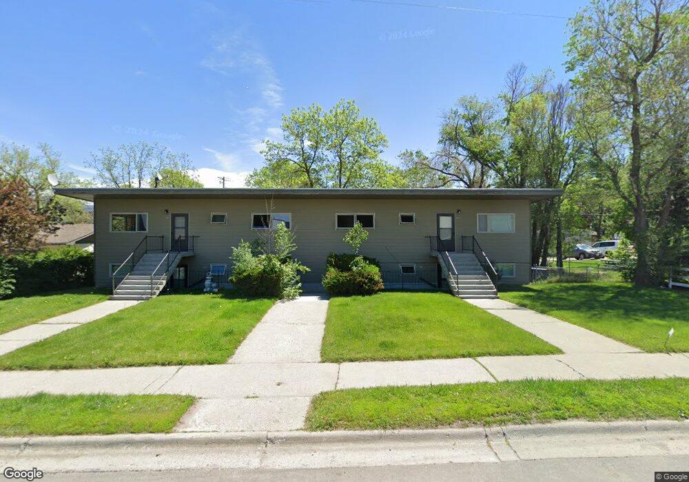
302 N 11th Ave Bozeman, MT 59715
Midtown NeighborhoodEstimated Value: $792,000 - $1,478,000
3
Beds
1
Bath
1,100
Sq Ft
$1,019/Sq Ft
Est. Value
About This Home
This home is located at 302 N 11th Ave, Bozeman, MT 59715 and is currently estimated at $1,120,667, approximately $1,018 per square foot. 302 N 11th Ave is a home located in Gallatin County with nearby schools including Whittier School, Chief Joseph Middle School, and Bozeman High School.
Ownership History
Date
Name
Owned For
Owner Type
Purchase Details
Closed on
Aug 16, 2021
Sold by
F & L Investments Llc
Bought by
The Brownstone Llc
Current Estimated Value
Home Financials for this Owner
Home Financials are based on the most recent Mortgage that was taken out on this home.
Original Mortgage
$743,708
Outstanding Balance
$676,261
Interest Rate
2.9%
Mortgage Type
Commercial
Estimated Equity
$444,406
Create a Home Valuation Report for This Property
The Home Valuation Report is an in-depth analysis detailing your home's value as well as a comparison with similar homes in the area
Home Values in the Area
Average Home Value in this Area
Purchase History
We collect this data history from publicly available records. To have your information removed, we recommend requesting removal directly through your county’s website.
| Date | Buyer | Sale Price | Title Company |
|---|---|---|---|
| The Brownstone Llc | -- | American Land Title Company |
Source: Public Records
Mortgage History
We collect this data history from publicly available records. To have your information removed, we recommend requesting removal directly through your county’s website.
| Date | Status | Borrower | Loan Amount |
|---|---|---|---|
| Open | The Brownstone Llc | $743,708 |
Source: Public Records
Tax History
| Year | Tax Paid | Tax Assessment Tax Assessment Total Assessment is a certain percentage of the fair market value that is determined by local assessors to be the total taxable value of land and additions on the property. | Land | Improvement |
|---|---|---|---|---|
| 2025 | $5,419 | $1,088,900 | $0 | $0 |
| 2024 | $6,655 | $999,700 | $0 | $0 |
| 2023 | $6,429 | $999,700 | $0 | $0 |
| 2022 | $3,891 | $507,400 | $0 | $0 |
| 2021 | $4,294 | $507,400 | $0 | $0 |
| 2020 | $3,781 | $443,200 | $0 | $0 |
| 2019 | $3,868 | $443,200 | $0 | $0 |
| 2018 | $3,285 | $348,800 | $0 | $0 |
| 2017 | $3,071 | $348,800 | $0 | $0 |
| 2016 | $3,054 | $324,100 | $0 | $0 |
| 2015 | $3,057 | $324,100 | $0 | $0 |
| 2014 | $3,154 | $196,834 | $0 | $0 |
Source: Public Records
Map
Nearby Homes
- 316 N 10th Ave
- 718 W Babcock St Unit 411
- 1120 W Babcock St Unit 7
- 1608 W Beall St Unit B
- 1608 W Beall St Unit F
- 1610 W Beall St Unit E
- 119 S 7th Ave
- 611 N 15th Ave
- 209 S 8th Ave
- 206 Pioneer Dr Unit 44
- 675 N 15th Ave
- 1605 Durston Rd Unit 43
- 617 N 5th Ave Unit A
- 818 Matheson Way
- 854 Matheson Way
- 803 N 15th Ave
- 516 W Olive St
- 418 W Babcock St
- 1301 W Koch St
- 407 S 10th Ave
- 312 N 11th Ave
- 215 N 10th Ave
- 303 N 10th Ave
- 208 N 11th Ave
- 211 N 10th Ave
- 316 N 11th Ave
- 309 N 10th Ave
- 204 N 11th Ave
- 203 N 10th Ave
- 1020 Durston Rd
- 302 & 304 N 10th
- 317 N 10th Ave
- 308 N 10th Ave
- 210 N 10th Ave
- 206 N 10th Ave
- 1016 W Lamme St
- 325 N 10th Ave
- 922 W Beall St
- 302 N 10th Ave
- 123 N 10th Ave
Your Personal Tour Guide
Ask me questions while you tour the home.