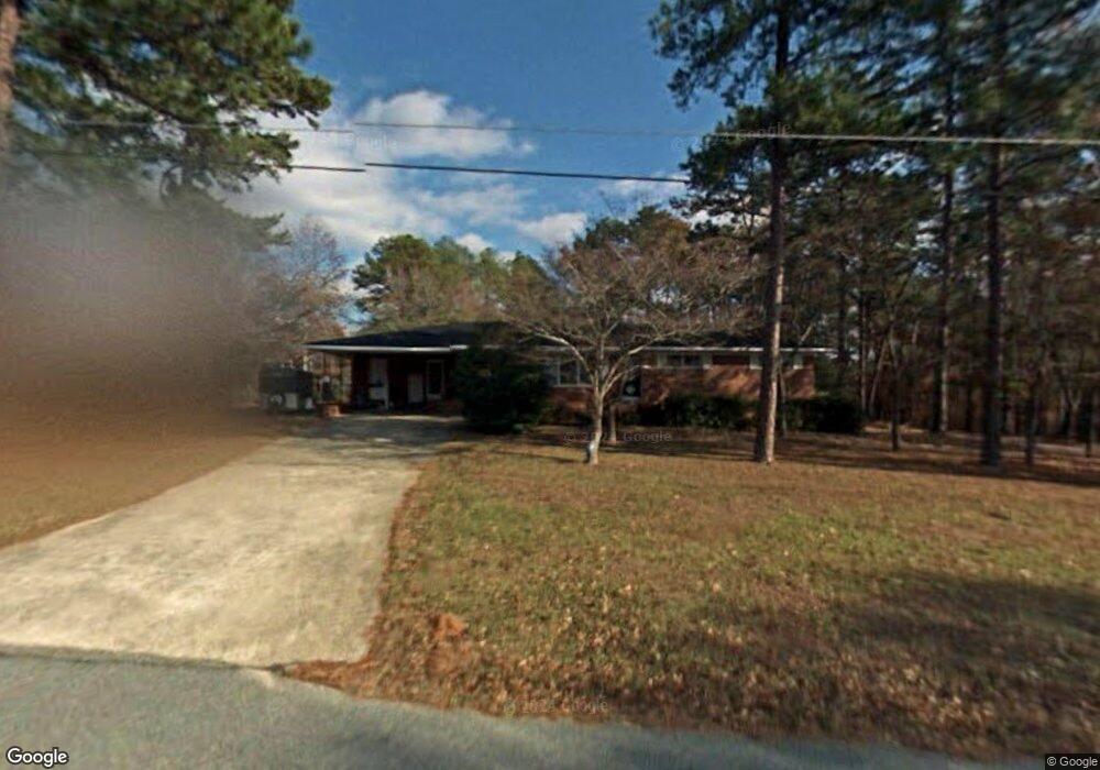
302 Taylor St Warner Robins, GA 31093
Estimated Value: $157,000 - $209,000
3
Beds
2
Baths
1,473
Sq Ft
$119/Sq Ft
Est. Value
About This Home
This home is located at 302 Taylor St, Warner Robins, GA 31093 and is currently estimated at $174,814, approximately $118 per square foot. 302 Taylor St is a home located in Houston County with nearby schools including Westside Elementary School, Northside Middle School, and Northside High School.
Ownership History
Date
Name
Owned For
Owner Type
Purchase Details
Closed on
Oct 17, 2005
Sold by
Carty James E and Carty Gail W
Bought by
Smock Robert A
Current Estimated Value
Purchase Details
Closed on
Mar 26, 2002
Sold by
Carter Adelle W
Bought by
Carty James E and Carty Gail W
Purchase Details
Closed on
Nov 2, 1989
Sold by
Carter James E Estate & Adelle
Bought by
Carter Adelle W
Purchase Details
Closed on
Apr 15, 1969
Sold by
Warner Robins Supply Co
Bought by
Carter James E and Carter Adelle W
Purchase Details
Closed on
Jan 5, 1969
Sold by
Quick W Lee
Bought by
Warner Robins Supply Co
Purchase Details
Closed on
Dec 5, 1966
Sold by
Warner Robins Supply Co Inc
Bought by
Quick W Lee
Create a Home Valuation Report for This Property
The Home Valuation Report is an in-depth analysis detailing your home's value as well as a comparison with similar homes in the area
Home Values in the Area
Average Home Value in this Area
Purchase History
| Date | Buyer | Sale Price | Title Company |
|---|---|---|---|
| Smock Robert A | $91,000 | -- | |
| Carty James E | $72,000 | -- | |
| Carter Adelle W | -- | -- | |
| Carter James E | -- | -- | |
| Warner Robins Supply Co | -- | -- | |
| Quick W Lee | -- | -- |
Source: Public Records
Tax History Compared to Growth
Tax History
| Year | Tax Paid | Tax Assessment Tax Assessment Total Assessment is a certain percentage of the fair market value that is determined by local assessors to be the total taxable value of land and additions on the property. | Land | Improvement |
|---|---|---|---|---|
| 2024 | $1,069 | $46,680 | $5,560 | $41,120 |
| 2023 | $877 | $38,280 | $5,560 | $32,720 |
| 2022 | $771 | $33,880 | $4,480 | $29,400 |
| 2021 | $678 | $29,920 | $4,480 | $25,440 |
| 2020 | $664 | $29,200 | $4,480 | $24,720 |
| 2019 | $664 | $29,200 | $4,480 | $24,720 |
| 2018 | $664 | $29,200 | $4,480 | $24,720 |
| 2017 | $665 | $29,200 | $4,480 | $24,720 |
| 2016 | $666 | $29,200 | $4,480 | $24,720 |
| 2015 | $667 | $29,200 | $4,480 | $24,720 |
| 2014 | -- | $29,200 | $4,480 | $24,720 |
| 2013 | -- | $30,240 | $5,000 | $25,240 |
Source: Public Records
Map
Nearby Homes
- 221 Gilchrist Dr
- 501 Pinecrest Dr
- 725 B East Side Dr
- 209 Knodishall Dr
- 110 Westcliff Cir Unit C
- 103 Westcliff Cir Unit A
- 103 Westcliff Cir Unit A
- 106 Westcliff Cir
- 111 Hawthorne Rd
- 110 Foxfire Dr
- 123 Tanglewood Dr
- 303 Pinecrest Dr
- 102 Westcliff Center St Unit D
- 110 Westcliff Center St
- 86 Westcliff Cir
- 102 Williams St
- 316 Meadowridge Dr
- 857 Ola Dr
- 300 Meadowridge Dr
- 111 Oakridge Dr
- 304 Taylor St
- 303 Taylor St
- 201 Stanford St
- 203 Meadow Glen Ct
- 306 Taylor St
- 201 Meadow Glen Ct
- 203 Taylor St
- 200 Lumpkin Dr
- 203 Stanford St
- 308 Taylor St
- 200 Taylor St
- 211 Hunters Ridge Rd
- 101 Meadow Glen Ct
- 202 Taylor St
- 202 Stanford St
- 201 Alexander Dr
- 202 Lumpkin Dr
- 209 Hunters Ridge Rd
- 201 Lumpkin Dr
- 400 Taylor St