Estimated Value: $202,000 - $243,000
4
Beds
3
Baths
2,192
Sq Ft
$105/Sq Ft
Est. Value
About This Home
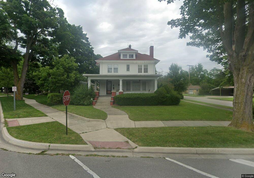
This home is located at 302 W Burnside St, Caro, MI 48723 and is currently estimated at $230,078, approximately $104 per square foot. 302 W Burnside St is a home located in Tuscola County with nearby schools including McComb Elementary School, Schall Elementary School, and Caro Middle School.
Ownership History
Date
Name
Owned For
Owner Type
Purchase Details
Closed on
Nov 14, 2011
Sold by
Clara Randal D and Clara Susan Page
Bought by
Rolfe Paul and Holloway Charlene
Current Estimated Value
Home Financials for this Owner
Home Financials are based on the most recent Mortgage that was taken out on this home.
Original Mortgage
$75,000
Outstanding Balance
$48,870
Interest Rate
3.12%
Mortgage Type
Adjustable Rate Mortgage/ARM
Estimated Equity
$181,208
Create a Home Valuation Report for This Property
The Home Valuation Report is an in-depth analysis detailing your home's value as well as a comparison with similar homes in the area
Home Values in the Area
Average Home Value in this Area
Purchase History
| Date | Buyer | Sale Price | Title Company |
|---|---|---|---|
| Rolfe Paul | $122,000 | Lighthouse Title Inc |
Source: Public Records
Mortgage History
| Date | Status | Borrower | Loan Amount |
|---|---|---|---|
| Open | Rolfe Paul | $75,000 |
Source: Public Records
Tax History Compared to Growth
Tax History
| Year | Tax Paid | Tax Assessment Tax Assessment Total Assessment is a certain percentage of the fair market value that is determined by local assessors to be the total taxable value of land and additions on the property. | Land | Improvement |
|---|---|---|---|---|
| 2025 | $3,824 | $114,200 | $0 | $0 |
| 2024 | $3,824 | $107,800 | $0 | $0 |
| 2023 | $3,656 | $98,900 | $0 | $0 |
| 2022 | $3,484 | $84,900 | $0 | $0 |
| 2021 | $3,374 | $72,400 | $0 | $0 |
| 2020 | $3,327 | $67,100 | $0 | $0 |
| 2019 | $3,263 | $61,900 | $0 | $0 |
| 2018 | $3,194 | $58,900 | $0 | $0 |
| 2017 | $3,128 | $53,300 | $0 | $0 |
| 2016 | $3,033 | $51,300 | $0 | $0 |
| 2015 | $9 | $49,400 | $0 | $0 |
| 2014 | $9 | $49,800 | $0 | $0 |
| 2013 | $8 | $48,900 | $0 | $0 |
Source: Public Records
Map
Nearby Homes
- 120 W Adams St
- 112 Alexander St
- 91 W Gilford Rd
- 621 Meek St
- 323 Green St
- 1164 Mary Jane Ct
- 17 N Hooper St
- 1565 Parkway Dr
- 1081 Cleaver Rd
- 140 2nd St
- 0000 E Dayton Rd
- 1303 Sugar Tree Ct
- 1333 E Caro Rd
- 0 Weeden Rd
- 1429 E Caro Rd
- 1600 E Dayton Rd
- 1685 E Dayton Rd
- 1548 E Caro Rd
- 1616 Willow Creek Dr
- 160 Wire Line Rd
- 310 N Almer St
- 232 W Burnside St
- 305 W Sherman St
- 309 W Sherman St
- 320 N Almer St
- 233 W Sherman St
- 233 W Burnside St
- 305 N Almer St
- 311 N Almer St
- 226 W Burnside St
- 229 W Sherman St
- 233 N Almer St
- 319 N Almer St
- 218 W Burnside St
- 319 W Sherman St
- 220 N Almer St
- 223 N Almer St
- 325 N Almer St
- 223 W Sherman St
- 302 W Sherman St